Chedabucto Bay Topo Map Online
Download Free Topo Map Sheet 011F06 at 1:50,000 scale
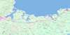
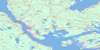
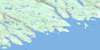
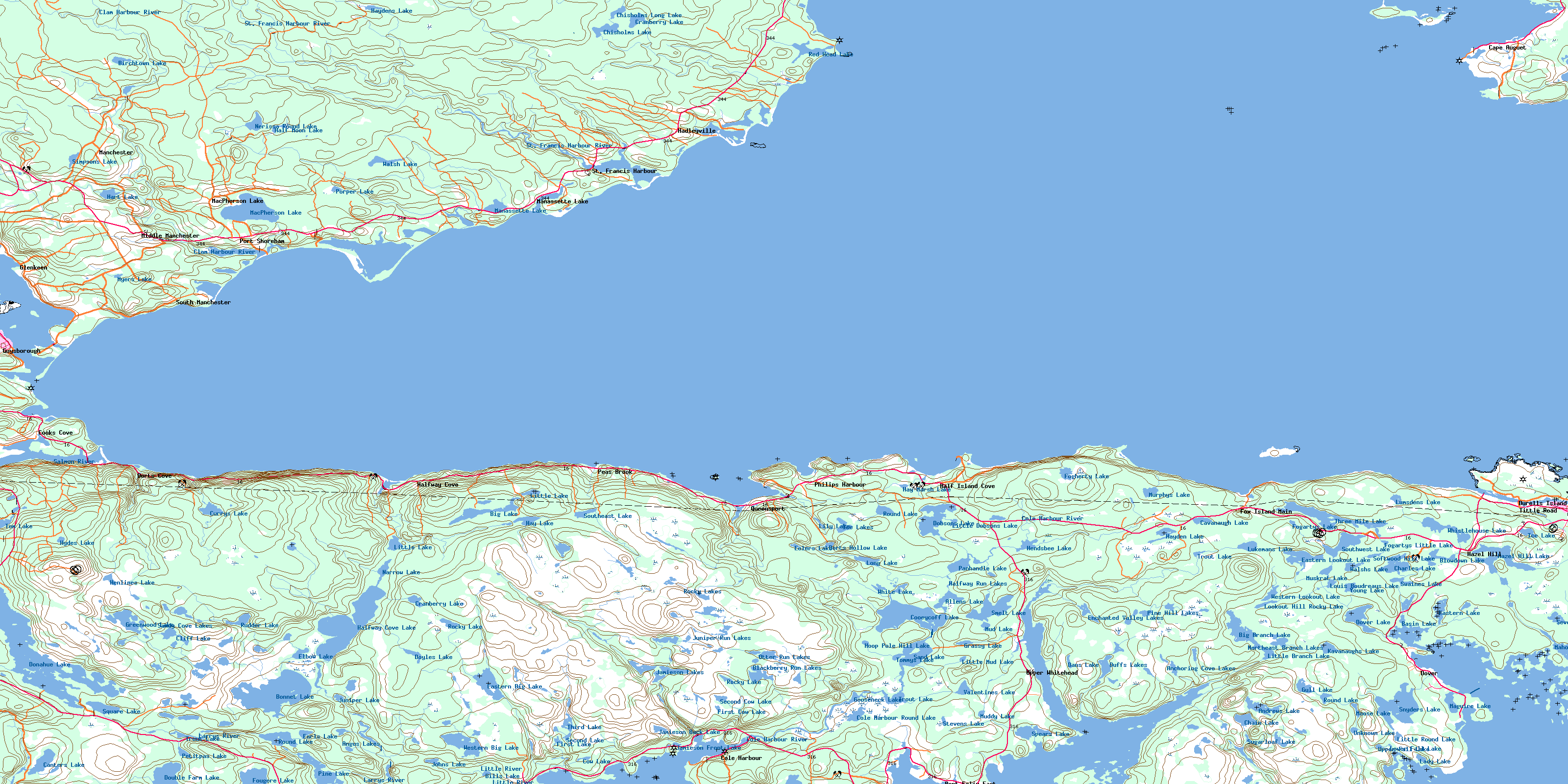
011F06 Chedabucto Bay Topo Map
To view this map, mouse over the map preview on the right.
You can also download this topo map for free:
011F06 Chedabucto Bay high-resolution topo map image.
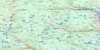
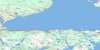
Maps for the Chedabucto Bay topo map sheet 011F06 at 1:50,000 scale are also available in these versions:
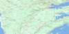
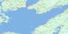
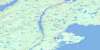
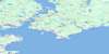
Chedabucto Bay Surrounding Area Topo Maps
 |
 |
 |
 |
 |
 |
 |
 |
 |
 |
 |
|
 |
 |
© Department of Natural Resources Canada. All rights reserved.
Chedabucto Bay Gazetteer
The following places can be found on topographic map sheet 011F06 Chedabucto Bay:
Chedabucto Bay Topo Map: Bays
American CoveAmerican Harbour
Anchoring Cove
Anse à Richard
Anse au Poulamon
Arichat Harbour
Big Cove
Blackduck Cove
Browns Cove
Cape Auget Bay
Cape Auguet Bay
Cashins Cove
Cashman Cove
Chedabucto Bay
Clam Harbour Bay
Clems Cove
Cole Harbour
Cooks Cove
Cooks Cove
Creamers Cove
Dover Basin
Dover Bay
Dover Harbour
English Cove
English Harbour
Forest Cove
Fox Bay
Grovers Cove
Guet Cove
Gun Cove
Guysborough Harbour
Guysborough Harbour
Hadley Cove
Hadleyville Harbour
Half Island Cove
Halfway Cove
Hortons Cove
Hunsons Cove
Indian Cove
Indian Cove
Lime Cove
Loon Cove
Louse Harbour
Lower Sand Cove
Mackerel Cove
Martin Pond
Mill Cove
Molasses Harbour
Moose Bay
Mud Cove
Mud Cove
Mussel Cove
Northeast Arm
Northwest Arm
Otter Cove
Philip Cove
Philips Harbour
Port Felix Harbour
Presquile Cove
Presqu'ile Cove
Queensport
Sandy Cove
Seal Cove
Spears Cove
St. Francis Harbour
Toby Cove
Tor Bay
Upper Sand Cove
Whitehaven Harbour
Whitehead Harbour
Chedabucto Bay Topo Map: Beaches
Carters BeachClam Harbour Beach
Fox Island Main Beach
Hadley Beach
Long Beach
The Sand Bar
West Beach
Chedabucto Bay Topo Map: Capes
Bigby HeadBlack Point
Bluff Point
Brodie Point
Cape Argos
Cape Argos
Cape Arichat
Cape Auguet
Cape Diamond
Cape Hogan
Creamers Point
Doughboy Point
Durell Point
Eagle Head
Eliza Point
Fogherty Head
Fort Point
French Point
Gaulman Point
Grady Point
Grovers Point
Gunning Point
Hardings Point
Huss Head
Katon Point
Keef Point
King Point
Lamb Point
Lazy Head
Lodge Point
Loon Point
Louse Head
Marache Point
Marshall Point
McCaul Point
Meades Point
Monroe Point
Moose Head
Moose Point
Moyac Point
Murdoch Head
Oyster Point
Parker Point
Peart Point
Philip Head
Philips Head
Pointe au Poulamon
Porper Point
Ragged Head
Red Head
Salmon Point
Simon Briands Point
Spears Head
Toby Point
Walsh Point
Chedabucto Bay Topo Map: Channels
Basin RunLittle Dover Run
Tickle Channel
Chedabucto Bay Topo Map: Cliffs
Crow CliffsEast Cliff
Chedabucto Bay Topo Map: Geographical areas
GuysboroughRichmond
Chedabucto Bay Topo Map: Islands
Bear IslandBig Island
Birch Island
Burnt Island
Burnt Island
Byron Island
Cage Island
Doverins Island
Durell Island
Durells Island
Flag Island
Fox Island
Grady Island
Grass Island
Gun Cove Island
Gurneys Island
Half Island
Ile aux Moutons
Isle Madame
Jamieson Island
Jerseyman Island
Larbord Island
Little Dover (White) Island
Little Island
Masons Island
McCaul Island
Millstone Island
Munroes Island
Poule Island
Poule Islet
Prices Island
Raspberry Island
Rook Island
Sheep Island
Sheep Island
Sheep Island
Sheep Island
Theodores Island
Tickle Island
Two Islands
White Island
Wreck Island
Chedabucto Bay Topo Map: Lakes
Allens LakeAnchoring Cove Lakes
Andrews Lake
Angus Lakes
Base Lake
Basin Lake
Big Branch Lake
Big Lake
Bills Lake
Birchtown Lake
Black Pond
Blackberry Run Lakes
Blowdown Lake
Bonnet Lake
Brandy Pot Lake
Canter Lake
Canters Lake
Carey Lake
Carr Pond
Carter Pond
Cavanaugh Lake
Chain Lake
Charles Lake
Chisholm Lake
Chisholms Lake
Chisholms Long Lake
Clam Pond
Cliff Lake
Cole Harbour Round Lake
Collins Pond
Cooeycoff Lake
Cow Lake
Cow Run Pond
Cranberry Lake
Cranberry Lake
Currys Lake
Dans Lake
Dobson Lake
Dobsons Lake
Donahue Lake
Dorts Hollow Lake
Double Farm Lake
Double Lake
Dover Lake
Doyles Lake
Duff Lake
Duffs Lakes
Earls Lake
East Halfway Cove Lakes
East Halfway Cove Lakes
East Halfway Cove Lakes
Eastern Big Lake
Eastern Lake
Eastern Lookout Lake
Eastern Pond
Eelers Lake
Elbow Lake
Enchanted Valley Lakes
Finlay Lake
First Cow Lake
First Lake
Fogartys Lake
Fogartys Little Lake
Fogartys Pool
Fogherty Lake
Fougère Lake
Goose Pond
Gooseneck Lake
Grassy Lake
Greenwood Lake
Gull Lake
Hadleyville Pond
Half Moon Lake
Halfway Cove Lake
Halfway Run Lakes
Hart Lake
Hay Lake
Hay Marsh Lake
Hayden Lake
Haydens Lake
Hazel Hill Lake
Hazel Lake
Hendsbee Lake
Henlines Lake
Hoop Pole Hill Lake
Hopkins Lake
Hydes Lake
Ice Lake
Ice Lakes
Jamieson Back Lake
Jamieson Front Lake
Jamieson Lakes
Johns Lake
Juniper Lake
Juniper Run Lakes
Kavanaughs Lake
Lady Lake
Levi Harts Pond
Lily Lake
Little Barachois
Little Branch Lake
Little Dobsons Lake
Little Lake
Little Lake
Little Mud Lake
Little Round Lake
Long Lake
Long Lake
Long Pond
Lookout Hill Rocky Lake
Louis Boudreaus Lake
Lower Fall Lake
Lower Pond
Lukemans Lake
Lumsden Lake
Lumsdens Lake
MacPherson Lake
Magoin Lake
Maguire Lake
Mahons Lake
Manassette Lake
McPherson Lake
Middle Lake
Moose Lake
Mound Lake
Mud Lake
Muddy Lake
Murdoch Pond
Murphys Lake
Muskrat Lake
Myers Lake
Narrow Lake
Nerissa Round Lake
Northeast Arm Lake
Northeast Branch Lakes
Northern Lakes
Otter Run Lakes
Oyster Ponds
Panhandle Lake
Petitpas Lake
Pine Hill Lakes
Pine Lake
Porper Lake
Porper Pond
Ragged Head Pond
Ragged Pond
Red Head Lake
Rocky Lake
Rocky Lake
Rocky Lakes
Round Lake
Round Lake
Round Lake
Rudder Lake
Sand Lake
Sandy Cove Lakes
Second Cow Lake
Second Lake
Seven Island Lake
Simpson Lake
Simpsons Lake
Simpsons Pond
Smelt Lake
Snyders Lake
Softwood Hill Lake
Southeast Lake
Southwest Lake
Southwest Pond
Spear Lake
Spears Lake
Square Lake
Stevens Lake
Stewart Pond
Sugarloaf Lake
Swaines Lake
Third Lake
Third Lake
Three Mile Lake
Tom Lake
Tommys Lake
Trout Lake
Trout Lake
Trout Lake
Unknown Lake
Upper Fall Lake
Valentines Lake
Walsh Lake
Walshs Lake
Western Big Lake
Western Lookout Lake
Western Pond
Whistlehouse Lake
White Lake
Wilkins Lake
Young Lake
Chedabucto Bay Topo Map: Mountains
Flag HillFlagstaff Hill
Lookout Hill
Pine Hill
Sugar Loaf
Sugarloaf Hill
Tom Hill
Chedabucto Bay Topo Map: Major municipal/district area - major agglomerations
GuysboroughRichmond
Chedabucto Bay Topo Map: Rivers
Blackberry RunCanters Lake Run
Carey Brook
Clam Harbour River
Cole Harbour River
Currys Lake Brook
Delaney Brook
Duck Run
Duffs Brook
Gaspereaux Brook
Goose Harbour River
Halfway Cove Brook
Hyde Brook
Jamieson Brook
Juniper Brook
Juniper Run
King Creek
Kyak Brook
Larrys River
Larry's River
Little River
McKenzie Brook
Meadow Brook
Meaghers Brook
Milford Haven River
Northeast Branch
Northwest Branch
Otter Brook
Otter Run
Patterson Brook
Peas Brook
Porcupine Hill Brook
Rattrays Run
Reynolds Brook
Salmon River
Sandy Cove Brook
Smelt Brook
Smelt Brook
Southwest Pond Brook
St. Francis Harbour River
St. Francis River
Stewart Brook
Taylor Brook
Underground Brook
Walsh Brook
Wash Brook
Winter Creek
Wood Duck Run
Chedabucto Bay Topo Map: River features
Crooked StillwatersDeep Pond Stillwater
Long Stillwater
Mud Hole
The Stillwater
The Stillwaters
Chedabucto Bay Topo Map: Sea features
The TittleChedabucto Bay Topo Map: Undersea features
Cat ShoalHard Shoal
Learys Shoal
Long Rocks
Lower Carney Rock
Murdoch Ledge
Southwest Ground
Yellow Rocks
Chedabucto Bay Topo Map: Shoals
Argos ShoalBig Shoal
Black Ledge
Brodie Rocks
Cage Shoal
Cat Shoal
Cerberus Rock
Corveau Rocks
Dans Ground
Doughboy Ledge
Eagle Head Rock
Eastern Shoals
Gull Rock
Hard Shoal
Hautfond Shoals
Henley Ledges
Horne Shoal
Hydra Shoal
Inner Fox
Inner Fox Rocks
Joes Rock
Ketch Shoal
King Creek Shoal
Learys Shoal
Long Rocks
Lower Carney Rock
Lumsden Shoal
Murdoch Ledge
Net Rocks
Outer Fox Rocks
Pilot Rock
Poule Reef
Rocky Ledge
Seal Ledges
Shallop Rocks
Southwest Ground
Stony Patch
The Sisters
The Tilly
Upper Carney Rock
Yellow Rocks
Chedabucto Bay Topo Map: Towns
CansoChedabucto Bay Topo Map: Unincorporated areas
BirchtownCape Auget
Cape Augnet
Cape Auguet
Cole Harbour
Cooks Cove
Dorts Cove
Durells Island
Fox Island Main
Glenkeen
Guysborough
Hadleyville
Half Island Cove
Halfway Cove
Hazel Hill
MacPherson Lake
Manassette Lake
Manchester
Marshall Point
Middle Manchester
Nerissa
Peas Brook
Philips Harbour
Port Felix
Port Felix East
Port Shoreham
Queensport
South Manchester
St. Francis Harbour
Tittle Road
Trout Lake
Upper Fox Island
Upper Whitehead
Yellow Marsh
Chedabucto Bay Topo Map: Low vegetation
Le PréChedabucto Bay Topo Map: Villages
DoverLittle Dover
© Department of Natural Resources Canada. All rights reserved.
