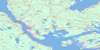
Mira River Topo Map Online
Download Free Topo Map Sheet 011F16 at 1:50,000 scale
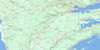
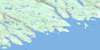
011F16 Mira River Topo Map
To view this map, mouse over the map preview on the right.
You can also download this topo map for free:
011F16 Mira River high-resolution topo map image.
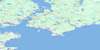
Maps for the Mira River topo map sheet 011F16 at 1:50,000 scale are also available in these versions:
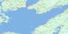
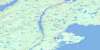
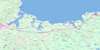
Mira River Surrounding Area Topo Maps
 |
 |
 |
 |
 |
 |
 |
 |
 |
 |
 |
|
 |
 |
© Department of Natural Resources Canada. All rights reserved.
Mira River Gazetteer
The following places can be found on topographic map sheet 011F16 Mira River:
Mira River Topo Map: Bays
Bear CoveBig Bay
Catherines Cove
Cripple Cove
Deep Cove
East Bay
Fourchu Bay
Gabarus Bay
Gabarus Cove
Gull Cove
Harbour Cove
Huntington Bay
Kennington Cove
Landing Cove
Little Harbour
MacGillivrays Cove
MacIsaacs Cove
Millers Cove
Morrisons Cove
Reids Cove
Sand Cove
Seal Cove
Sherwoods Cove
Sugar Loaf Cove
Yellow Cove
Mira River Topo Map: Beaches
Belfry BeachEastern Beach
George Hardys Breaker
Harris Beach
Levers Beach
Slatterys Beach
Southwest Breaker
Staceys Beach
Western Beach
Mira River Topo Map: Capes
Belfry HeadCape Gabarus
Cossit Point
Cossitt Point
Dancers Point
Eagle Head
Eagles Head
Fergusons Point
Germans Point
Harbour Point
Hardys Point
Hilliards Point
Indian Point
Indian Point
Lowell Point
MacCormicks Point
MacDougall Point
MacDougalls Point
MacEacherns Point
MacIsaacs Cape
MacKays Point
MacLeans Point
MacLeods Cape
Martins Point
McAdam Point
Neils Point
Rams Head
Rouse Point
Rouses Point
Sandys Point
Simon Point
Simons Point
Spruce Point
Tims Winging Point
Winging Point
Mira River Topo Map: Channels
Belfry GutThe Narrows
Thompsons Narrows
Mira River Topo Map: Cliffs
Hardys BankRed Bank
Mira River Topo Map: Falls
MacIsaacs Brook FallsMira River Topo Map: Geographical areas
Cape BretonRichmond
Mira River Topo Map: Islands
Alex Gillis IslandArchies Island
Cape Breton Island
Christie Gillis Island
Fergusons Island
Green Island
Guyon Island
Île du Cap-Breton
MacIsaacs Island
MacLeods Island
MacNeils Island
Rams Island
Mira River Topo Map: Lakes
Barren LakeBear Cove Pond
Beaver Dam Lake
Beaver Lake
Belfry Lake
Belle Lake
Big Island Lake
Bluff Lake
Bras d'Or Lake
Buscombe Lake
Camp Lake
Campbell Lake
Canoe Lake
Cavanagh Lake
Cavanaghs Lake
Copper Lake
Cow Pond
Cranberry Lake
Currie Lake
Curries Lake
Curry Lake
Dam Lake
Danny MacDonalds Lake
Dixon Lake
Duck Lake
East Hay Lake
East of Rock Lakes
Ferguson Lake
Ferguson Lake
Fiddlers Lake
Fieldings Lake
Figure of Eight Lake
French Village Lake
Gabarus Lake
Gaspereaux Lake
Giant Lake
Gillis Lake
Gillis Lake
Gillis Lakes
Goose Lake
Grant Hill Lake
Grant Lake
Grants Hill Lake
Grants Old Lake
Gull Lake
Hardy Lake
Hardy Lake
Hardys Lake
Harris Lake
Hay Lake
Heifer Lake
Hilliard Lake
Hilliards Lakes
Huntington Lake
Island Lake
Island Lake
Island Lake
Jake Lake
Jimmys Lake
Johnston Lakes
Kelly Lake
Kellys Lake
Kelvin Lake
Klondyke Lake
Lauchies Pond
Lever Lake
Levers Lake
Lily Lake
Lily Pond
Little Ferguson Lake
Little Harbour Lake
Little Lake
Little Lake
Little MacDonald Lake
Little MacLeod Lake
Long Lake
Long Pond
Lower Barachois
Lower MacLeod Lake
Lynk Lake
MacAdams Lake
MacArthurs Lake
MacAuley Lake
MacCallums Lake
MacCormicks Lake
MacCuishs Lake
MacCullum Lake
MacDonald Lake
MacDonald Lake
MacDonald Lake
MacDonalds Lake
MacDonalds Lake
MacDonalds Lake
MacDonalds Little Lake
MacDonalds Little Pond
MacDonalds Pond
MacDonalds Small Lake
MacDougall Lake
MacDougall Pond
MacDougalls Lake
MacEachern Lake
MacEachern Lake
MacInnis Lake
MacInnis Lake
MacIntyre Lake
MacIntyre Lake
MacIntyres Lake
MacIsaac Pond
MacIsaacs Lake
MacIsaacs Pond
MacKinnon Lake
MacKinnon Lake
MacKinnons Lakes
MacKinnons Little Lake
MacKinnons Ponds
MacLeans Lake
MacLeans Pond
MacLeod Lake
MacLeod Lake
MacLeod Lake
MacLeod Lake
MacLeod Lake
MacLeods Lake
MacMillans Lake
MacMillans Lakes
MacMullin Lake
MacMullin Lake
MacMullins Lake
MacNeil Lakes
MacNeils Lake
MacPhees Lake
MacPherson Lake
MacPhersons Lake
MacVicars Lake
Matheson Lakes
Mathieson Lake
McAdam Lake
McCauley Lake
McCormick Lake
McCuish Lake
McCuish Lake
McDonald Lake
McDonald Lake
McDonald Lake
McDonald Lake
McDonald Lake
McDonald Lake
McDonald Lake
McDougall Lake
McDougall Lake
McInnes Lake
McInnis Lake
McIntyre Lake
McIntyre Lake
McIntyre Lake
McKay Lake
McKinnon Lake
McKinnon Lakes
McLeod Lake
McLeod Lake
McLeod Lake
McLeod Lake
McLeod Lake
McMullen Lake
McMullin Lake
McNeil Lake
McNeill Lakes
McPherson Lake
McPherson Lake
McVicker Lake
Middle Lake
Mira Lake
Mohawk Lake
Morrison Lake
Morrison Lake
Morrison Lake
Morrisons Lake
Morrisons Little Lake
Mountain Lake
Mud Lake
Mulcuish Lake
Mullcuish Lake
Munroe Lake
Munros Lake
Otter Lake
Otter Lake
Otter Lake
Patterson Lake
Pattersons Lake
Peggy Allan Lake
Peggy Allans Lake
Penneys Lake
Peters Lake
Powder Horn Lake
Powderhorn Lake
Ranalds Pond
Rock Lake
Rocky Lake
Round Lake
Rush Lake
Salmon River Lake
Sand Lake
Sgadan Lake
Shibinette Lakes
Slatterys Lake
Spectacle Lakes
Stewart Lake
Stewarts Lake
String Lakes
String Lakes
Sugar Loaf Lakes
Taylors Ponds
Three Stone Lake
Twelve Mile Lake
Upper Barachois
Walkers Lake
White Lily Lake
Willis Lake
Winging Point Lake
Mira River Topo Map: Mountains
Big HillBig Ridge
Blue Mountain
Boisdale Hills
Bull Hill
Cailleux Hill
Devils Hill
East Bay Hills
Gillis Mountain
Huntington Mountain
Sgurra Bhreac
Spring Hill
Walker Hill
Walkers Hill
Mira River Topo Map: Major municipal/district area - major agglomerations
Cape BretonRichmond
Mira River Topo Map: Conservation areas
Ben Eoin Provincial ParkFortress of Louisbourg National Historic Site of Canada
Lieu historique national du Canada de la Forteresse-de-Louisbourg
Lieu historique national du Canada du Débarquement-de-Wolfe
Two Rivers Wildlife Provincial Park
Wolfe's Landing National Historic Site of Canada
Mira River Topo Map: Rivers
Back BrookBagnells River
Black Brook
Bonds Meadow Brook
Breac Brook
Caribou River
Catalogne River
Catalone River
Charlies Brook
Dan Morrisons Brook
Dawes Brook
Easg Brook
Eastern Brook
Eel Brook
Framboise River
Gaspereaux River
Gerald Brook
Gerard Brook
Gerards Brook
Gerratt Brook
Gillis Brook
Irish Brook
Jimmys Brook
Kennington Cove Brook
Landing Cove Brook
Lawrences Brook
MacDonald Brook
MacDougalls Brook
MacIsaacs Brook
MacKeigans Brook
MacKenzies River
Masons River
Matheson Brook
McCuish Brook
McIsaac Brook
Middle River Framboise
Mill Brook
Millers Brook
Mineral Spring Brook
Mira River
Morrison Brook
Nicholas Brook
North River
Northeast Framboise River
Salmon River
Six Mile Brook
Soapstone Brook
South Catalone River
Stewarts Brook
Stillwater Brook
Trout Brook
Village Lake Brook
Wilsons Brook
Woodbine Brook
Mira River Topo Map: River features
MacDonalds StillwatersThe Stillwater
The Stillwater
The Stillwaters
Mira River Topo Map: Shoals
Ayles ShoalBig Shoal
Black Rocks
Black Rocks Shoal
Bobs Rock
Bull Rock
Constance Rock
Coot Shoal
Duck Rock
Eastern Rocks
Flat Ledge
Gabarus Round Rock
Green Rock
Green Rock
Guyon Ledges
Harbour Rock
Harbour Rock Shoal
Inside Seal Rock
Iron Shoal
Joyces Rock
Kelp Shoal
Kennington Rocks
Little Harbour Ledge
Myers Rock
Outside Seal Rock
Pollock Ledge
Regan Rocks
Salmon Rock
Schooner Rock
Seal Rocks
Shag Rock
Shallop Rock
Simons Shoals
Steering Rock
Sugar Loaf
The Whaleback
Winging Point Rocks
Mira River Topo Map: Unincorporated areas
Ben EoinBig Glen
Big Ridge
Big Ridge South
Campbelldale
Canoe Lake
Deep Cove
East Bay North Side
French Road
Gabarouse
Gabarouse Lake
Gabarus
Gabarus Barachois
Gabarus Lake
Glen Currie
Glen Morrison
Grand Mira North
Grand Mira South
Hillsdale Road
Huntington
Juniper Mount
Juniper Mountain
Kennington Cove
Lewis Bay West
Louisbourg Road
Louisburg Road
Marion Bridge
Marion Bridge Road
McKenzie East Bay
Mineral Rock
New Boston
North Glen
Northside East Bay
Oceanview
Rear Big Pond
Rear of East Bay
Rock Elm
Rock Elm West
Salmon River Road
Sandfield
Silver Mine
Trout Brook
Upper Grand Mira
Victoria Bridge
Wolfes Landing
Woodbine
Mira River Topo Map: Low vegetation
Bonds MeadowCaribou Barren
Caribou Marsh
MacPhersons Meadows
The Big Barren

© Department of Natural Resources Canada. All rights reserved.
