Port Hawkesbury Topo Map Online
Download Free Topo Map Sheet 011F11 at 1:50,000 scale
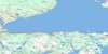
011F11 Port Hawkesbury Topo Map
To view this map, mouse over the map preview on the right.
You can also download this topo map for free:
011F11 Port Hawkesbury high-resolution topo map image.
Maps for the Port Hawkesbury topo map sheet 011F11 at 1:50,000 scale are also available in these versions:
Port Hawkesbury Surrounding Area Topo Maps
 |
 |
 |
 |
 |
 |
 |
 |
 |
 |
 |
|
 |
 |
© Department of Natural Resources Canada. All rights reserved.
Port Hawkesbury Gazetteer
The following places can be found on topographic map sheet 011F11 Port Hawkesbury:
Port Hawkesbury Topo Map: Bays
Anse à la ChaloupeArichat Harbour
Auld Cove
Aulds Cove
Babins Cove
Bear Cove
Bear Island Cove
Benoit Creek
Benoits Big Creek
Bonhomme Cove
Bras de Mury
Browns Cove
Byers Cove
Cape Auget Bay
Cape Auguet Bay
Caribacoo Bay
Caribacoo Cove
Caribacoo Cove
Caribou Cove
Carrigans Cove
Cass Cove
Chedabucto Bay
Couteau Inlet
Critchett Cove
Crokes Cove
Deep Cove
Deep Cove
Dunpheys Cove
Eddy Cove
False Bay
Forgerons Cove
George Bay
Georges Bay
Grande Anse
Haddock Harbour
Half Island Cove
Head Bay Cove
Head of Bay Cove
Head of West Bay Cove
Inhabitants Bay
Inhabitants Harbour
Janvrin Harbour
Le Blanc Harbour
Long Cove
MacDonalds Cove
MacDonalds Harbour
MacDougalls Cove
MacIntosh Cove
MacLeans Cove
MacLeod Creek
Macmillan Creek
MacNamaras Cove
MacNeils Cove
Madden Cove
Malcolm Cove
Martinique Cove
McCarthys Cove
McIntosh Cove
McMillan Creek
McNairs Cove
McNamara Cove
Melford Creek
Morrisons Cove
Murray Cove
Murray Cove
Northwest Arm of the River Inhabitants
Peter Smiths Cove
Pirate Harbour
Plaster Cove
Port Mulgrave
Port Royal Harbour
Poulamon Bay
Poulamon Harbour
Proctor Cove
Proctors East Cove
Proctors West Cove
Rae Cove
Rogers Cove
Ross Pond
Scalloping Cove
Scanlans Cove
Seacoal Bay
Seacoal Bay
Seacoal Cove
Seal Cove
Ship Harbour
St. Georges Bay
St. Marys Harbour
The Basin
The Big Basin
The Little Basin
The Sluice
Thorn Creek
Turbalton Bay
Upper MacNamaras Cove
Venus Cove
Walsh Road Cove
Walshs Creek
Walshs Deep Cove
Welsh Cove
West Arichat Harbour
West Bay
Whale Cove
Port Hawkesbury Topo Map: Beaches
Big BeachCrichton Beach
Ghost Beach
MacDonalds Beach
Port Hawkesbury Topo Map: Capes
Arichat HeadBabin Point
Balache Point
Ballam Head
Ballams Point
Beach Point
Bear Head
Birch Point
Bosdet Point
Brule Point
Brûlé Point
Burnt Point
Campbells Point
Cape Porcupine
Caribou Head
Carleton Head
Cloakes Point
Crichton Head
Crichton Point
Critchett Point
Delorier Island Point
Delorier Point
Doirons Point
Dorey Point
Doreys Creek Point
Doreys Point
Drinkwaters Head
Dunphey Head
Dunpheys Head
Eddy Point
Eddy Spit
Fergusons Point
Ferry Point
Fishermans Point
Flat Head
Flying Point
Glasgow Point
Grandique Point
Grant Point
Grant Point
Haddock Point
Hadley Point
Heffernan Point
Heron Point
Hureaus Point
Indian Point
Indian Point
Irish Point
Janvrin Point
Kavanagh Point
Keaton Point
Kuliks Point
Le Blanc Point
Levangies Cape
Long Point
Louis Point
Low Point
Low Point
MacDonalds Head
MacIntosh Point
MacKays Point
MacKenzies Point
MacKenzies Point
Macnair Point
MacRaes Point
Madden Point
McInnes Point
McIntosh Point
McKeen Point
McNairs Point
Melford Point
Moulin Point
Mussel Point
Mussel Point
Park Point
Peebles Point
Peninsula Point
Point Tupper
Poulamon Point
Rabbit Point
River Point
Robin Point
Rock Point
Roger Point
Sammys Point
Scanlans Point
Ship Point
Spruce Point
St. Andrews Point
Steep Head
Stone Building Head
Strawberry Point
Suffering Pond Head
Thomas Head
Tongue Point
Turbalton Head
Whale Point
Widow Point
Wright Point
Port Hawkesbury Topo Map: Channels
Carry PassageCary Passage
Crid Passage
Gows Gap
La Mouclière
La Vanelle
Lennox Passage
Mousseliers Passage
Strait of Canso
The Haulover
Tickle Channel
Port Hawkesbury Topo Map: Falls
Hartleys FallsPort Hawkesbury Topo Map: Geographical areas
AntigonishGuysborough
Inverness
Juste au Corps
Richmond
Sydney
Port Hawkesbury Topo Map: Islands
Bear IslandBee Island
Benoit Island
Berry Island
Birch Island
Birch Island
Boudreaus Island
Bumbo Island
Bumbo Islet
Burnt Island
Campbell Island
Cape Breton Island
Crammond Islands
Crichton Island
Crid Islands
Crow Island
Crow Island
Delorier Island
Delorier Island
Dog Island
Duncan Walkers Island
Eagle Island
Embrees Island
Evans Island
Freeman Island
Green Island
Half Island
Heron Island
Hog Island
Île du Cap-Breton
Île Sec
Indian Island
Isle Madame
Janvrin Island
Jerseyman Island
Knife Island
Lazares Island
Leonards Island
Little Spirits Islands
MacNamaras Island
MacRae Island
Magnus Island
Malcolms Island
McRae Island
Mussel Island
Parkers Island
Pirate Island
Poulamon Islet
Purcells Island
Rabbit Island
Round Island
Scanlans Island
Susies Island
The Blocks
Thorn Island
Walkers Island
Walshs Island
Wasting Island
Port Hawkesbury Topo Map: Lakes
Archie PondAuld Lake
Babins Lake
Back Pond
Ballams Pond
Beaver Dam Lake
Big Pond
Bras d'Or Lake
Buchanan Lake
Butlers Lake
Campbell Pond
Campbells Pond
Carters Lake
Chisholms Lake
Critchetts Lake
Dans Lake
Dead Raven Pond
Doolan Pond
Dore Lake
Doreys Lake
Doreys Lake
Duck Pond
Embree Pond
Embrees Pond
Emery Pond
Englands Lake
False Bay Lake
False Bay Lakes
First Lake
French Lake
Front Pond
Goose Harbour Lake
Goose Harbour Lakes
Grand Lake
Grant Lake
Hahasy Pond
Halfmoon Lake
Harveys Lake
Hawker Lake
Hector Lake
Heffernan Pond
Hill Lake
Hines Lake
Hopes Lake
Horton Lake
Hunsons Lake
Knight Lake
Lac à Jean
Lac Sec
Lake Elizabeth
Lake Murray
Landrie Lake
Lauchlin Lake
Leonards Pond
Little Dry Lake
Little River Reservoir
Long Lake
Long Pond
MacGregors Lake
MacIntyre Lake
MacMillan Lakes
MacMillans Lake
MacNeils Pond
MacPhersons Lake
Mary Lake
Matties Lake
McCarthys Lake
McIntyre Lake
McMillan Lakes
Middle Lake
Moosehorn Lake
Morrisons Lake
Mundell Pond
Mundells Lake
Mundells Pond
Neds Lake
Nicholas Lake
Noels Lake
Otter Burrow Lake
Peebles Pond
Pottie Lake
Potty Lake
Reeves Lake
Sampson Lake
Second Lake
Shannon Lake
Shaw Lake
Shoal Lake
Skinners Pond
Suffering Pond
Sugar Camp Lake
Summers Lake
Sundown Lake
Sunset Lake
The Pond
Theriaults Lake
Third Lake
Tracadieur Lake
Upper MacMillan Lake
Victoria Lake
Walshs Lake
Walshs Little Lake
West Lake
West Lakes
Wheatons Lake
White Lake
Whites Lake
Port Hawkesbury Topo Map: Mountains
Campbells MountainCraignish Hills
Creignish Hills
Creignish Mountain
MacDonald Mountain
McDonald Mountain
Mill Hill
Pleasant Hill
South Mountain
Sporting Mountain
Sporting Mountain
The Big Ridge
Port Hawkesbury Topo Map: Major municipal/district area - major agglomerations
AntigonishGuysborough
Inverness
Richmond
Port Hawkesbury Topo Map: Conservation areas
Lennox Passage Provincial ParkPort Hawkesbury Topo Map: Rivers
Angus BrookArchies Brook
Barrys River
Ben Hughies Brook
Benoit Creek
Benoit Creek Brook
Black Brook
Black Brook
Black River
Brown Brook
Byers Brook
Cameron Brook
Clam Harbour River
Coal Brook
Critchell Brook
Daniels Brook
Deep Brook
Doreys Creek
Dowlings Brook
East Branch Tracadie River
East Brook
Embree Brook
Embrees Brook
Emery Brook
Fall Brook
False Bay Brook
Ferguson Brook
Glenora Brook
Goose Harbour River
Havre Bouché Brook
Havre Boucher Brook
Hayes Brook
Horton Brook
Horton Brook
Johnny MacInnes Brook
Kempt Brook
Kennys Brook
Kens Brook
Kuliks Brook
Lamey Brook
Little River
MacAskills Brook
MacDonalds Brook
MacLeod Brook
MacLeod Brook
MacMaster Brook
MacMasters Brook
MacPhees Brook
MacPherson Brook
MacRaes Brook
Malcolms Brook
McDonald Brook
McMaster Brook
McNairs Brook
McPherson Brook
Meadow Brook
Melford Brook
Mile Brook
Mill Brook
Mill Brook
Mill Creek
Morgans Brook
Morrisons Brook
Moulin River
Murray Brook
North Little River
North West Arm Brook
Northwest Arm Brook
Peters Brook
Peters Brook
Poulamon Creek
Proctors Brook
Queensville Brook
Rae Brook
Rae Creek
Red Brook
River Inhabitants
Rough Brook
Seacoal Brook
Shannon Brook
Smelt Brook
St. Francis Harbour River
St. Francis River
Steeles Brook
Steep Creek
Sugar Camp Brook
The Ruisseau
Thorn Creek
Thorn Creek Brook
Three Mile Brook
Two Mile Brook
Urquharts Brook
Venus Brook
Venus Brook
Walshs Creek Brook
West Brook
White Brook
White Brook
Wrights River
Port Hawkesbury Topo Map: Undersea features
Campbells ShoalPort Hawkesbury Topo Map: Shoals
Balache RockBallam Shoal
Bear Reef
Bentinck Shoals
Birch Shoal
Black Rock
Cahil Rock
Campbells Shoal
Crichton Shoal
Dixon Rock
Dorey Ledge
Doreys Ledge
Ferry Reef
Fiddle Shoal
Fish Shoal
Janvrin Shoal
Laceys Rocks
Long Ledge
Macdonald Shoal
MacDonalds Shoal
MacRaes Shoal
Madagascar Rock
Martin Shoal
McInnes Shoals
Middle Ground
Peninsula Shoals
Picard Reef
Poule Reef
Premier Shoal
Ship Rock
Smith Shoal
Thomas Shoal
Wasting Rocks
Port Hawkesbury Topo Map: Towns
MulgravePort Hawkesbury
Port Hawkesbury Topo Map: Unincorporated areas
ArichatAskilton
Auld Cove
Aulds Cove
Balmoral
Basin Road
Camerons Mountain
Cape Porcupine
Chapel Road
Cleveland
Crandall Road
Creignish
Creignish Rear
Dundee
East Havre Boucher
Evanston
Glenora
Grande Anse
Grandique Ferry
Grantville
Hawker
Hureauville
Janvrin Harbour
Kempt Road
Lennox
Lennox Passage
Lexington
Lochside
Louisdale
Low Point
Lower River Inhabitants
MacIntyre Lake
Mackdale
Martinique
McIntyre Lake
McPhersons Ferry
Middle Melford
Morrison
Morrison Siding
Newtown
Pirate Harbour
Pleasant Hill
Point Tupper
Port Hastings
Port Malcolm
Port Richmond
Port Royal
Poulamon
Queensville
Rear Black River
Riverside
Robins
Sand Point
St. George Channel
St. Georges Channel
St. Marys
St. Peters Junction
Steep Creek
Sugar Camp
Sunnyside
Troy
Tupper
Walkerville
West Arichat
West Bay
West Bay Centre
West Bay Road
Whiteside
Port Hawkesbury Topo Map: Low vegetation
Doyles MarshMacs Meadow
Northwest Arm Intervale
Proctors Meadow
© Department of Natural Resources Canada. All rights reserved.
