Windsor Topo Map Online
Download Free Topo Map Sheet 021A16 at 1:50,000 scale
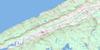
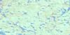
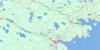
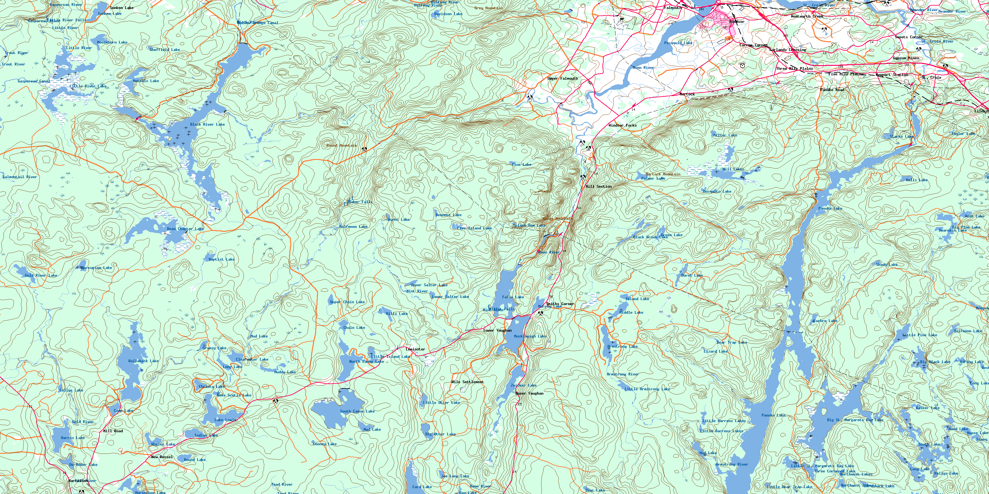
021A16 Windsor Topo Map
To view this map, mouse over the map preview on the right.
You can also download this topo map for free:
021A16 Windsor high-resolution topo map image.
Maps for the Windsor topo map sheet 021A16 at 1:50,000 scale are also available in these versions:
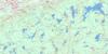
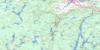
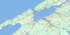
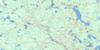
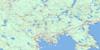
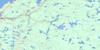
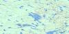
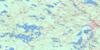
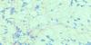
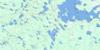
Windsor Surrounding Area Topo Maps
 |
 |
 |
 |
 |
 |
 |
 |
 |
 |
 |
 |
 |
 |
 |
 |
© Department of Natural Resources Canada. All rights reserved.
Windsor Gazetteer
The following places can be found on topographic map sheet 021A16 Windsor:
Windsor Topo Map: Bays
Blind BayDucks Nest
Eagle Cove
Goose Neck
Lebreau Creek
Long Bay
Northeast Cove
Thumb Hill Creek
Windsor Topo Map: Capes
Armstrong PointHalfway Point
Oak Point
Windsor Topo Map: Channels
Blind RunWindsor Topo Map: Falls
Baker FallsLittle River Falls
Millet Falls
Windsor Topo Map: Geographical areas
HalifaxHants
Kings
Lunenburg
Windsor Topo Map: Indian Reserves
New Ross 20Pennal 19
St. Croix 34
Windsor Topo Map: Islands
Briar IslandErns Island
McGlones Island
Pine Island
Windsor Topo Map: Lakes
Adams LakeAnthony Lake
Armstrong Lake
Bag Lake
Baptist Lake
Barrens Lakes
Bear Lake
Bear Trap Lake
Bearskin Lake
Bennett Lake
Big Black Lake
Big Otter Lake
Big Pine Lake
Big St. Margarets Bay Lake
Big St. Margaret's Bay Lake
Bill Lake
Bills Lake
Birchbark Lake
Black Brook Lake
Black River Lake
Blind Lake
Bog Lake
Burnt Lake
Burnt Lake
Camp Lake
Card Lake
Chain Lake
Chain Lakes
Christy Lake
Clearwater Lake
Cooney Lake
Davidson Lake
De Adder Lake
Dean Chapter Lake
Duck Pond
Duck Pond
Duck Pond
Duck Ponds
Euchre Lake
Falls Lake
Falls Lake
Falls Lake
Five Island Lake
Gold River Lake
Grassy Lake
Green Lake
Halfmoon Lake
Halfmoon Lake
Halls Lake
Hand Lake
Harris Lake
Hebbs Mill Pond
Holloway Lake
Horseshoe Lake
Indian Lake
Island Lake
Joe Long Lake
Kellys Lake
Lake Lewis
Lewis Lake
Lily Pond
Little Armstrong Lake
Little Barrens Lakes
Little Bear Trap Lake
Little Island Lake
Little Joe Long Lake
Little Otter Lake
Little Pine Lake
Little River Lake
Little Salter Lake
Little St. Margarets Bay Lake
Little St. Margaret's Bay Lake
Lizard Lake
Long Lake
Long Lake
Long Lake
Lower Canoe Lake
Lower Salter Lake
MacDonald Pond
Marshy Lake
Meadow Pond
Methals Lake
Methal's Lake
Middle Lake
Mill Lakes
Miller Lake
Mockingigh Lake
Moose Lake
Moosehorn Lake
Moosehorn Lake
Mosquito Lake
Mud Lake
Mud Lake
Mud Lake
Muddy Lake
Murphy Lake
Murphy Lake
North Canoe Lake
Northwest Lakes
Nova Scotia Lake
Otter Lake
Palmer Lake
Panuke Lake
Pesaquid Lake
Pine Lake
Ponhook Lake
Porcupine Lake
Rollaway Lake
Round Lake
Sallys Hole
Sallys Lake
Salter Lake
Shady Lake
Sheffield Lake
Simey Lake
South Canoe Lake
South Lake
Splash Dam Lake
St. Croix Lake
Starch Lake
Starks Lake
Sunken Lake
Taylor Lake
Three Cornered Lake
Three Lakes
Upper Canoe Lake
Upper Chain Lake
Upper Salter Lake
Walker Lake
Wallaback Lake
West Lake
West Moose Lake
Whalen Lake
Zwicker Lake
Windsor Topo Map: Mountains
Big HillColpitt Hill
First Hill
Froth Hole Hill
Grey Mountain
Hemlock Hill
Martock Mountain
Moses Mountain
Round Mountain
South Mountain
Windsor Topo Map: Major municipal/district area - major agglomerations
ChesterEast Hants
Halifax
Kings
West Hants
Windsor Topo Map: Conservation areas
Falls Lake Provincial ParkFort Edward National Historic Site of Canada
Lieu historique national du Canada du Fort-Edward
Windsor Topo Map: Rapids
Simey Lake RunWindsor Topo Map: Rivers
Aalders Lang BrookAllen Brook
Armstrong River
Avon River
Baptist Brook
Barkhouse Brook
Bear Trap Lake Brook
Becky Bog Brook
Bills Brook
Black Brook
Black Brook
Black Brook
Black Brook
Black River
Bog Brook
Bog Brook
Brandywine Brook
Burnt Lake Brook
Burntwoods Brook
Collins Brook
Cross Brook
Dead Brook
Deep Hollow Brook
Eagle Cove Brook
East Branch Gold River
Fall Brook
First Run
Five Island Lake Brook
French Mill Brook
French Mill Brook
French Mill Brook
Gaspereau Canal
Gaspereau River
Gold River
Grassy Brook
Green Lake Brook
Gudgeon Brook
Gully Brook
Halfmoon Lake Brook
Halfway River
Halls Lake Brook
Hollow Bridge Canal
Horton Meadow Brook
Hunts Lake Brook
Lebreau Creek
Lebreau Creek Brook
Levy Meadow Brook
Little Lake Brook
Little River
Maple Brook
Maple Run
Marsh Brook
Marshy Lake Brook
Meadow Brook
Meander River
Methals Brook
Methal's Brook
Mill Brook
Mill Brook
Millet Brook
Mint Brook
Mint River
Moose Brook
Mud Lake Brook
Otter Lake Brook
Peck Meadow Brook
Piney Stream
Poplar Run
Porcupine Brook
Porcupine Gully
Roachs Brook
Roaring Brook
Rocky Brook
Salmontail River
Salmontail River
Sam Brook
Sams Brook
Sandy Brook
Schofield Brook
Schofield Meadow Brook
Second Run
Shady Brook
Shady Lake Brook
Shaw Brook
Shaw Creek
Shinglemill Brook
Simms Brook
Smelt Brook
Smeltzer Brook
South Branch
Southwest Avon River
Southwest Avon River
Southwest Branch Avon River
Southwest Brook
Southwest River
St. Croix River
Stoney Brook
Stony Brook
Sucker Brook
Swinamers Brook
Thans Brook
The Carry
Thompsons Brook
Thompson's Brook
Thumb Hill Creek
Toad River
Toney Brook
Trout River
Walsh Brook
Weir Brook
West Avon River
West Branch Avon River
West Branch Gold River
Whitney River
Windsor Topo Map: River features
Baker StillwaterBig Bend
Black Brook Deadwaters
Burnt Stillwater
Conrad Stillwater
Crooked Gully
Crooked Stillwater
Duncanson Hole
Eagles Nest
First Stillwater
Fox Stillwater
Froth Hole
Gilberts Stillwater
Juniper Stillwater
Juniper Stillwater
Larders Stillwater
Leary Stillwater
Long Stillwater
McInnis Stillwaters
Mud Lake Deadwaters
Piney Deadwaters
Second Stillwater
Stoney Brook Deadwater
The Stillwater
Thompsons Stillwaters
Titus Dam Stillwater
Trout Hole
Williams Deadwaters
Windsor Topo Map: Towns
WindsorWindsor Topo Map: Unincorporated areas
Benjamins MillBenjamin's Mill
Currys Corner
Curry's Corner
Ellershouse
Falmouth
Five Mile Plains
Garlands Crossing
Gypsum Mines
Harriston
Hartville
Leminster
Lower Vaughan
Martock
Mill Road
Mill Section
New Russel
New Russell
Newport Station
Panuke Road
Pemberton's
Smiths Corner
Smith's Corner
St. Croix
Sunken Lake
Sweets Corner
Sweets Corners
Sweet's Corners
Three Mile Plains
Upper Falmouth
Upper Vaughan
Vaughan
Waterville
Wentworth Creek
Wile Settlement
Windsor Forks
Windsor Topo Map: Low vegetation
Aalders Lang MeadowBecky Bog
Caribou Bog
Cherrytree Meadow
Deal Bog
Driscolls Meadows
Duncan Meadow
Falls Bog
Fielding Meadows
Floating Bog
Halfmoon Meadow
Indian Bog
Jollymores Meadow
Levy Meadows
Meisners Meadow
Murphy Mill Pond Bog
Peck Meadow
Quinlan Bog
Redman Meadow
Richards Meadow
Salts Meadow
Schofield Meadow
Sefferns Meadow
Toms Meadow
Wiles Meadow
© Department of Natural Resources Canada. All rights reserved.
021A Related Maps:
021A Annapolis Royal021A01 Lahave Islands
021A02 Liverpool
021A03 Lake Rossignol
021A04 Wentworth Lake
021A05 Weymouth
021A06 Kejimkujik Lake
021A07 Bridgewater
021A08 Lunenburg
021A09 Chester
021A10 New Germany
021A11 Milford
021A12 Digby
021A13 Granville Ferry
021A14 Bridgetown
021A15 Gaspereau Lake
021A16 Windsor
