Liverpool Topo Map Online
Download Free Topo Map Sheet 021A02 at 1:50,000 scale
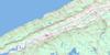
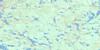
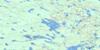
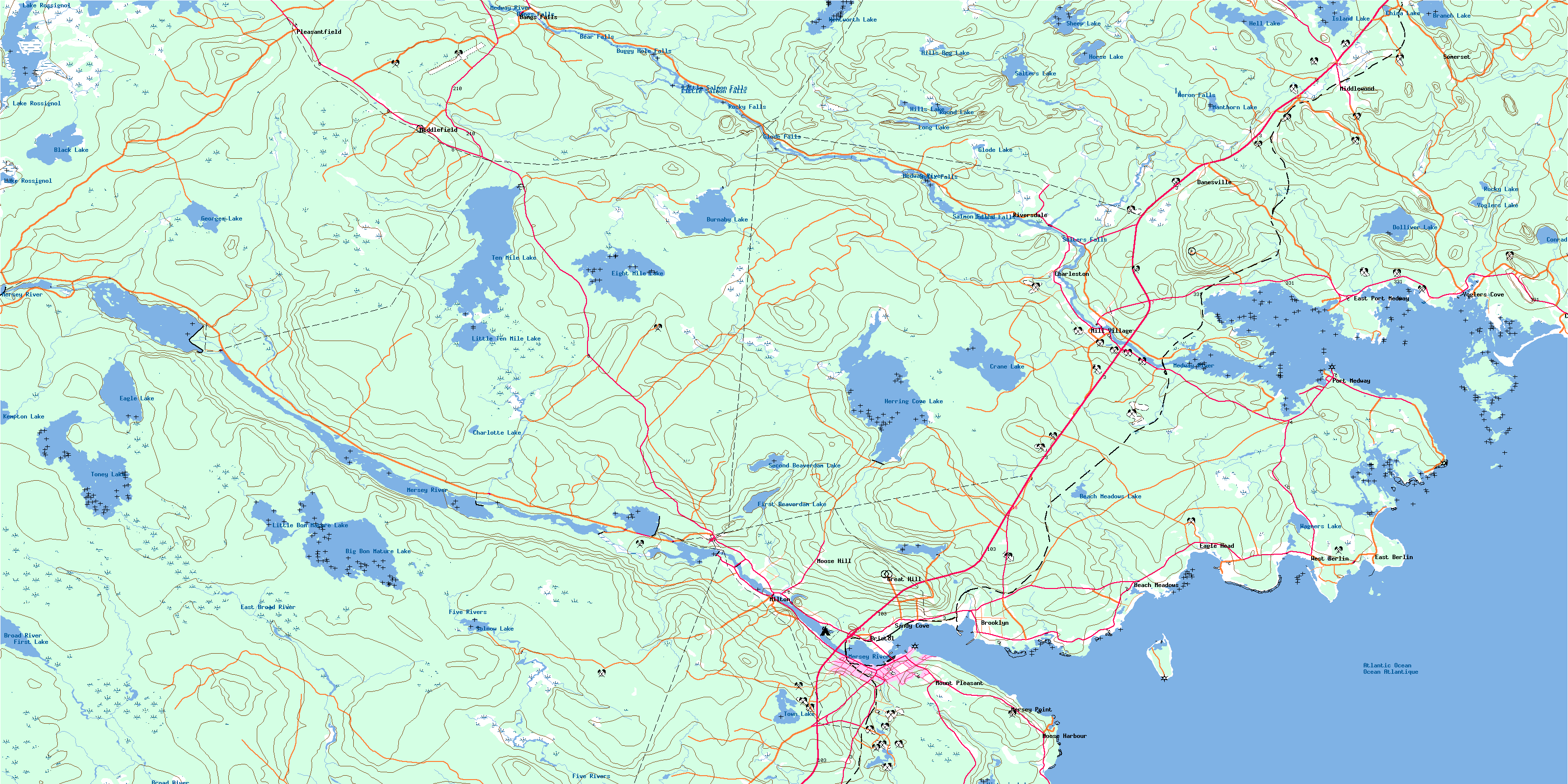
021A02 Liverpool Topo Map
To view this map, mouse over the map preview on the right.
You can also download this topo map for free:
021A02 Liverpool high-resolution topo map image.
Maps for the Liverpool topo map sheet 021A02 at 1:50,000 scale are also available in these versions:
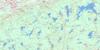
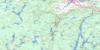
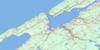
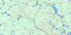
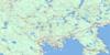
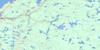
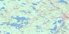
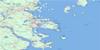
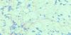
Liverpool Surrounding Area Topo Maps
 |
 |
 |
 |
 |
 |
 |
 |
 |
 |
 |
 |
 |
 |
 |
 |
© Department of Natural Resources Canada. All rights reserved.
Liverpool Gazetteer
The following places can be found on topographic map sheet 021A02 Liverpool:
Liverpool Topo Map: Bays
Beach CoveBees Cove
Big Cove
Big Sixteen Mile Bay
Blueberry Bay
Conrad Cove
Dogs Hole
Eagle Bay
Eagle Head Bay
East Berlin Bay
East Brook Bay
Faders Cove
Fox Creek
Fralick Cove
Froelich Cove
Hell Bay
Herring Cove
Hubleys Creek
Indian Bay
Indian Cove
Little Sixteen Mile Bay
Liverpool Bay
Liverpool Harbour
Long Bay
Long Cove
Medway Harbour
Minister Cove
Ministers Cove
Moose Harbour
Moshers Cove
Northwest Bay
Oak Hill Creek
Parks Cove
Privateer Cove
Puddingpan Bay
Ragged Harbour
Rugged Harbour
Sandy Cove
Scott Bay
Southwest Cove
The Cove
The Guzzle
Voglers Cove
Liverpool Topo Map: Beaches
Beach Meadows BeachConrad Beach
Southwest Breaker
Western Breaker
Liverpool Topo Map: Capes
Andrew HeadAndrews Head
Banges Point
Black Point
Blueberry Point
Calf Point
Coopers Point
Dollivers Point
Eagle Head
Eagle Point
Eastern Head
Flagstaff Point
Forbes Point
Fort Point
Indian Point
Lohnes Head
Long Cove Point
Long Point
MacDonalds Point
Martins Point
Medway Head
Mersey Point
Moose Point
Neil Point
Seligs Point
Smiths Point
Tuppers Point
Wagner Point
Wolfs Point
Liverpool Topo Map: Channels
Hells GatesThe Gut
Toby Island Passage
Liverpool Topo Map: Falls
Bangs FallsBear Falls
Big Falls
Buggy Hole Falls
Cowie Falls
Glode Falls
Guzzle Falls
Heron Falls
Island Fall
Island Falls
Little Salmon Falls
Lower Lake Falls
MacLeods Falls
Poltz Fall
Poltz Falls
Rocky Falls
Salmon Fall
Salmon Falls
Salter Falls
Salters Falls
Upper Lake Falls
Liverpool Topo Map: Geographical areas
LunenburgQueens
Liverpool Topo Map: Indian Reserves
Ponhook Lake 10Liverpool Topo Map: Islands
Bark IslandBass Island
Bear Island
Bear Island
Beaver Island
Big Cat Island
Big Guzzle Island
Birch Island
Birch Island
Cahoon Island
Cat Island
Cattle Island
Clam Island
Coffin Island
Dog Island
Fosters Islands
Fosters Islets
Fryingpan Island
Great Island
Green Island
Little Cat Island
Mattie Island
Middle Island
Mink Island
Mortons Island
Oak Island
Puddingpan Island
Ragged Harbour Great Island
Selig Island
Sheep Island
Stage Island
Teals Island
Thrum Cap
Timber Island
Toby Island
Whynacht Island
Wild Pear Island
Wynacht Island
Liverpool Topo Map: Lakes
Bar PondBeach Meadows Lake
Big Bon Mature Lake
Big Winnifred Lake
Black Lake
Blueberry Pond
Branch Lake
Burnaby Lake
Charlotte Lake
China Lake
Conrad Lake
Cranberry Lake
Crane Lake
Doctors Pond
Dolliver Lake
Duck Pond
Duck Pond
Duck Pond
Eagle Lake
Eight Mile Lake
First Beaverdam Lake
First Lake
George Lake
Georges Lake
Glode Lake
Hell Lake
Herring Cove Lake
Hills Bog Lake
Hills Lake
Hirtle Mill Pond
Horse Lake
Horse Pond
Island Lake
Johns Millpond
Kempton Lake
Lake Rossignol
Lily Pond
Lily Pond
Little Bon Mature Lake
Little Ten Mile Lake
Long Lake
Lower Fall Pond
Manthorn Lake
Meadow Pond
Neck Pond
Nickersons Pond
Rocky Lake
Round Lake
Round Pond
Salter Lake
Salters Lake
Second Beaverdam Lake
Sheep Lake
Solnow Lake
Solnow Pond
Ten Mile Lake
Toney Lake
Town Lake
Trout Pond
Upper Fall Pond
Victoria Lake
Vogler Lake
Voglers Lake
Wagners Lake
Wentworth Lake
Liverpool Topo Map: Mountains
Beech HillBetty Hill
Great Hill
Hog Hill
Humphs Hill
Kenney Hill
Moose Hill
Parks Hill
Liverpool Topo Map: Major municipal/district area - major agglomerations
LunenburgQueens
Liverpool Topo Map: Conservation areas
Ten Mile Lake Provincial ParkLiverpool Topo Map: Rapids
Black RattleBlack Rattle Rapid
Black Rattle Rapids
Upper Black Rattle
Liverpool Topo Map: Rivers
Allens BrookBeach Meadows Brook
Beaverdam Brook
Birch Point Brook
Black Meadow Brook
Boggy Hole Brook
Bon Mature Brook
Broad River
Brown Branch
Brown Branch Brook
Buggy Hole Brook
Burnaby Brook
Cahoon Brook
Cameron Brook
Cohoon Brook
De Wolfe Brook
Dean Brook
Deep Brook
Ditch Brook
Dolliver Brook
Dutch Brook
Eagle Lake Brook
East Branch Five Rivers
East Broad River
East Brook
East Brook Five Rivers
Eleven Mile Brook
Fifteen Mile Brook
Five River Creek
Five Rivers
Five Rivers Creek
Freeman Meadow Brook
Freemans Brook
Freemans Run
George Brook
Georges Brook
Glode Meadow Brook
Hagan Brook
Hagen Meadow Brook
Halfway Brook
Halfway Brook
Halfway Brook
Heatherington Brook
Hemeon Brook
Hemlock Run
Herring Cove Brook
Hirtle Brook
Hogan Brook
Hollow Log Brook
Humtagut Creek
Humtagut Creek
Humtagut Creek
Humtagut Creek
Hunsegut Brook
Hypocrite Brook
Kempton Brook
Kempton Meadow Brook
Knowles Meadow Brook
Lily Brook
Lily Pond Brook
Limestone Brook
Little Hemlock Run
Little Mountain Run
Lower Great Brook
Martin Brook
McAlpine Brook
McAlpines Brook
Meadow Pond Brook
Medway River
Mersey River
Mink Trap Brook
Morton Brook
Mortons Brook
Munroe Brook
Murley Brook
Murray Brook
Nine Mile Brook
Number Two Brook
Oakes Mill Brook
Otter Pond Brook
Ox Brook
Parke Brook
Parks Brook
Payzant Brook
Petite Brook
Quarterway Brook
Salter Brook
Salters Brook
Sewards Brook
Shingle Mill Brook
Six Mile Brook
Slabpile Brook
Smith Brook
Solomon Brook
Solomon Brook
Ten Mile Brook
The Branch
Tumblingdown Brook
Twelve Mile Brook
Two Inch Brook
Upper Great Brook
Vogler Brook
Voglers Brook
Wentworth Brook
West Brook
West Deep Brook
Liverpool Topo Map: River features
Buggy HoleReef Pool
Liverpool Topo Map: Shoals
Blueberry Bay ReefDog Ledge
Dogs Hole Ledge
Dry Ledge
Eagle Rock
Garretts Rocks
Green Ledge
Halfway Rocks
Jasons Ledges
Jonathan Rock
Medway Ledge
Middle Island Rock
Middle Ledge
Nautilus Rock
Ragged Rock
Rugged Rock
Seal Rock
Sow and Pigs
Stonehorse Rock
Stoney Ridge
Stony Ridge
Liverpool Topo Map: Unincorporated areas
Bangs FallsBeach Hill
Beach Meadows
Beech Hill
Bristol
Brooklyn
Charleston
Cherry Hill
County Line
Danesville
Eagle Head
East Berlin
East Port Medway
Great Hill
Indian Gardens
Lake Rossignol
Liverpool
Medway
Mersey Point
Middlefield
Middlewood
Mill Village
Milton
Moose Harbour
Moose Hill
Mount Pleasant
New Courage
Pleasantfield
Port Medway
Potanook
Riversdale
Sandy Cove
Somerset
Voglers Cove
West Berlin
Liverpool Topo Map: Low vegetation
Clancys MeadowClear Bog
Eleven Mile Bog
Five Rivers Meadow
Flake Woods Bog
Flakeswood Bog
Freeman Meadows
Hagen Meadow
Hayes Pan
Kempton Meadow
Long Lake Bog
Lower Great Brook Meadows
McGintys Meadows
Murray Meadows
Payzant Meadows
Six Mile Bog
The Meadow
Tom Knowles Meadow
© Department of Natural Resources Canada. All rights reserved.
021A Related Maps:
021A Annapolis Royal021A01 Lahave Islands
021A02 Liverpool
021A03 Lake Rossignol
021A04 Wentworth Lake
021A05 Weymouth
021A06 Kejimkujik Lake
021A07 Bridgewater
021A08 Lunenburg
021A09 Chester
021A10 New Germany
021A11 Milford
021A12 Digby
021A13 Granville Ferry
021A14 Bridgetown
021A15 Gaspereau Lake
021A16 Windsor
