
Venetian Lake Topo Map Online
Download Free Topo Map Sheet 041I14 at 1:50,000 scale
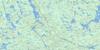
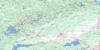
041I14 Venetian Lake Topo Map
To view this map, mouse over the map preview on the right.
You can also download this topo map for free:
041I14 Venetian Lake high-resolution topo map image.
Maps for the Venetian Lake topo map sheet 041I14 at 1:50,000 scale are also available in these versions:
Venetian Lake Surrounding Area Topo Maps
 |
 |
 |
 |
 |
 |
 |
 |
 |
 |
 |
 |
 |
 |
 |
 |
© Department of Natural Resources Canada. All rights reserved.
Venetian Lake Gazetteer
The following places can be found on topographic map sheet 041I14 Venetian Lake:
Venetian Lake Topo Map: Bays
Copenhagen BayGreen Bay
Turcotte Bay
Venetian Lake Topo Map: City
Grand SudburyGreater Sudbury
Venetian Lake Topo Map: Geographical areas
BeaumontBeresford
Botha
Bowell
Creelman
Dunbar
Emo
Fairbairn
Foy
Harty
Hess
Hutton
Kitchener
Leinster
Munster
Rhodes
Roberts
Sudbury
Sweeny
Tyrone
Wisner
Venetian Lake Topo Map: Hydraulic construction
Onaping DamVenetian Lake Topo Map: Lakes
Arm LakeAyotte Lake
Baseline Lake
Bay Lake
Beau Lake
Bennet Lake
Bessie Lake
Bigwood Lake
Blueberry Lake
Botha Lake
Burnish Lake
Camp Island Lake
Camp Lake
Copenhagen Lake
Decair Lake
Duck Lake
Fisher Lake
Foy Lake
Foyross Lake
Friday Lake
Frog Lake
Graveyard Lake
Hollow Lake
Hutton Lake
Ironside Lake
Joe Lake
Kasakawawia Lake
Kawawia Lake
Kitchener Lake
Kumska Lake
Leinster Lake
Little Lonely Lake
Little Michaud Lake
Little Sandcherry Lake
Lonely Lake
Loonfeather Lake
Lostend Lake
Madge Lake
McGrindle Lake
McLeod Lake
Michaud Lake
Minnow Lake
Morin Lake
Morton Lake
Mule Lake
North Lake
Onaping Lake
Osbourne Lake
Proudfoot Lake
Raffia Lake
Rand Lake
Raphoe Lake
Reed Lake
Rhodes Lake
Richardson Lake
Roberts Lake
Rome Lake
Sandcherry Lake
Sandfly Lake
Schkowona Lake
Scotia Lake
Shingwak Lake
Slide Lake
Smith Lake
South Lake
Towchain Lake
Tyrone Lake
Venetian Lake
Wanitanga Lake
Venetian Lake Topo Map: Mountains
Moose MountainVenetian Lake Topo Map: Major municipal/district area - major agglomerations
SudburyVenetian Lake Topo Map: Other municipal/district area - miscellaneous
BlezardCapreol
Capreol and Hanmer
Garson
Hanmer
Neelon and Garson
Venetian Lake Topo Map: Conservation areas
Kawawia Lake Old Growth Conservation ReserveVenetian Creek Old Pine Conservation Reserve
Venetian Lake Topo Map: Rivers
Beau CreekBee Creek
Bessie Creek
Botha Creek
Burnish Creek
Friday Creek
Frog Creek
Kumska Creek
Laforest Creek
Leinster Creek
Little Sandcherry Creek
Lonely Creek
McGrindle Creek
McLeod Creek
Michaud River
Morton Creek
Onaping River
Rand Creek
Rapid River
Reedy Creek
Rhodes Creek
Richardson Creek
Rivière Vermillion
Roberts River
Sandcherry Creek
Sandfly Creek
Shingwak Creek
Venetian Creek
Vermilion River
Wanitanga Creek
Wingekisinaw River
Venetian Lake Topo Map: Unincorporated areas
AnsticeCapreol
Dorchester Station
Raphoe
Sellwood
St. Clair Junction
Valley East

© Department of Natural Resources Canada. All rights reserved.

 Newsletter Sign-up


