Delamere Topo Map Online
Download Free Topo Map Sheet 041I02 at 1:50,000 scale
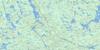
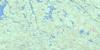
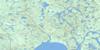
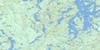
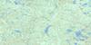
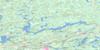
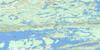
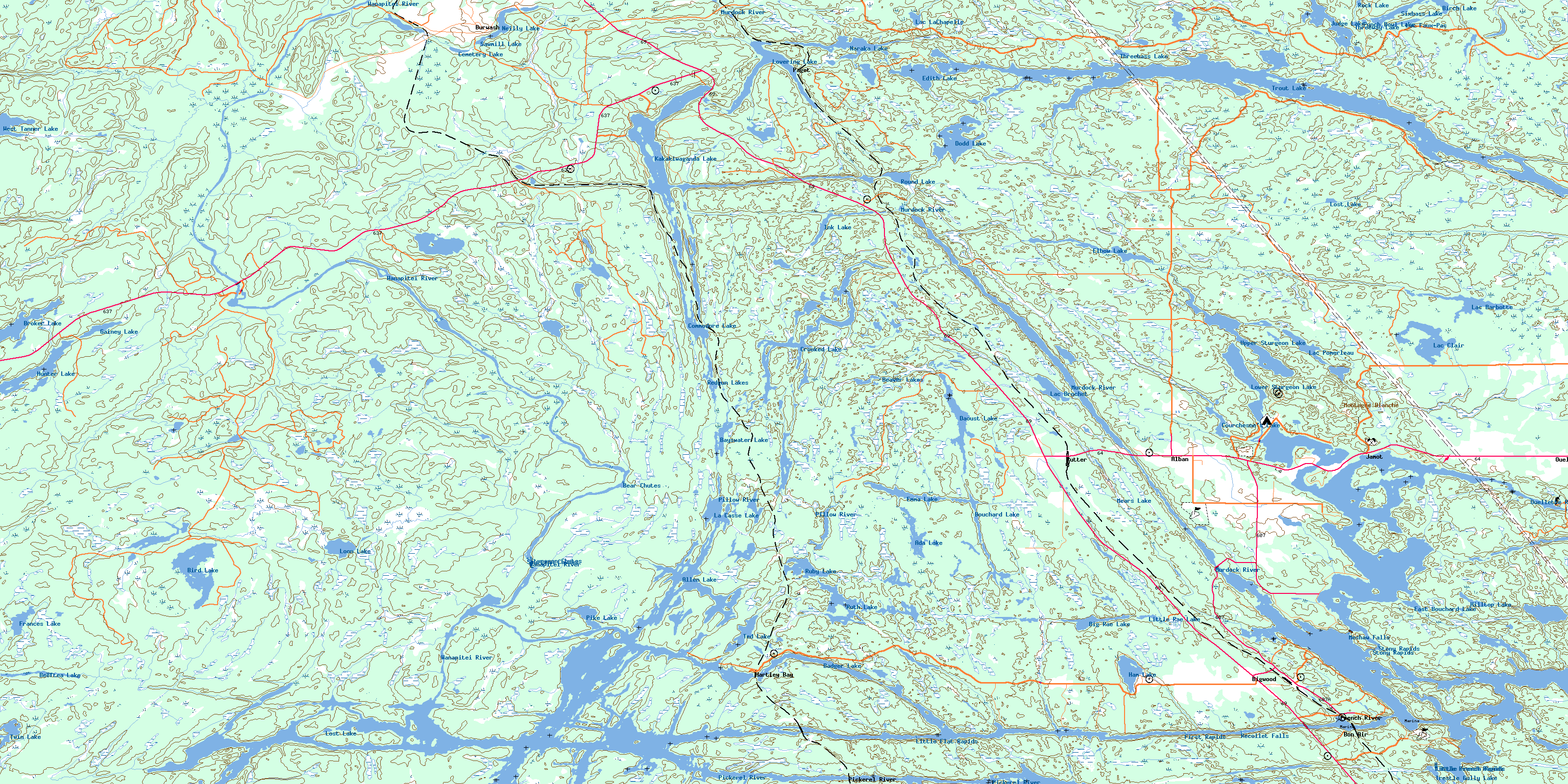
041I02 Delamere Topo Map
To view this map, mouse over the map preview on the right.
You can also download this topo map for free:
041I02 Delamere high-resolution topo map image.
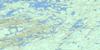
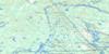
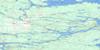
Maps for the Delamere topo map sheet 041I02 at 1:50,000 scale are also available in these versions:
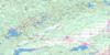
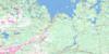
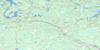
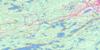
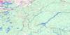
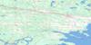
Delamere Surrounding Area Topo Maps
 |
 |
 |
 |
 |
 |
 |
 |
 |
 |
 |
 |
 |
 |
 |
 |
© Department of Natural Resources Canada. All rights reserved.
Delamere Gazetteer
The following places can be found on topographic map sheet 041I02 Delamere:
Delamere Topo Map: Bays
Bearsden BayBigwood Bay
Bill's Bay
Cow Bay
Crombie Bay
David's Bay
Deer Bay
Dodd Bay
Dry Pine Bay
Eagles Nest
Eighteen Mile Bay
Flowerpot Bay
Fraser Bay
Hartley Bay
Little Moose Bay
Mary's Bay
Ox Bay
Pickerel Bay
Rangers Bay
Rock Bay
Smith Bay
Thompson Bay
Wanapitei Bay
Washpan Bay
X Bay
Delamere Topo Map: Capes
Crombie Bay PointDesrochers Point
Delamere Topo Map: Channels
Canoe Bay ChannelCanoe Channel
Canoe Pass
French River Main Channel
Little Canoe Channel
Main Channel (French River)
McCullam's Narrows
North Channel (French River)
Tug Channel
Western Channel
Western Channel
Western Channel (French River)
Delamere Topo Map: City
Rivière des FrançaisDelamere Topo Map: Cliffs
The ElephantsDelamere Topo Map: Falls
Bear ChutesChute du Récollet
Chutes de Meshaw
Meshaw Falls
Michaud Falls
Recollet Falls
Sturgeon Chutes
Delamere Topo Map: Geographical areas
AllenAttlee
Bigwood
Cherriman
Cosby
Cox
Delamere
Halifax
Hoskin
Kilpatrick
Laura
Mason
Mowat
Parry Sound
Servos
Struthers
Sudbury
Travers
Waldie
Delamere Topo Map: Indian Reserves
French River Indian Reserve 13Réserve indienne French River 13
Delamere Topo Map: Islands
Attwood IslandBear Island
Big Island
Blueberry Island
Boom Island
Canal Island
Cantin Island
Dead Dog Island
Dispute Island
Duck Island
Eaglenest Island
Eighteen Mile Island
Fifteen Mile Island
Fourmile Island
Fourteen Mile Island
Green Island
Homestead Island
Île des Dix-Huit Milles
Kentucky Club Island
King's Island
Little Pig Island
McDougal Island
Merranger's Island
Nishoda Island
Ox Island
Pig Island
Potvin Island
Smith's Island
Delamere Topo Map: Lakes
Ada LakeAllen Lake
Attlee Lake
Badger Lake
Band Lake
Bayswater Lake
Beaver Lakes
Beeftea Lake
Big Rae Lake
Birch Lake
Bird Lake
Bouchard Lake
Broker Lake
Campsite Lake
Catfish Lake
Cemetery Lake
Commodore Lake
Courchesne's Lake
Crooked Lake
Daoust Lake
Delamere Lake
Dodd Lake
East Bouchard Lake
Edith Lake
Elbow Lake
Emma Lake
Frances Lake
Gainey Lake
Ham Lake
Hilltop Lake
Hunter Lake
Ink Lake
Judge Lake
Kakakiwaganda Lake
La Casse Lake
Lac à la Truite
Lac Barbotte
Lac Brochet
Lac Clair
Lac Faux-Pas
Lac LaChapelle
Lac Pomerleau
Len Lake
Little Rae Lake
Loon Lake
Lost Lake
Lost Lake
Lovering Lake
Lower Sturgeon Lake
Mears Lake
Naraka Lake
Neilly Lake
Pike Lake
Punch Bowl Lake
Pure Lake
Redgun Lakes
Rock Lake
Round Lake
Ruby Lake
Ruth Lake
Sawmill Lake
Sixbass Lake
Ted Lake
Threebass Lake
Threeway Lake
Trestle Gully Lake
Trout Lake
Twin Lake
Upper Sturgeon Lake
West Tanner Lake
Delamere Topo Map: Mountains
Gibraltar RockMontagne Blanche
Delamere Topo Map: Other municipal/district area - miscellaneous
Cosby and MasonCosby, Mason and Martland
Martland
Rutherford and George Island
Delamere Topo Map: Conservation areas
Attlee Conservation ReserveCherriman Township Conservation Reserve
Eighteen Mile Island Wilderness Area
French River Provincial Park
Delamere Topo Map: Rapids
First RapidsLittle Flat Rapids
Little French Rapids
Ouellette Rapids
Petite rivière French
Stony Rapids
Delamere Topo Map: Rivers
Band RiverBeeftea Creek
Bird Lake Creek
Cosby Creek
Daoust Creek
Dodd Creek
Eastern Outlet (French River)
French River
French River (Main Outlet)
French River North Channel
Little Beaverstone Creek
Loon Creek
Main Outlet
Main Outlet (French River)
Millerd Creek
Moose Creek
Murdock River
Parent Creek
Pickerel River
Pillow River
Rivière des Français
Rivière Murdock
Rivière Wanapitei
Sucker Creek
Wanapitei River
White Oak Creek
Wolf Creek
Wolf Creek
Delamere Topo Map: River features
Lost Child BendThe Forks
Delamere Topo Map: Shoals
Tinnerman's RockDelamere Topo Map: Towns
French RiverKillarney
Northeastern Manitoulin and the Islands
Delamere Topo Map: Unincorporated areas
AlbanBayswater
Bigwood
Bon Air
Burwash
Delamere
Delamere
French River
Hartley Bay
Jamot
Ouellette
Paget
Pickerel River
Porlock
Rutter
Servos
© Department of Natural Resources Canada. All rights reserved.
