Michipicoten Island Topo Map Online
Download Free Topo Map Sheet 041N12 at 1:50,000 scale
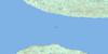
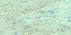
041N12 Michipicoten Island Topo Map
To view this map, mouse over the map preview on the right.
You can also download this topo map for free:
041N12 Michipicoten Island high-resolution topo map image.
Maps for the Michipicoten Island topo map sheet 041N12 at 1:50,000 scale are also available in these versions:
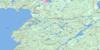
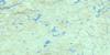
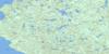
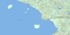
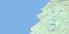
Michipicoten Island Surrounding Area Topo Maps
 |
 |
 |
 |
 |
 |
 |
|
 |
 |
 |
|
 |
 |
© Department of Natural Resources Canada. All rights reserved.
Michipicoten Island Gazetteer
The following places can be found on topographic map sheet 041N12 Michipicoten Island:
Michipicoten Island Topo Map: Bays
Cotton CoveCozens Cove
Cozens Harbour
East Sand Bay
False Harbour
Quebec Harbour
Schafer Bay
West Sand Bay
Michipicoten Island Topo Map: Capes
Four Mile PointPurvis Point
The Junction
Michipicoten Island Topo Map: Forests
Deer YardMichipicoten Island Topo Map: Geographical areas
Thunder BayMichipicoten Island Topo Map: Islands
Agate IslandAndesite Island
Billys Island
Davieaux Island
Green Island
Hope Island
MacMeekin Island
McMeacin Island
Michipicoten Island
Ship Island
Stack Island
West End Island
Michipicoten Island Topo Map: Lakes
Birch LakeCedar Lake
Channel Lake
Coldwater Lake
Curtis Lake
Lac Supérieur
Lake Superior
Loon Lake
Michi Lake
Triangle Lake
Michipicoten Island Topo Map: Conservation areas
Michipicoten Island Provincial ParkMichipicoten Island Topo Map: Shoals
Antelope RockBlack Rock
Chummy Bank
Dixon Reef
McMillan Bank
The Breeders
The Hummock
Michipicoten Island Topo Map: Unincorporated areas
Quebec Harbour
© Department of Natural Resources Canada. All rights reserved.
