Lethbridge Topo Map Online
Download Free Topo Map Sheet 082H10 at 1:50,000 scale
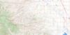
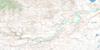
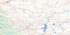
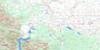
082H10 Lethbridge Topo Map
To view this map, mouse over the map preview on the right.
You can also download this topo map for free:
082H10 Lethbridge high-resolution topo map image.
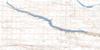
Maps for the Lethbridge topo map sheet 082H10 at 1:50,000 scale are also available in these versions:
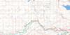
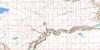
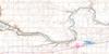
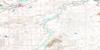
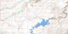
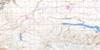
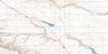
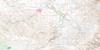
Lethbridge Surrounding Area Topo Maps
 |
 |
 |
 |
 |
 |
 |
 |
 |
 |
 |
 |
 |
 |
 |
 |
© Department of Natural Resources Canada. All rights reserved.
Lethbridge Gazetteer
The following places can be found on topographic map sheet 082H10 Lethbridge:
Lethbridge Topo Map: City
LethbridgeLethbridge Topo Map: Lakes
Henderson LakeStirling Lake
Lethbridge Topo Map: Military areas
Champ de tir LethbridgeLethbridge Range
Lethbridge Topo Map: Major municipal/district area - major agglomerations
Cardston CountyCounty of Lethbridge No. 26
County of Warner No. 5
Municipal District of Cardston No. 6
Lethbridge Topo Map: Rivers
Oldman RiverPothole Creek
St. Mary River
Lethbridge Topo Map: Towns
CoaldaleCoalhurst
Lethbridge Topo Map: Unincorporated areas
BroxburnGhent
Hardieville
Lenzie
Maybutt
Stewart
Tempest
Wilson
Lethbridge Topo Map: Valleys
Nine Mile CouleePrairie Blood Coulee
Prairie Blood Coulée
Prairieblood Coulee
Lethbridge Topo Map: Low vegetation
Bailey's BottomDavis Bottom
Excoffin Bottom
Jerry the Bird's Bottom
Lethbridge Topo Map: Villages
Stirling
© Department of Natural Resources Canada. All rights reserved.
