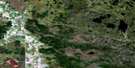
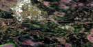
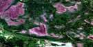
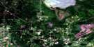
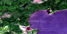
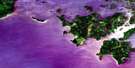
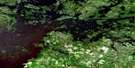
Clearwater Bay Satellite Image Map
Download Free Aerial Photo 052E10 at 1:50,000 scale
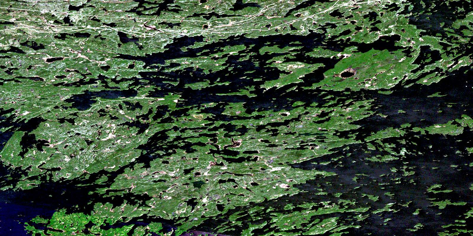
Clearwater Bay Satellite Imagery
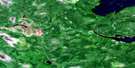
To view this satellite map, mouse over the air photo on the right.
You can also download this satellite image map for free:
052E10 Clearwater Bay high-resolution satellite image map.
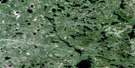
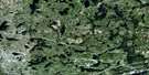
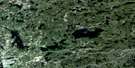
Maps for the Clearwater Bay aerial map sheet 052E10 at 1:50,000 scale are also available in these versions:
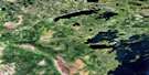
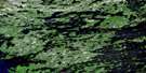
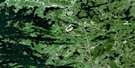
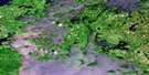
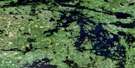
Clearwater Bay Surrounding Area Aerial Photo Maps
 |
 |
 |
 |
 |
 |
 |
 |
 |
 |
 |
 |
 |
 |
 |
 |
© Department of Natural Resources Canada. All rights reserved.
Clearwater Bay Gazetteer
The following places can be found on satellite image map 052E10 Clearwater Bay:
Clearwater Bay Satellite Image: Bays
Ash BayBag Bay
Bulman Bay
Carl Bay
Clearwater Bay
Clytie Bay
Deception Bay
Echo Bay
Gauthier Bay
Hansens Bay
Helldiver Bay
Kendalls Inlet
Labyrinth Bay
Lily Pad Bay
Little Poplar Bay
Micrometer Bay
Oak Bay
Ogawa Bay
Ogema Bay
Outer Bay
Poplar Bay
Portage Bay
Ptarmigan Bay
Quandary Bay
Quiet Bay
Rat Portage Bay
Rheault Bay
Rush Bay
Trinity Bay
Turtle Bay
White Partridge Bay
Whiting Bay
Wiley Bay
Woodchuck Bay
Clearwater Bay Satellite Image: Capes
Aylmer PointBrûlé Point
Carmichael Point
Gateway Point
Infernal Point
Kellys Point
Kendall Point
Machin Point
McCallum Point
Northern Peninsula
Oak Point
Picnic Point
Point Aylmer
Sherlock Point
Spike Point
Spruce Point
Western Peninsula
Wiley Point
Yum Yum Point
Zigzag Point
Clearwater Bay Satellite Image: Channels
Big NarrowsCanoe Channel
Corkscrew Channel
Crow Rock Channel
Deadbroke Channel
Keewatin Channel
Mud Portage Channel
Nebraska Avenue
Norman Channel
Quiet Channel
Second Channel
Shoal Lake Narrows
The Elbow
Tranquil Channel
Welcome Channel
Clearwater Bay Satellite Image: City
KenoraClearwater Bay Satellite Image: Cliffs
The CanyonClearwater Bay Satellite Image: Geographical areas
BoysBroderick
Forgie
Gidley
Glass
Pellatt
Clearwater Bay Satellite Image: Indian Reserves
Lake of the Woods 31BLake of the Woods Indian Reserve 31B
Rat Portage 38A
Rat Portage Indian Reserve 38A
Réserve indienne Lake of the Woods 31B
Réserve indienne Rat Portage 38A
Clearwater Bay Satellite Image: Islands
Abbott IslandBarrier Islands
Big Fraser Island
Big Narrows Island
Big Tree Island
Birch Island
Bishop Point Island
Bulman Island
Cameron Island
Caragana Island
Cedar Island
Channel Island
Charlie Island
Cintiss Island
Coney Island
Copper Island
Corkscrew Island
Crescent Island
Cross Island
Crow Rock Island
Crowe Island
de Noyon Island
Deadbroke Island
Dingwall Island
Donald Duck Island
Doris Island
Drum Island
Duffy's Island
Dumbell Island
Espapeka Island
Ferris Island
Flat Rocker Island
Forrest Island
Fort Sam Island
Fortunes Island
Fox Island
Galt Island
Gourlay Island
Greenwood Island
Gull Island
Gun Club Island
Hare Island
Harris Island
Houghs Island
Iriam Island
Isle of Pines
Isle Ste. Marie
Kalamalka Island
Kennedy Island
Leisure Island
Lemon Island
Little Forrest Island
Little Rope Island
Luella Island
Mack Island
Mackies Island
Manitou Island
Martineau Island
Mather Island
McMillan Island
Menzia Island
Micrometer Island
Mouse Island
Net Nokwa Island
Oliver Island
Palisade Island
Pan Island
Panorama Island
Peewee Island
Pine Island
Pulfords Island
Queen Island
Rabson Island
Rileys Island
Rope Island
S Island
Saucer Island
Shammis Island
Shannons Island
Shragges Island
Slate Islands
St. George Island
St. Helena Island
Stanley Island
Sunbath Island
Teepee Island
Temperance Island
The Hump
The Tangle
The Tangle Islands
Thompson Island
Tippecanoe Island
Treaty Island
Turnbull Island
Twin Islands
Victoria Island
Whisky Island
Wolf Island
Yacht Club Island
Zigzag Island
Clearwater Bay Satellite Image: Lakes
Abernethy LakeBare Hill Lake
Barrage Lake
Birch Lake
Bluebell Lake
Boyne Lake
Brocket Lake
Bwan Lake
Canoe Lake
Caribou Lake
Cedarskirt Lake
Chebucto Lake
Chick Lake
Crowduck Lake
Cul de Sac Lake
Cuthbert Lake
Darkwater Lake
Deception Lake
Douglas Lake
Endportage Lake
Engineers Lake
Englis Lake
First Lake
Fox Lake
Gold Mountain Lake
Granite Lake
Hall Lake
Hatmaker Lake
Helen Lake
Hendrick Lake
Hertz Lake
Hinterland Lake
Hopkins Lake
Inglis Lake
Iris Lake
James Lake
Jennie Lake
Joyce Lake
Lac des Bois
Lake of the Woods
Lake of Two Mountains
Lily Lake
Lily Lake
Line Lake
Little Rock Lake
Lock Lake
Love Lake
Lownest Lake
McConnell Lake
McLauchlin Lake
Melborne Lake
Menzia Lake
Midportage Lake
Minkaduza Lake
Moss Lake
Moth Lake
Nola Lake
Owl Lake
Paddy Lake
Parth Lake
Partridge Lake
Patricia Lake
Potter Lake
Question Lake
Rice Lake
Ridge Lake
Ross Lake
Seager Lake
Shoal Lake
Slate Lake
Spitzi Lake
Spruce Lake
Squaw Lake
Umbel Lake
War Eagle Lake
Waseca Lake
Winnetka Lake
Clearwater Bay Satellite Image: Rapids
Ash RapidsUpper Rapids
Clearwater Bay Satellite Image: Rivers
Bare Hill CreekCrowduck Creek
Deception Creek
Granite Creek
Moss Creek
Paddy Creek
War Eagle Creek
Clearwater Bay Satellite Image: Road features
Deadman PortageTwelve Mile Portage
Clearwater Bay Satellite Image: Shoals
Gull Rock ReefLine Reef
MacKenzie Reef
Menzies Reef
Wylies Reef
Clearwater Bay Satellite Image: Towns
Jaffray and MelickJaffray Melick
Clearwater Bay Satellite Image: Unincorporated areas
Clearwater BayGranite Lake
Clearwater Bay Satellite Image: Low vegetation
Holmstrom MarshHolmstroms Marsh
© Department of Natural Resources Canada. All rights reserved.
052E Related Maps:
052E Kenora052E01 Morson
052E02 Big Island
052E03 Buffalo Bay
052E04 Sprague
052E05 Whitemouth River
052E06 Berry Point
052E07 Falcon Island
052E08 Sioux Narrows
052E09 Longbow Lake
052E10 Clearwater Bay
052E11 Falcon Lake
052E12 Mcmunn
052E13 Whitemouth
052E14 Caddy Lake
052E15 Keewatin
052E16 Kenora
