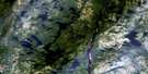
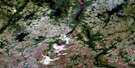
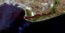
Lac Kegashka Satellite Image Map
Download Free Aerial Photo 012K06 at 1:50,000 scale
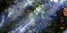
Lac Kegashka Satellite Imagery
To view this satellite map, mouse over the air photo on the right.
You can also download this satellite image map for free:
012K06 Lac Kegashka high-resolution satellite image map.
Maps for the Lac Kegashka aerial map sheet 012K06 at 1:50,000 scale are also available in these versions:
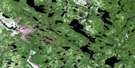
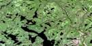
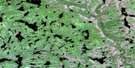
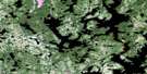
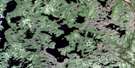
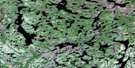
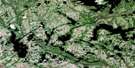
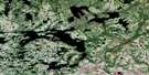
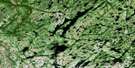
Lac Kegashka Surrounding Area Aerial Photo Maps
 |
 |
 |
 |
 |
 |
 |
 |
 |
 |
 |
 |
 |
 |
 |
 |
© Department of Natural Resources Canada. All rights reserved.
Lac Kegashka Gazetteer
The following places can be found on satellite image map 012K06 Lac Kegashka:
Lac Kegashka Satellite Image: Bays
Baie de la Troisième ChuteBaie du Camp à Samuel
Baie du Diable
Baie du Lac à Castor
Baie du Portage à Pierriche
Lac Kegashka Satellite Image: Beaches
Plage du Camp à MarioLac Kegashka Satellite Image: Capes
Pointe à CyrillePointe à la Loutre
Pointe aux Outardes
Pointe de la Chaloupe
Pointe de la Fourche
Pointe de la Première Chute
Pointe Musquaro
Lac Kegashka Satellite Image: Channels
Étroit de la PancarteÉtroit du Lac du Camp à John
Lac Kegashka Satellite Image: Geographical areas
BissotKegaska
Lalande
Musquaro
Lac Kegashka Satellite Image: Islands
Île aux TremblesÎle de la Pourvoirie
Île des Rats Musqués
Île des Vents Violents
Lac Kegashka Satellite Image: Lakes
Lac à CastorLac à Pierriche
Lac Alnepopocatanan
Lac Anepopocatanan
Lac Bonenfant
Lac Charest
Lac des Outardes
Lac Desruisseaux
Lac du Camp à John
Lac du Grand Portage
Lac du Grand Priant
Lac Kapitahkuiat
Lac Katshiputiskamatunant
Lac Kauikuiauatshitihk
Lac Kégashka
Lac Kegaska
Lac Marie-Claire
Lac Matsheku
Lac Missu
Lac Mistahiniu
Lac Musquanousse
Lac Musquaro
Lac Pehitshikateu
Lac Simard
Lacs Uhatshimin
Lac Kegashka Satellite Image: Rivers
Rivière à DutroRivière Kégashka
Rivière Kegaska
Rivière Musquanousse
Rivière Musquaro
Ruisseau à Castor
Ruisseau à Pierriche
Ruisseau à Scott
Ruisseau de l'Aigle
Ruisseau Pakutshanuku
Lac Kegashka Satellite Image: Road features
Portage à PierrichePortage Atam Utenni

© Department of Natural Resources Canada. All rights reserved.
012K Related Maps:
012K Musquaro012K01 Baie Des Loups
012K02 Gethsemani
012K03 Kegashka
012K04 Natashquan
012K05 Lac Paimpont
012K06 Lac Kegashka
012K07 Lac Washicoutai
012K08 Lac Coacoachou
012K09 Lac Wabouchagamou
012K10 Lac Cauchy
012K11 Lac D'Auteuil
012K12 Lac Victor
012K13 Lac Rancin
012K14 Lac Durocher
012K15 Lac Goyelle
012K16 Lac De Re
