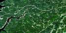
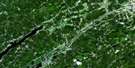
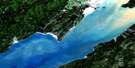
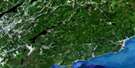
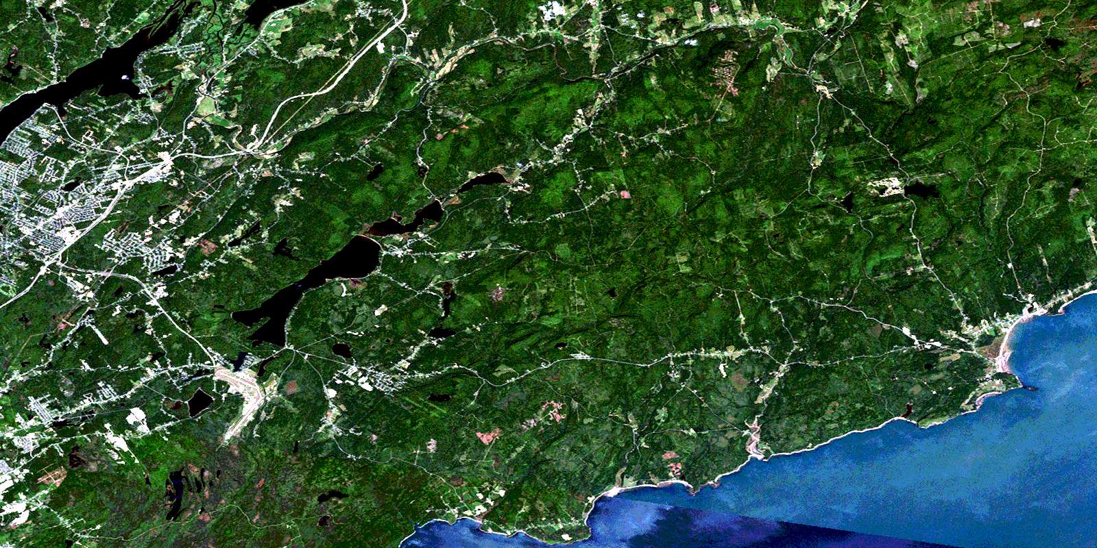
Loch Lomond Satellite Image Map
Download Free Aerial Photo 021H05 at 1:50,000 scale
Loch Lomond Satellite Imagery
To view this satellite map, mouse over the air photo on the right.
You can also download this satellite image map for free:
021H05 Loch Lomond high-resolution satellite image map.
Maps for the Loch Lomond aerial map sheet 021H05 at 1:50,000 scale are also available in these versions:
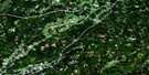
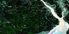
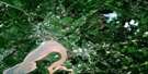
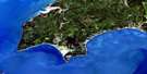
Loch Lomond Surrounding Area Aerial Photo Maps
 |
 |
 |
 |
 |
 |
 |
 |
 |
 |
 |
 |
 |
 |
 |
 |
© Department of Natural Resources Canada. All rights reserved.
Loch Lomond Gazetteer
The following places can be found on satellite image map 021H05 Loch Lomond:
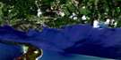
Loch Lomond Satellite Image: Bays
Baie de FundyBay of Fundy
East Bay
Echo Cove
Forester Cove
Forresters Cove
Matthew Cove
Matthews Cove
Meehans Cove
Meenans Cove
Murphy Cove
Quaco Bay
Robinson Cove
Thompson Cove
Tynemouth Creek
West Bay
Loch Lomond Satellite Image: Beaches
Berry BeachBrowns Beach
Gardner Creek Beach
Macs Beach
McLeods Beach
Powers Beach
Reeds Beach
St. Martins Beach
Wallace Beach
Loch Lomond Satellite Image: Capes
Dicksons PointDicksons Point
East Head
East Red Head
Gondola Point
Honeycomb Point
Kingston Peninsula
MacCormack Point
Macomber Point
McCoy Head
McCumber Point
Oliver Point
Perry Point
Powers Point
Quaco Head
Reeds Point
Rogers Head
The Neck
Wheatons Point
Loch Lomond Satellite Image: Channels
Loch Lomond ThoroughfareSecond Lake Thoroughfare
Third Lake Thoroughfare
Loch Lomond Satellite Image: City
Saint JohnLoch Lomond Satellite Image: Cliffs
Forresters BluffLoch Lomond Satellite Image: Geographical areas
HammondHampton
Kings
Kingston
Rothesay
Saint John
Saint Martins
Simonds
Upham
Loch Lomond Satellite Image: Islands
Darlings IslandSplit Rock
Spoon Island
Loch Lomond Satellite Image: Lakes
Adams LakeAllison Lake
Bates Lake
Bay Lake
Beaver Lake
Berrys Lake
Blackall Lake
Blindman Lake
Bowes Lake
Bradley Lake
Bradley Lakes
Brawley Lake
Browns Lake
Buck Lake
Burley Lake
Calvert Lake
Carpenter Pond
Carvel Lake
Chalet Lake
Cosy Lake
Cruickshank Lake
Darlings Lake
Dolan Lake
Dolan Pond
Donaldson Lake
Douglas Lake
Drummonds Lake
Duck Lake
Duck Pond
Eastern Lakes
First Eastern Lake
Flamingo Lake
Giffin Pond
Grassy Lake
Grassy Lake
Grassy Lakes
Haynes Lake
Hayns Lake
Henry Lake
Hopey Lake
Hosford Lake
Hotsford Lake
Hunter Lake
Irwin Lake
Kelly Lake
Kennebecasis Lake
Kingston Lake
Latimer Lake
Lillis Pond
Lily Lake
Little Ben Lomond Lake
Little River Reservoir
Loch Lomond
Long Lake
MacFarlane Lake
Mackins Lake
Marks Lake
Marsh Lake
McBrien Lake
McCormac Lake
McDonald Lake
McKeever Lake
McLachlan Lake
McVanes Lake
Minote Lake
Molaskey Lake
Mulasky Lake
Mystery Lake
Nugent Pond
Otter Lake
Perch Lake
Ping Pond
Ping Pong Pond
Pitts Lake
Porcupine Lake
Porcupine Lake
Quinn Lake
Ritchie Lake
Robertson Lake
Round Lake
Second Eastern Lake
Second Lake
Shaw Lake
Stoker Lake
Taylor Lake
Terreo Lake
Theobald Lake
Third Lake
Tracey Lake
Treadwell Lake
Waddell Lake
Wolsely Lake
Wood Lake
Loch Lomond Satellite Image: Mountains
Baxters MountainBear Mountain
Ben Lomond
Bloomsbury Mountain
Boyles Hill
Burchills Mountain
Drawlin Hill
Golden Grove Mountain
Grove Hill
Handren Hill
Mosher Hill
Mount Misery
Mount Theobald
Porcupine Mountain
Pumpkin Hill
Silver Hill
Spy Glass Hill
Upham Mountain
Vernons Mountain
Weatherbys Peak
Loch Lomond Satellite Image: Conservation areas
StoneycroftLoch Lomond Satellite Image: Plains
Burchills FlatsChapel Flats
Loch Lomond Satellite Image: Rivers
Alder BrookArmstrong Brook
Bain Brook
Bain Brook
Bain Brook
Bains Brook
Bater Brook
Bates Brook
Bean Brook
Beaver Brook
Bedford Brook
Berrys Brook
Beyea Brook
Big Rody Brook
Black River
Black River
Bonney Brook
Bradley Brook
Brandy Brook
Brawley Brook
Clark Brook
Colton Brook
Curry Brook
Cutler Brook
Darlings Brook
Davidson Brook
Doctors Brook
Dolan Brook
Donnelly Brook
East Black River
East Branch Black River
East Branch Irish River
East Irish River
Emerson Creek
Fairweather Brook
Flaglar Brook
Fletcher Brook
Fossil Brook
Gardner Creek
Gardner Creek
Germaine Brook
Grahams Brook
Grassy Brook
Grassy Lake Brook
Greer Brook
Grooms Brook
Half Gallon Brook
Hammond River
Hanford Brook
Hanford Brook
Hosford Brook
Irish River
Isaac Brook
Jacob Brook
Jenny Lind Brook
Kennebecasis River
Langstroth Brook
Little River
Macomber Brook
Macomber Brook
McBrien Brook
McCumber Brook
McGonagle Brook
McGuire Brook
McLennan Brook
Mispec River
Mispek River
Monette Brook
Mosher River
Murphy Brook
North Branch Black River
Nugent Brook
Palmer Brook
Porter Brook
Quaco River
Ratcliffe Brook
Reeds Brook
Ritchie River
Salmon Creek
Salt Springs Brook
Saunders Brook
Scoodic Brook
Snider Brook
South Stream
Stony Brook
Taylors Brook
Ten Mile Creek
Terreo Brook
Titus Brook
Tynemouth Creek
Washburn Brook
Washburn Brook
Loch Lomond Satellite Image: Shoals
The SistersLoch Lomond Satellite Image: Towns
HamptonQuispamsis
Rothesay
Loch Lomond Satellite Image: Unincorporated areas
Bains CornerBarnesville
Barsa Subdivision
Baxters Corner
Bay View
Ben Lomond
Black River
Black River Road
Blairs
Bonney Road
Burchills Flats
Champlain Heights
Chester
Churchland Road
Clifton
Clifton Royal
Coleraine
Damascus
East Riverside
East Riverside-Kinghurst
Fair View
Fairfield
Fairvale
Fairvale Station
French Village
Gardner Creek
Garnet
Garnett Settlement
Glen Titus
Golden Grove
Gondola Point
Grandview Industrial Park
Greenwood
Greer
Greer Settlement
Grove Hill
Hammond River
Hanford Brook
Hardingville
Hillhurst
Jubilee
Kingshurst
Lake Henry
Lakewood
Lakewood Heights
Latimer Lake
Little River
Loch Lomond
Meehans Corner
Meenans Corner
Model Farm
Mount Prospect
Mount Prospect
Nauwigewauk
Orange Hill
Otty Glen
Perry Point
Porter
Porter Road
Primrose
Pumpkin Hill
Quaco
Quaco Road
Red Head
Reeds Point
Renforth
Ritchie Lake
Riverview Heights
Robertson
Rowley
Shanklin
Sherwood Park
Silver Falls
Smithtown
Stoneycroft
Ten Mile Creek
Titus Mills
Titusville
Tynemouth Creek
Upham
Upper Golden Grove
Upper Loch Lomond
Upperton
Wells
West Quaco
Willow Grove
Loch Lomond Satellite Image: Low vegetation
Gardner Creek MarshSt. Martins Marsh
Loch Lomond Satellite Image: Villages
East Riverside-KingshurstSt. Martins
© Department of Natural Resources Canada. All rights reserved.
