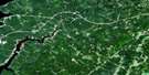
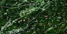
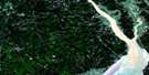
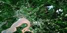
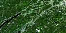
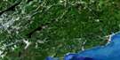
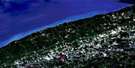
Hillsborough Satellite Image Map
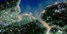
Download Free Aerial Photo 021H15 at 1:50,000 scale
Hillsborough Satellite Imagery
To view this satellite map, mouse over the air photo on the right.
You can also download this satellite image map for free:
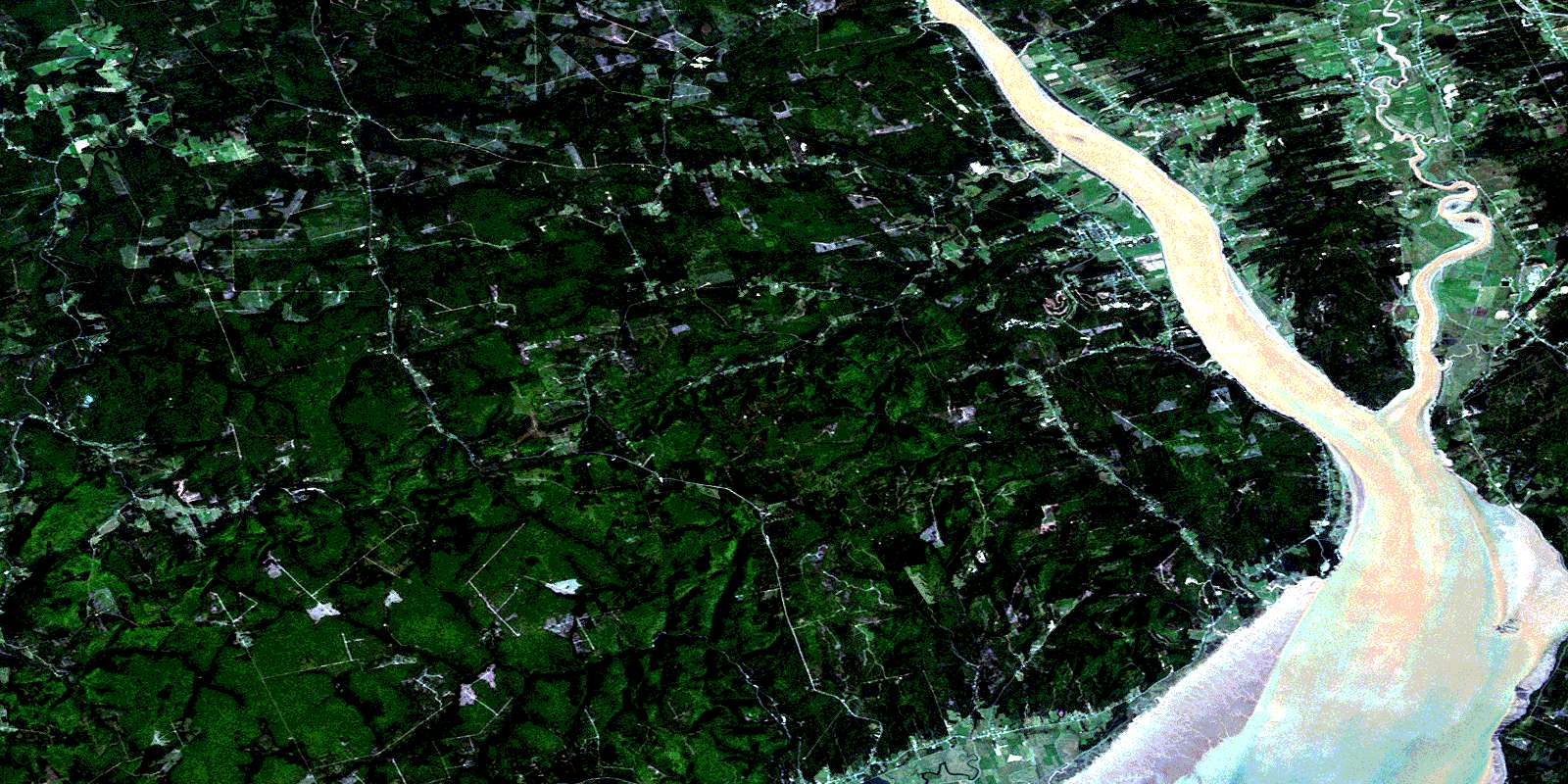
021H15 Hillsborough high-resolution satellite image map.
Maps for the Hillsborough aerial map sheet 021H15 at 1:50,000 scale are also available in these versions:
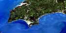
Hillsborough Surrounding Area Aerial Photo Maps
 |
 |
 |
 |
 |
 |
 |
 |
 |
 |
 |
 |
 |
 |
 |
 |
© Department of Natural Resources Canada. All rights reserved.
Hillsborough Gazetteer
The following places can be found on satellite image map 021H15 Hillsborough:
Hillsborough Satellite Image: Bays
Cranberry CoveGrande Anse
Hendersons Cove
Shepody Bay
Hillsborough Satellite Image: Beaches
Calhoun FlatsMaringouin Flats
Hillsborough Satellite Image: Capes
Big CapeCape Demoiselle
Cole Head
Cole Point
Dorchester Cape
Dorchester Island
Fort Folly Point
Hopewell Cape
Memramcook Spit
Hillsborough Satellite Image: Geographical areas
AlbertCoverdale
Dorchester
Elgin
Harvey
Hillsborough
Hopewell
Sackville
Westmorland
Hillsborough Satellite Image: Indian Reserves
Fort Folly 1Hillsborough Satellite Image: Islands
Gray IslandGrays Island
Indian Island
Indian Island
Hillsborough Satellite Image: Lakes
Blackwood LakeMcFadden Lake
Memramcook Lake
Palmers Pond
Pink Rock Lake
Stanyard Lake
Hillsborough Satellite Image: Mountains
Boars BackCaledonia Mountain
Crooked Creek Lookout
Fillmore Hill
Flint Hill
Foley Hill
Hayward Pinnacle
Jonah Hill
Kent Hills
Lewis Mountain
Lime Rocks Hill
Livingstones Hill
Oak Hill
Oil Hill
Pound Hill
Round Hill
Shepody Mountain
Solomon Hill
Stuart Mountain
Sweet Mountain
William Prosser Mountain
Hillsborough Satellite Image: Conservation areas
Bell InnChapelle de Beaumont
Keillor House
Le Bell Inn
Lieu historique national du Canada du Monument-Lefebvre
Maison de Keillor
Monument Lefebvre National Historic Site of Canada
The Rocks Provincial Park
Hillsborough Satellite Image: Rivers
Apple CreekArabian Vault Brook
Ayers Brook
Back Brook
Beaman Brook
Bear Brook
Beaver Brook
Beaver Brook
Beeman Brook
Belliveau Creek
Bennett Brook
Berry Brook
Berryton Brook
Big Spring Brook
Blackwood Brook
Bordeaux Creek
Boudreau Creek
Boyd Creek
Bray Brook
Breau Creek
Brydon Brook
Bull Creek
Bull Creek
Caledonia Brook
Canada Creek
Canadian Brook
Cariboo Brook
Caribou Brook
Carson Brook
Cat Creek
Chapman Creek
Chemical Creek
Coverdale River
Crank Brook
Crooked Creek
Curryville Creek
Daniel Brook
Daniels Brook
Deed Brook
Demoiselle Creek
Downey Brook
Downing Creek
Dryden Brook
East Branch Little River
East Branch Turtle Creek
East Turtle Creek
Elliott Brook
Flat Brook
Fox Brook
Frederick Brook
Georges Brook
George's Brook
Godfrey Brook
Hamilton Creek
Hayward Brook
Hiram Brook
Hopper Brook
Hopper Creek
Keillor Brook
Keillor Brook
Keillor Brook
Le Blanc Creek
Leaman Brook
LeBlanc Creek
Little River
Lower Maple Creek
Lumsden Brook
Lumsden Brook
McFadden Brook
McGee Brook
McHenry Brook
McKinley Brook
McKinley Brook
Meadow Brook
Memel Creek
Memramcook River
Mill Brook
Mill Creek
Mill Creek
Minors Brook
Mitton Brook
Mollins Brook
Northwest Branch Brook
Northwest Branch Crooked Creek
Northwest Crooked Creek
Palmers Creek
Patterson Brook
Peck Creek
Petitcodiac River
Pow Brook
Prescott Brook
Prosser Brook
Randall Brook
Rat Tail Brook
Rhody Brook
Robbs Brook
Rockwell Creek
Sawmill Creek
Shaw Brook
Shaw Creek
Sherman Brook
Spar Brook
Stiles Brook
Stoney Creek
Stony Creek
Stuart Brook
Tingley Brook
Toms Brook
Tower Brook
Turner Creek
Turtle Creek
Upham Brook
Upper Creek
Upper Maple Creek
Weldon Creek
Wells Brook
West Branch Turtle Creek
West Turtle Creek
Wilson Brook
Hillsborough Satellite Image: Shoals
Cape RocksGrande Anse Ledge
Middle Ground
Middle Ground
The Rocks
Hillsborough Satellite Image: Unincorporated areas
Albert MinesBaltimore
Baltimore
Beaumont
Beech Hill
Belliveau Village
Berryton
Boudreau Village
Breau Creek
Caledonia Mountain
Caledonia Settlement
Cap Demoiselle Creek
Cape
Cape Station
Chemical Road
Chester
College Bridge
Colpitts
Colpitts Settlement
Cormier Cove
Cormier's Cove
Curryville
Dawson
Dawson Settlement
Demoiselle Creek
Dorchester Cape
Dover
Edgett Landing
Edgetts Landing
Edgett's Landing
Ferndale
Flint Hill Settlement
Gautreau Village
Hopewell Cape
Hopewell Hill
Hopper
Isaiah Corner
Johnson Mills
Johnson's Mills
La Montagne
Le Lac
Little Dover
Little River
Lower Cape
Lumsden Settlement
McGinleys Corner
McGinley's Corner
Memel Settlement
Memramcook East
Middleton
Montaigne
Mountville
Nixon
Osborne Corner
Parkindale
Pré d'en haut
Pré-d'en-Haut
Prosser Brook
Rockland
Rosevale
Saint-Joseph
Salem
Shenstone
Shepody
St. Joseph
Steeves Mills
Steevescote
Stoney Creek
Stony Creek
Stony Creek Station
Surrey
Taylor Village
Turtle Creek
Upper Dorchester
Upper Turtle Creek
Weldon
Woodworth
Woodworth Settlement
Hillsborough Satellite Image: Valleys
Oliver GulchHillsborough Satellite Image: Low vegetation
Breau MarshBurley Bog
Daniels Flats
Shepody Marsh
Hillsborough Satellite Image: Villages
DorchesterHillsborough
Memramcook
Riverside-Albert
© Department of Natural Resources Canada. All rights reserved.
