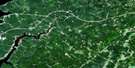
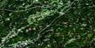
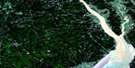
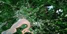
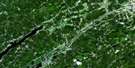
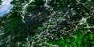
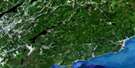
Springhill Satellite Image Map
Download Free Aerial Photo 021H09 at 1:50,000 scale
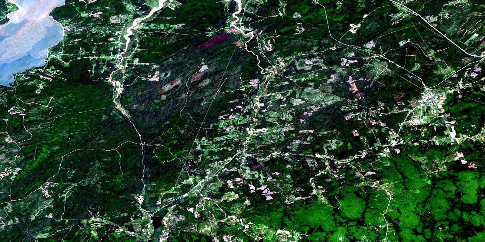
Springhill Satellite Imagery
To view this satellite map, mouse over the air photo on the right.
You can also download this satellite image map for free:
021H09 Springhill high-resolution satellite image map.
Maps for the Springhill aerial map sheet 021H09 at 1:50,000 scale are also available in these versions:
Springhill Surrounding Area Aerial Photo Maps
 |
 |
 |
 |
 |
 |
 |
 |
 |
 |
 |
 |
 |
 |
 |
 |
© Department of Natural Resources Canada. All rights reserved.
Springhill Gazetteer
The following places can be found on satellite image map 021H09 Springhill:
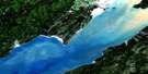
Springhill Satellite Image: Bays
Boss CoveChignecto Bay
Cumberland Basin
Downing Cove
Pecks Cove
Springhill Satellite Image: Capes
Boss PointDowning Head
Hardscrabble Point
Pecks Point
Ragged Reef Point
Two Rivers Point
Ward Point
Springhill Satellite Image: Geographical areas
ColchesterCumberland
Westmorland
Springhill Satellite Image: Indian Reserves
Franklin Manor 22Springhill Satellite Image: Lakes
British LakeCleveland Lake
Forty Puzzle Lake
Harrison Lake
Long Lake
Newville Lake
Randalls Lake
Round Lake
Smiths Pond
Springhill Satellite Image: Mountains
Boars Back RidgeCanaan Mountains
Christie Hill
Cobequid Mountains
Thundering Hill
Springhill Satellite Image: Major municipal/district area - major agglomerations
ColchesterCumberland
Springhill Satellite Image: Conservation areas
Chignecto Game SanctuaryJoggins Fossil Cliffs World Heritage Site
Maccan River Wildlife Management Area
Site du patrimoine mondial des falaises fossilifères de Joggins
Springhill Satellite Image: Provinces
New BrunswickNouveau-Brunswick
Nouvelle-Écosse
Nova Scotia
Springhill Satellite Image: Rivers
Adams BrookAtkinson Brook
Baird Brook
Barnhill River
Barren Brook
Bass River of Five Islands
Bearden Brook
Black River
Boss Brook
Broad Brook
Brown Brook
Brown Brook
Canada Creek
Chase Brook West Branch
Christie Brook
Cleveland Brook
Coal Mine Brook
Coldspring Brook
Davidson Brook
Deep Brook
East Branch Southampton River
East Brook
East River
East River of Five Islands
Elm Brook
Fishweir Brook
Five Islands River
Fordyce Brook
Forty Puzzle Brook
Fullerton Brook
Glennies Brook
Halfway Brook
Halfway River
Halliday Brook
Hancock Brook
Hannah Brook
Harrington River
Harrison Brook
Haycock Brook
Henry Brook
Hoig Brook
Holt Mill Brook
Indian Brook
John Curry Brook
Jones Brook
Kelley River
Kelley River (Mill Creek)
Kelly River
Kennedy Creek
Lake Brook
Latta Brook
Lavers Brook
Lawrence Brook
Leamington Brook
Little Forks River
Little Forks River
Little River
Maccan River
Maccan River
MacCarrons River
Mapleton Brook
McCarren Creek
Meadow Brook
Mile Brook
Mill Creek
Mills Brook
Moses Brook
Muddy Brook
North River
North Sherman Brook
O'Rourke Brook
Patton Creek
Polly Brook
Poole Creek
Porter Brook
Pugsley Brook
Pugsley Brook
Puzzle Brook
Rattling Brook
Reid Brook
River Hébert
Rutledge Brook
Sandhill Brook
Scott Brook
South Brook
South Brook
Southampton River
Sparks Brook
St. Georges Brook
Stanley Brook
Stewarts Brook
Styles Brook
Sugarwoods Brook
Taggart Brook
Tipping Brook
Welton Brook
West Brook
Whetstone Brook
Springhill Satellite Image: Towns
SpringhillSpringhill Satellite Image: Unincorporated areas
AtholAthol Road
Athol Station
Black River Road
Chignecto
East Mapleton
East Southampton
Gilbert Mountain
Halfway River
Halfway River East
Halfway River Station
Harrison Road
Harrison Settlement
Joggins
Joggins Mines
Jubilee
Leamington
Little Forks
Lower Cove
Lower River Hebert
Lower River Hébert
Maccan
Mapleton
Millers Corner
New Canaan
Newville
Pettigrew Settlement
Ragged Reef
River Hebert East
River Hébert East
River Hebert East (Strathcona)
Rockport
Rodney
Salt Springs
Salt Springs Station
South Athol
South Brook
Southampton
Spring Hill Junction
Springhill Junction
Strathcona
Two Rivers
West Brook
Windham Hill
Springhill Satellite Image: Low vegetation
Bearden BarrensBucktagen Barrens
Jubilee Bog
Tipping Meadow
Springhill Satellite Image: Villages
River HebertRiver Hébert
© Department of Natural Resources Canada. All rights reserved.
