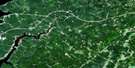
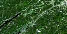
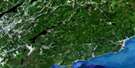
Parrsboro Satellite Image Map
Download Free Aerial Photo 021H08 at 1:50,000 scale
Parrsboro Satellite Imagery
To view this satellite map, mouse over the air photo on the right.
You can also download this satellite image map for free:
021H08 Parrsboro high-resolution satellite image map.
Maps for the Parrsboro aerial map sheet 021H08 at 1:50,000 scale are also available in these versions:
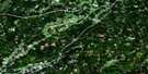
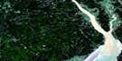
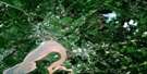
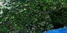
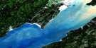
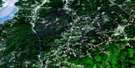
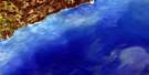
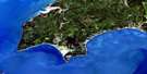
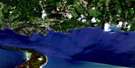
Parrsboro Surrounding Area Aerial Photo Maps
 |
 |
 |
 |
 |
 |
 |
 |
 |
 |
 |
 |
 |
 |
 |
 |
© Department of Natural Resources Canada. All rights reserved.
Parrsboro Gazetteer
The following places can be found on satellite image map 021H08 Parrsboro:
Parrsboro Satellite Image: Bays
Amethyst CoveBig Cove
Clam Cove
Davidson Cove
Dixons Cove
East Bay
Ells Creek
Gentleman Cove
Lady Cove
Little Cove
Little Split Rock Cove
Lobster Hole
Minas Basin
Parrsboro Harbour
Parrsboro Roads
Phinneys Cove
Scots Bay
Scotsman Bay
Scotts Bay
Shad Creek
Sheddley Cove
Turners Cove
West Bay
Parrsboro Satellite Image: Beaches
First BeachPartridge Island Beach
Sand Point Beach
Second Beach
Parrsboro Satellite Image: Capes
Blomidon PeninsulaCape Blomidon
Cape Sharp
Cape Split
Clarke Head
Crane Point
McKay Head
Ram Head
Rams Head
Ramshead Point
Red Head
Sand Point
Sheddley Point
Parrsboro Satellite Image: Channels
Minas ChannelParrsboro Satellite Image: Cliffs
Bull BluffMcLaughlin Bluff
Wasson Bluff
Parrsboro Satellite Image: Forests
Black Rock WoodsParrsboro Satellite Image: Geographical areas
ColchesterCumberland
Hants
Kings
Parrsboro Satellite Image: Islands
Diamond IslandEgg Island
Five Islands
Long Island
Moose Island
Partridge Island
Pinnacle Island
The Brothers
Parrsboro Satellite Image: Lakes
Black LakeCranberry Lake
Duck Lake
Fowler Lake
Gilbert Lake
Gilbert Lake
Hatfields Pond
Jeffers Lake
Leak Lake
Leake Lake
MacAloneys Lake
McAlese Lake
Murray Lake
Otter Lake
Parrsboro Aboiteau
Pleasant Lake
Pleasant Lake
Summit Lake
Wasson Lake
Welton Lake
Parrsboro Satellite Image: Mountains
Blockhouse HillCobequid Mountains
Economy Mountain
Gerrish Mountain
Gilbert Hills
Glasgow Mountain
Kirk Hill
Lynn Mountain
North Mountain
North Mountain Range
Woods Mountain
Parrsboro Satellite Image: Major municipal/district area - major agglomerations
ColchesterCumberland
Kings
Parrsboro Satellite Image: Conservation areas
Blomidon Provincial ParkChignecto Game Sanctuary
Five Islands Provincial Park
Parrsboro Satellite Image: Rapids
Big EddyParrsboro Satellite Image: Rivers
Adams BrookBarkhouse Brook
Bass River of Five Islands
Beaver Brook
Big Pike Fire Brook
Black Brook
Borden Brook
Boyd Brook
Broad Brook
Brown Brook
Brown Brook
Bumper Brook
Bumpers Brook
Crane Creek
Dan Jess Brook
Davidson Brook
Dead Horse Brook
Diligent River
Diligent River
Dow Brook
East Branch Diligent River
East Branch Moose River
East Parrsboro River
East River
East River of Five Islands
Eaton Brook
Ells Brook
Ells Brook
Farrell Brook
Farrells River
Five Islands River
Fullerton Brook
Gavin Brook
Glasgow Brook
Gundalow Brook
Hanna Brook
Hannas Brook
Harrington River
Henry Brook
Herbert Tupper Brook
Horse Brook
Humming Brook
Huntley Brook
Indian Springs Brook
Jeffers Brook
Jess Brook
Jones Brook
Little Pike Fire Brook
Manse Huntley Brook
McAlese Brook
McCallum Brook
McCarthy Brook
McCoy Brook
McLaughlin Brook
Mile Brook
Mill Brook
Mill Creek
Moose Creek
Moose River
Moose River
Ned Brook
Neds Brook
Newton Brook
North Branch Diligent River
North River
Orchard Brook
Parrsboro River
Ramshead River
River Hébert
Salter Brook
Shad Brook
Shad Brook
Sheddley Brook
Shipyard Brook
Straddle Leg Brook
Swan Creek
Taggart Brook
Tupper Brook
Turners Brook
Two Brooks
Vault Brook
Wasson Brook
Watering Brook
Welton Brook
West Branch Harrington River
West Branch Moose River
West Brook
West Diligent River
West Harrington River
West Moose River
Wharton Brook
Whitehall Creek
Zeek Brook
Parrsboro Satellite Image: Shoals
Black RockDickson Bar
Lighthouse Bar
Little Split Rock
Pinnacle Rock
Shoe Bridge Ledge
The Old Wife
Two Hour Rock
Walton Bar
Parrsboro Satellite Image: Towns
ParrsboroParrsboro Satellite Image: Unincorporated areas
Black RockBlue Sac Road
Diligent River
Five Islands
Greenhill
Kirkhill
Lake Road Corner
Lakelands
Lower Five Islands
Lynn
Moose River
New Britain
New Prospect
Riverside
Riverside Beach
Scot Bay
Scots Bay
Scotts Bay
South Scots Bay
Two Islands
Union Valley
West Bay
Wharton
White Water
Yorke Settlement
Parrsboro Satellite Image: Valleys
McCallum GulchMcCarthy Gulch
Parrsboro Satellite Image: Low vegetation
Gundalow Plains
© Department of Natural Resources Canada. All rights reserved.
