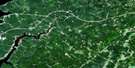
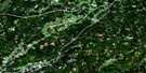
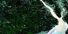
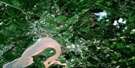
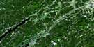
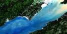
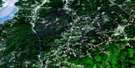
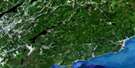
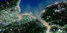
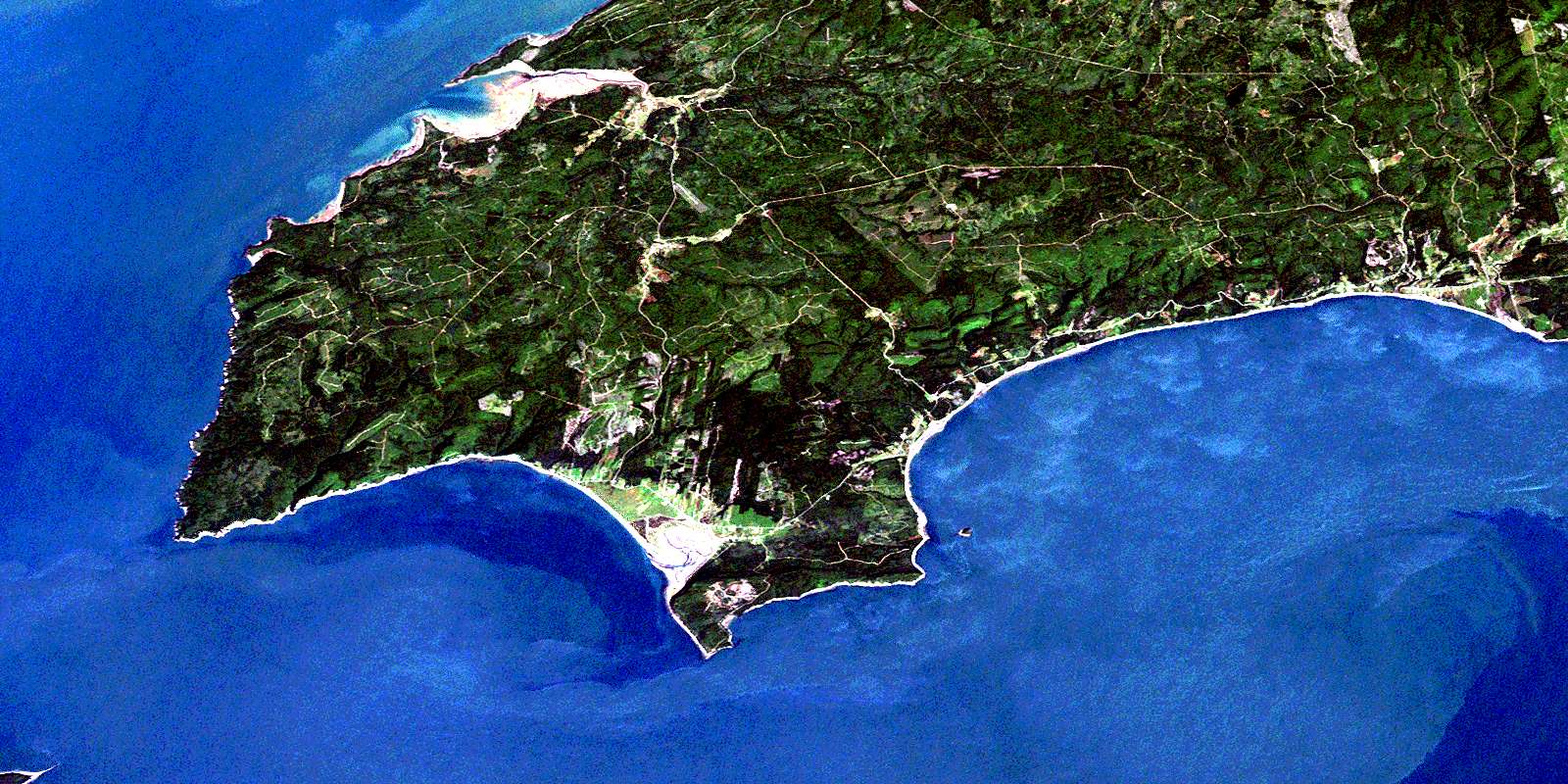
Cape Chignecto Satellite Image Map
Download Free Aerial Photo 021H07 at 1:50,000 scale
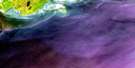
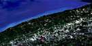
Cape Chignecto Satellite Imagery
To view this satellite map, mouse over the air photo on the right.
You can also download this satellite image map for free:
021H07 Cape Chignecto high-resolution satellite image map.
Maps for the Cape Chignecto aerial map sheet 021H07 at 1:50,000 scale are also available in these versions:
Cape Chignecto Surrounding Area Aerial Photo Maps
 |
 |
 |
 |
 |
 |
 |
 |
 |
 |
 |
 |
 |
 |
 |
 |
© Department of Natural Resources Canada. All rights reserved.
Cape Chignecto Gazetteer
The following places can be found on satellite image map 021H07 Cape Chignecto:
Cape Chignecto Satellite Image: Bays
Advocate BayAdvocate Harbour
Andersons Cove
Apple River Bay
Baie de Fundy
Bay of Fundy
Bay of Fundy
Broad Cove
Carrying Cove
Chignecto Bay
Devils Slide Cove
Greville Bay
Horseshoe Cove
Lubber Hole
Minas Basin
Refugee Cove
Scots Bay
Seal Cove
Spicer Cove
Spicers Cove
Cape Chignecto Satellite Image: Beaches
Big BeachEdgetts Beach
Polly Flats
Pollys Flats
The Bar
West Beach
Cape Chignecto Satellite Image: Capes
Apple HeadBoars Head
Cap d'Or
Cape Capstan
Cape Chignecto
Cape d'Or
Cape D'Or
Cape Spencer
Fowler Head
Fox Point
Green Point
Halibut Head
Pudsey Point
Squally Point
Cape Chignecto Satellite Image: Channels
Minas ChannelCape Chignecto Satellite Image: Geographical areas
CumberlandCape Chignecto Satellite Image: Islands
Ile HauteIsle Haute
Spencer Island
Spencers Island
Cape Chignecto Satellite Image: Lakes
Beaverdam LakeShulie Lake
Cape Chignecto Satellite Image: Mountains
Allen HillBeech Hill
Bennett Hill
Birch Hill
Fields Hill
French Lookout
New Yarmouth Mountain
Turple Hill
Watering Brook Hill
Woods Mountain
Cape Chignecto Satellite Image: Major municipal/district area - major agglomerations
CumberlandCape Chignecto Satellite Image: Conservation areas
Chignecto Game SanctuaryCape Chignecto Satellite Image: Plains
Jardine PlainsCape Chignecto Satellite Image: Rivers
Apple RiverApple River
Arch Brook
Back Channel
Baldrock Brook
Barn Camp Brook
Barren Brook
Bear Creek
Big Bald Rock Brook
Birch Cove Brook
Bog Brook
Brown Dugway Brook
Brown Hollow Brook
Brown Hollow Brook
Burke Brook
Carey Brook
Clark Hollow Brook
Coldspring Brook
Copp Hollow Brook
Dewis Brook
Dewolf Brook
Dow Brook
Dows Brook
Dry Hollow Brook
East Apple River
East Branch Apple River
Eatonville Brook
Elliott Brook
Finney Brook
Fowler Brook
Fowler Brook
Fox River
George Fraser Brook
Grant Brook
Greville River
Henning Brook
Hollow Brook
Indian Brook
Jardine Brook
Kelley River
Kelley River (Mill Creek)
Kelly River
Keyhole Brook
Killam Brook
Little Bald Rock Brook
Little Baldrock Brook
MacKay Brook
Mahoney Brook
Marsh Creek
McCully Brook
McGahey Brook
McRitchie Brook
Melton Brook
Mill Brook
Mill Creek
Mill Creek
Morang Branch Apple River
Morang River
Ninemile Brook
North Mill Creek
Northeast Branch McRitchie Brook
Northeast McRitchie Brook
Northwest Fox River
Nuttall Brook
Otter Brook
Paint Mine Brook
Phinney Brook
Quinn Brook
Rapid Brook
Red River
Refugee Cove Brook
Sand River
Seal Brook
Seal Cove Brook
Ship Timber Brook
Shulie River
Smith Brook
Soldier Brook
South Apple River
South Apple River
South Branch Apple River
Spicer Brook
Spicer Cove Brook
Spicers Cove Brook
Spring Brook
Upper Seal Brook
Ward Brook
Wards Brook
Warmspring Brook
Watering Brook
West Branch Red River
West Greville River
Cape Chignecto Satellite Image: Shoals
Bald RockDudgen Rock
Field Rocks
Fields Rocks
Narrows Reef
Red Rocks
Three Sisters
Cape Chignecto Satellite Image: Unincorporated areas
Advocate HarbourAllen Hill
Apple River
Brookville
East Advocate
East Apple River
East Fraserville
Eatonville
Fox River
Fraserville
New Salem
New Yarmouth
North Greville
Parrsboro Shore
Parrsborough Shore
Point Hill
Port Greville
Red River
Spencers Island
Wards Brook
West Advocate
West Apple River
Cape Chignecto Satellite Image: Valleys
Arch GulchDiamond Gulch
Cape Chignecto Satellite Image: Low vegetation
Advocate Dyke MarshApple River Bog
Big Bog
Big Bog
Little Bog
Polly Bog
Pollys Bog
© Department of Natural Resources Canada. All rights reserved.
