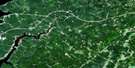
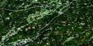
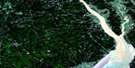
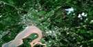
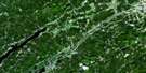
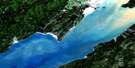
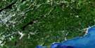
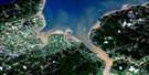
Cape Spencer Satellite Image Map
Download Free Aerial Photo 021H04 at 1:50,000 scale
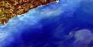
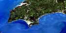
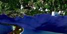
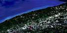
Cape Spencer Satellite Imagery
To view this satellite map, mouse over the air photo on the right.
You can also download this satellite image map for free:
021H04 Cape Spencer high-resolution satellite image map.
Maps for the Cape Spencer aerial map sheet 021H04 at 1:50,000 scale are also available in these versions:
Cape Spencer Surrounding Area Aerial Photo Maps
 |
 |
 |
 |
 |
 |
 |
 |
 |
 |
 |
 |
 |
 |
 |
 |
© Department of Natural Resources Canada. All rights reserved.
Cape Spencer Gazetteer
The following places can be found on satellite image map 021H04 Cape Spencer:
Cape Spencer Satellite Image: Bays
Baie de FundyBay of Fundy
Beveridge Cove
Deep Cove
Evans Cove
Mispec Bay
Mispek Bay
Moore Cove
Cape Spencer Satellite Image: Beaches
Beveridge BeachLouisa D. Beach
McElwains Beach
West Beach
Cape Spencer Satellite Image: Capes
Cape SpencerConnoly Head
Mispec Point
Mispek Point
Cape Spencer Satellite Image: Geographical areas
SimondsCape Spencer Satellite Image: Lakes
Balls LakeCalvert Lake
Millican Lake
Southern Lakes
Cape Spencer Satellite Image: Marine navigation features
CanaportCape Spencer Satellite Image: Mountains
Red HeadRed Head Mountain
Cape Spencer Satellite Image: Rivers
Anthonys BrookBean Brook
Beaver Brook
Beyea Brook
Brandy Brook
Grassy Brook
Grassy Lake Brook
McKenzie Brook
Millican Brook
Mispec River
Mispek River
Thomas Brook
Cape Spencer Satellite Image: Shoals
Black RockPloughshare Rock
The Sisters
Cape Spencer Satellite Image: Unincorporated areas
Cape SpencerMispec
Mispec Park
Mispek
Red Head
Rocky Corner
West Beach
© Department of Natural Resources Canada. All rights reserved.
