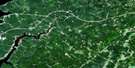
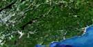
Salmon River Satellite Image Map
Download Free Aerial Photo 021H06 at 1:50,000 scale
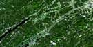
Salmon River Satellite Imagery
To view this satellite map, mouse over the air photo on the right.
You can also download this satellite image map for free:
021H06 Salmon River high-resolution satellite image map.
Maps for the Salmon River aerial map sheet 021H06 at 1:50,000 scale are also available in these versions:
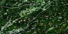
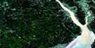
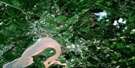
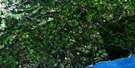
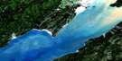
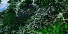
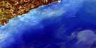
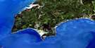
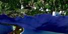
Salmon River Surrounding Area Aerial Photo Maps
 |
 |
 |
 |
 |
 |
 |
 |
 |
 |
 |
 |
 |
 |
 |
 |
© Department of Natural Resources Canada. All rights reserved.
Salmon River Gazetteer
The following places can be found on satellite image map 021H06 Salmon River:
Salmon River Satellite Image: Bays
Baie de FundyBaie de Fundy
Bay of Fundy
Bay of Fundy
Chignecto Bay
Salmon River Satellite Image: Beaches
Berry BeachFownes Beach
Long Beach
Melvin Beach
Seely Beach
Salmon River Satellite Image: Capes
Black PointBoars Head
Fownes Head
Martin Head
Tufts Point
Salmon River Satellite Image: Geographical areas
Saint JohnSaint Martins
Salmon River Satellite Image: Islands
Ile HauteIsle Haute
Salmon River Satellite Image: Lakes
Arnold LakeDonnelly Lake
Dowdall Lake
Four Mile Lake
Little Donnelly Lake
Mary Pitcher Lake
McFadden Lake
Pats Lake
Portage Lake
Rody Lake
Rody Lake
Tufts Lake
Walker Lake
Salmon River Satellite Image: Major municipal/district area - major agglomerations
CumberlandSalmon River Satellite Image: Provinces
Nouvelle-ÉcosseNova Scotia
Salmon River Satellite Image: Rivers
Berry BrookBig Rody Brook
Big Salmon River
Cradle Brook
Cranberry Brook
Dowdall Lake Brook
Dustan Brook
Falls Brook
Falls Brook
Flaglar Brook
Four Mile Brook
Fownes Mill Brook
Fuller Brook
Hemlock Brook
Hunter Brook
Little Rody Brook
Little Salmon River
Long Beach Brook
Macomber Brook
Martin Head Stream
Mary Pitcher Brook
McCumber Brook
Northwest Branch Big Salmon River
Northwest Salmon River
Porter Brook
Quiddy River
Rapidy Brook
Renard Brook
Rody Brook
Row Brook
Saddleback Brook
Seely Beach Brook
Telegraph Brook
Walker Lake Brook
Walton Glen Brook
Wolf Brook
Salmon River Satellite Image: Unincorporated areas
Bay ViewFair View
Greer
Greer Settlement
Little Beach
Salmon River
Salmon River Satellite Image: Valleys
Diamond Gulch
© Department of Natural Resources Canada. All rights reserved.
