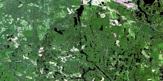
Radisson Lake Satellite Imagery
To view this satellite map, mouse over the air photo on the right.
You can also download this satellite image map for free:
042A02 Radisson Lake high-resolution satellite image map.
Maps for the Radisson Lake aerial map sheet 042A02 at 1:50,000 scale are also available in these versions:
Radisson Lake Surrounding Area Aerial Photo Maps
© Department of Natural Resources Canada. All rights reserved.
Radisson Lake Gazetteer
The following places can be found on satellite image map 042A02 Radisson Lake:
Radisson Lake Satellite Image: Bays
Big Island BaySable Bay
Radisson Lake Satellite Image: Channels
Redpine NarrowsRadisson Lake Satellite Image: Falls
Matachewan FallsRadisson Lake Satellite Image: Geographical areas
AlmaArgyle
Baden
Bannockburn
Cairo
Cleaver
Dunmore
Fallon
Fasken
Flavelle
Hincks
Holmes
McNeil
Michie
Montrose
Nordica
Powell
Robertson
Sheba
Terry
Timiskaming
Radisson Lake Satellite Image: Indian Reserves
Matachewan 72Matachewan Indian Reserve 72
Réserve indienne Matachewan 72
Radisson Lake Satellite Image: Islands
Big IslandRadisson Lake Satellite Image: Lakes
Argyle LakeAshley Lake
Baptiste Lake
Barris Lake
Bastian Lake
Beaudin Lake
Beaver Lake
Belt Lake
Bird Lake
Blackburn Lake
Browning Lake
Byng Lake
Canoe Lake
Cariboo Lake
Chief Lake
Clearwater Lake
Cowie Lake
Currie Lake
Dara Lake
Deak Lake
Dixon Lake
Dowsett Lake
East Night Hawk Lake
East Nighthawk Lake
East Whitefish Lake
Esker Lake
Ezra Lake
Fan Lake
Galer Lake
Geraldine Lake
Gerry Lake
Golub Lake
Greenwater Lake
Holmes Lake
Island Lake
Jackson Lake
Kenaja Lake
Kowisis Lake
Latouche Lake
Laurad Lake
Leziert Lake
Little Chief Lake
Little Whitefish Lake
Lula Lake
Mackay Lake
Matachewan Lake
McDonnel Lake
McNaughton Lake
McPhail Lake
McWilliams Lake
Michie Lake
Mima Lake
Mistinikon Lake
Muhquoh Lake
Narrow Lake
Neegeek Lake
Nokomis Lake
Ononlo Lake
Powell Lake
Radisson Lake
Robb Lake
Robertson Lake
Ronald Lake
Sanborn Lake
Separation Lake
Sheba Lake
Skoodeas Lake
Slim Lake
Squaw Lake
Steve Lake
Sunny Lake
Tent Lake
Tomfox Lake
Toy Lake
Tully Lake
Turtle Lake
Upper Kenaja Lake
Upper Sylvia Lake
Watabeag Lake
Weldy Lake
Whiskeyjack Lake
Whitefish Lake
Willard Lake
Wyley Lake
Radisson Lake Satellite Image: Other municipal/district area - miscellaneous
MatachewanMatachewan
Radisson Lake Satellite Image: Conservation areas
West Montreal River Provincial ParkWhitefish and East Whitefish Lakes Sandy Till Upland Conservation Reserve
Whitefish River Sandy Till Conservation Reserve
Radisson Lake Satellite Image: Rivers
Argyle CreekBaptiste Creek
Belt Creek
Browning Creek
Brush Creek
Chief Creek
East Night Hawk River
East Nighthawk River
East Whitefish River
Esker Creek
Gerry Creek
Hawley Creek
Kenaja Creek
Latouche Creek
Leziert Creek
Little Whitefish River
McCollum Creek
McDonnel Creek
Night Hawk River
Nighthawk River
Nokomis Creek
Powell Creek
Radisson Creek
Sheba Creek
Squaw Creek
St. Paul Creek
Sylvia Creek
Tent Creek
West Montreal River
West Night Hawk River
West Nighthawk River
Whitefish River
Radisson Lake Satellite Image: River features
Great Northern Bend© Department of Natural Resources Canada. All rights reserved.
042A Related Maps:
042A Timmins042A01 Kirkland Lake
042A02 Radisson Lake
042A03 Peterlong Lake
042A04 Kenogaming Lake
042A05 Dana Lake
042A06 Timmins
042A07 Watabeag River
042A08 Ramore
042A09 Matheson
042A10 Porquis Junction
042A11 Pamour
042A12 Kamiskotia Lake
042A13 Manning Lake
042A14 Buskegau River
042A15 Iroquois Falls
042A16 Low Bush


