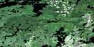
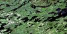
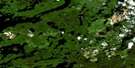
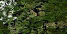
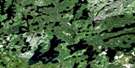
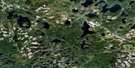
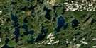
Gulliver Lake Satellite Image Map
Download Free Aerial Photo 052G03 at 1:50,000 scale
Gulliver Lake Satellite Imagery
To view this satellite map, mouse over the air photo on the right.
You can also download this satellite image map for free:
052G03 Gulliver Lake high-resolution satellite image map.
Maps for the Gulliver Lake aerial map sheet 052G03 at 1:50,000 scale are also available in these versions:
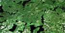
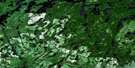
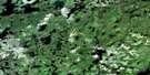
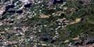
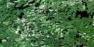
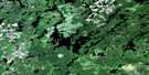
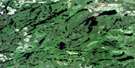
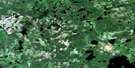
Gulliver Lake Surrounding Area Aerial Photo Maps
 |
 |
 |
 |
 |
 |
 |
 |
 |
 |
 |
 |
 |
 |
 |
 |
© Department of Natural Resources Canada. All rights reserved.
Gulliver Lake Gazetteer
The following places can be found on satellite image map 052G03 Gulliver Lake:
Gulliver Lake Satellite Image: Bays
Beancan BayEast Bay
Garnet Bay
Kabik Bay
Pisky Bay
Gulliver Lake Satellite Image: Geographical areas
CathcartCorman
Grummett
McNevin
Rainy River
Gulliver Lake Satellite Image: Lakes
Adele LakeBar Lake
Bark Lake
Belgium Lake
Benelux Lake
Blowout Lake
Bolio Lake
Boucher Lake
Boulder Lake
Bow Lake
Brim Lake
Buckingham Lakes
Bufo Lake
Cain Lake
Cawing Lake
Chill Lake
Claw Lake
Cloven Lake
Core Lake
Cornell Lake
Crosscut Lake
Cryderman Lake
Dark Lake
Delos Lake
Denmark Lake
Divide Lake
Fire Island Lake
Franklin Lake
Galbraith Lake
Gamble Lake
Gargoyle Lake
Gulliver Lake
Heart Lake
Hematite Lake
Herontrack Lake
Holland Lake
Hook Lake
Horseshoe Lake
Hutt Lake
Irish Lake
Jefferson Lake
Kathleen Lake
Kay Lake
Keewatin Lake
Kendall Lake
Kerney Lake
Knute Lake
Lazy Lake
Leach Lake
Leatherhead Lake
Leo Lake
Little Bar Lake
Little Chill Lake
Little Holland Lake
Little Rea Lake
Little Scotch Lake
Lodge Lake
Long Hike Lake
Longross Lake
Lorne Lake
Lower Scotch Lake
Lumby Lake
Magnesium Lake
Marguerite Lake
Mathieu Lakes
McNevin Lake
Mitten Lake
Morris Lake
Norseman Lake
Norway Lake
Nut Lake
Ogre Lake
Old Man Lake
Phyllis Lake
Pinecone Lake
Pipestem Lake
Pisky Lake
Pogo Lake
Portage Lake
Premier Lake
Prism Lake
Rea Lake
Red Paint Lake
Richardson Lake
Riverview Lake
Rosscairn Lake
Rye Lake
Sandy Lake
Scotch Lake
Scott Lake
Seahorse Lake
Serpent Lake
Solon Lake
Sparkle Lake
Spook Lake
Spool Lake
Spoon Lake
St. Patrick Lake
Star Lake
Stretch Lake
Sweden Lake
Swiss Lake
Theron Lake
Timlin Lake
Tiny Lake
Top Lake
Turning Lake
Twobay Lake
Upper Doan Lake
Upper Leach Lake
Upper Scotch Lake
Upper Squirrel Lake
Upper Welsh Lake
Val Lake
Valkyrie Lake
Van Nostrand Lake
Viking Lake
Welsh Lake
Whim Lake
Wilson Lake
Woody Lake
Yokum Lake
Gulliver Lake Satellite Image: Rivers
Bar CreekBenelux Creek
Brush Creek
Caribou River
Chill Creek
Cornell Creek
Dam Creek
Gargoyle Creek
Grummett Creek
Gulliver River
Leach Creek
Little Turtle River
Lumby Creek
Rosscairn Creek
Scotch River
Seine River
Serpent Creek
Spook Creek
Welsh Creek
Gulliver Lake Satellite Image: Road features
Red Paint PortageSkunk Portage

© Department of Natural Resources Canada. All rights reserved.
052G Related Maps:
052G Ignace052G01 Upsala
052G02 Firesteel River
052G03 Gulliver Lake
052G04 White Otter Lake
052G05 Ignace
052G06 Bonheur
052G07 Petry River
052G08 Pakashkan Lake
052G09 Empire Lake
052G10 Shikag Lake
052G11 Mattabi
052G12 Mameigwess Lake
052G13 Yonde
052G14 Valora
052G15 Glitter Lake
052G16 Harmon Lake
