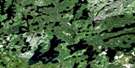
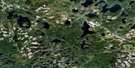
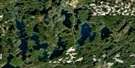
Mameigwess Lake Satellite Image Map
Download Free Aerial Photo 052G12 at 1:50,000 scale
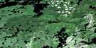
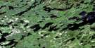
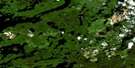
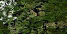
Mameigwess Lake Satellite Imagery
To view this satellite map, mouse over the air photo on the right.
You can also download this satellite image map for free:
052G12 Mameigwess Lake high-resolution satellite image map.
Maps for the Mameigwess Lake aerial map sheet 052G12 at 1:50,000 scale are also available in these versions:
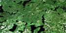
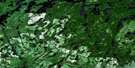
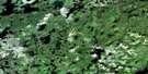
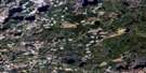
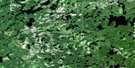
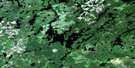
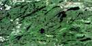
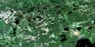
Mameigwess Lake Surrounding Area Aerial Photo Maps
 |
 |
 |
 |
 |
 |
 |
 |
 |
 |
 |
 |
 |
 |
 |
 |
© Department of Natural Resources Canada. All rights reserved.
Mameigwess Lake Gazetteer
The following places can be found on satellite image map 052G12 Mameigwess Lake:
Mameigwess Lake Satellite Image: Bays
Lynx BayMoose Bay
Raleigh Bay
Mameigwess Lake Satellite Image: Channels
Shaw's NarrowsMameigwess Lake Satellite Image: Falls
Indian Lake FallsMameigwess Lake Satellite Image: Geographical areas
BradshawGour
Ilsley
Mameigwess Lake Satellite Image: Islands
Burnt IslandHaystack Island
Mameigwess Lake Satellite Image: Lakes
Abamategwia LakeArethusa Lake
Army Lake
Arneson Lake
Barrel Lake
Basket Lake
Bee Pond
Berglund Lake
Bug Lake
Côté Lake
Deer Lake
Dollar Lake
Dome Lake
Don Lake
Fox Lake
Fummerton Lake
Godden Lake
Gooch Lake
Gustauson Lake
Hearld Lake
Hearsey Lake
Heathwalt Lake
Hermanson Lake
Hook Lake
Ilsley Lake
Indian Lake
Jim Lake
Juniper Lake
Knobby Lake
Ku Lake
Kukukus Lake
Little Gooch Lake
Little Indian Lake
Little Paguchi Lake
Little Snowstorm Lake
Mameigwess Lake
Mars Lake
Meridian Lake
Mit Lake
Moose Lake
Mud Lake
Ostrum Lake
Paguchi Lake
Pluto Lake
Pratt Lake
Reguly Lake
Repent Lake
Ripple Lake
Roper Lake
Sally Lake
Saturn Lake
Shrimp Lake
Shutter Lake
Snowstorm Lake
Square Lake
Steinhoff Lake
Tremble Lake
Victoria Lake
Walsh Lake
Watson Lake
Widow Lake
Mameigwess Lake Satellite Image: Mountains
Trout Lake HillMameigwess Lake Satellite Image: Rivers
Agimac RiverAgimak River
Basket River
Gooch Creek
Juniper Creek
Knobby Creek
Little Wabigoon River
Mameigwess River
Paguchi Creek
Pratt Creek
Spring Creek
Square Creek
Wabigoon River

© Department of Natural Resources Canada. All rights reserved.
052G Related Maps:
052G Ignace052G01 Upsala
052G02 Firesteel River
052G03 Gulliver Lake
052G04 White Otter Lake
052G05 Ignace
052G06 Bonheur
052G07 Petry River
052G08 Pakashkan Lake
052G09 Empire Lake
052G10 Shikag Lake
052G11 Mattabi
052G12 Mameigwess Lake
052G13 Yonde
052G14 Valora
052G15 Glitter Lake
052G16 Harmon Lake
