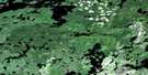
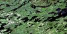
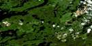
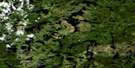
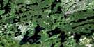
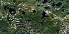
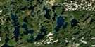
Petry River Satellite Image Map
Download Free Aerial Photo 052G07 at 1:50,000 scale
Petry River Satellite Imagery
To view this satellite map, mouse over the air photo on the right.
You can also download this satellite image map for free:
052G07 Petry River high-resolution satellite image map.
Maps for the Petry River aerial map sheet 052G07 at 1:50,000 scale are also available in these versions:
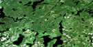
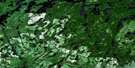
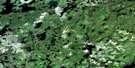
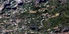
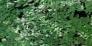
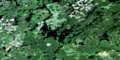
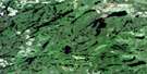
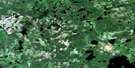
Petry River Surrounding Area Aerial Photo Maps
 |
 |
 |
 |
 |
 |
 |
 |
 |
 |
 |
 |
 |
 |
 |
 |
© Department of Natural Resources Canada. All rights reserved.
Petry River Gazetteer
The following places can be found on satellite image map 052G07 Petry River:
Petry River Satellite Image: Geographical areas
ChartrandCorman
Dye
Thunder Bay
Petry River Satellite Image: Lakes
Axe LakeBig McLouds Lake
Bud Lake
Byril Lake
Carre Lake
Clay Lake
East Oscar Lake
Ermine Lake
Graham Lake
Gravel Beach Lake
Haas Lake
Halfpint Lake
Haze Lake
Jackpine Lake
Knuckle Lake
Lac de Dejeuner
Little Carre Lake
Little McCausland Lake
Little Petry Lake
Lost Lake
Low Wave Lake
McCausland Lake
McLouds Lake
Mere Lake
Mettawi Lake
Moon Lake
Oscar Lake
Quorn Lake
Rabbitswim Lake
Reba Lake
Redfox Lake
Rumbo Lake
Savoy Lake
Selwyn Lake
Ted Lake
Tide Lake
Upper Grid Lake
Upper Selwyn Lake
Wawang Lake
Weed Lake
Winter Lake
Wynd Lake
Petry River Satellite Image: Rivers
Beach RiverEnglish River
Ermine Creek
Fallscamp Creek
Grid Creek
Little Petry River
McCausland River
Mettawi Creek
North Firesteel River
Oscar Creek
Petry River
Reba River
Redfox Creek
Rush Creek
Savoy Creek
Tide River
Petry River Satellite Image: Unincorporated areas
GrahamOscar
Petry
Quorn
Reba

© Department of Natural Resources Canada. All rights reserved.
052G Related Maps:
052G Ignace052G01 Upsala
052G02 Firesteel River
052G03 Gulliver Lake
052G04 White Otter Lake
052G05 Ignace
052G06 Bonheur
052G07 Petry River
052G08 Pakashkan Lake
052G09 Empire Lake
052G10 Shikag Lake
052G11 Mattabi
052G12 Mameigwess Lake
052G13 Yonde
052G14 Valora
052G15 Glitter Lake
052G16 Harmon Lake
