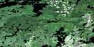
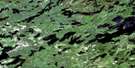
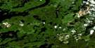
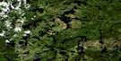
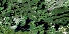
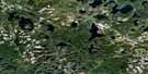
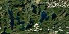
Pakashkan Lake Satellite Image Map
Download Free Aerial Photo 052G08 at 1:50,000 scale
Pakashkan Lake Satellite Imagery
To view this satellite map, mouse over the air photo on the right.
You can also download this satellite image map for free:
052G08 Pakashkan Lake high-resolution satellite image map.
Maps for the Pakashkan Lake aerial map sheet 052G08 at 1:50,000 scale are also available in these versions:
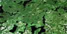
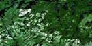
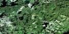
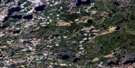
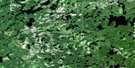
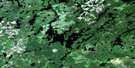
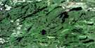
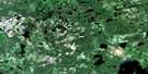
Pakashkan Lake Surrounding Area Aerial Photo Maps
 |
 |
 |
 |
 |
 |
 |
 |
 |
 |
 |
 |
 |
 |
 |
 |
© Department of Natural Resources Canada. All rights reserved.
Pakashkan Lake Gazetteer
The following places can be found on satellite image map 052G08 Pakashkan Lake:
Pakashkan Lake Satellite Image: Bays
Outlet BayPakashkan Lake Satellite Image: Lakes
Armistice LakeAylsworth Lake
Dora Lake
Fallscamp Lake
Foxpaw Lake
Grew Lake
Harry Lake
Holly Lake
John Lake
John Lake
Kearns Lake
Little Harry Lake
Little Shell Lake
Loganberry Lake
Mirage Lake
Mooseland Lake
North Oriole Lake
Oriole Lake
Pakashkan Lake
Peat Lake
Piche Lake
Pug Lake
Radio Lake
Shell Lake
Snipe Lake
Twining Lake
Upper Pug Lake
Wawang Lake
Weaver Lake
Pakashkan Lake Satellite Image: Conservation areas
Brightsand River Provincial ParkGarden-Pakashkan Conservation Reserve
Pakashkan Lake Satellite Image: Rivers
Dog RiverFallscamp Creek
Fly Creek
Grew River
Harry Creek
Loganberry Creek
Mirage Creek
Mooseland River
Oriole Brook
Oriole River
Peat Creek
Pug Creek
Radio Creek
Snipe Creek
Wawang River
Weaver River

© Department of Natural Resources Canada. All rights reserved.
052G Related Maps:
052G Ignace052G01 Upsala
052G02 Firesteel River
052G03 Gulliver Lake
052G04 White Otter Lake
052G05 Ignace
052G06 Bonheur
052G07 Petry River
052G08 Pakashkan Lake
052G09 Empire Lake
052G10 Shikag Lake
052G11 Mattabi
052G12 Mameigwess Lake
052G13 Yonde
052G14 Valora
052G15 Glitter Lake
052G16 Harmon Lake
