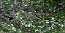
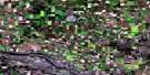
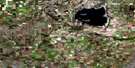
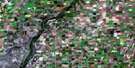
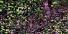
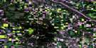
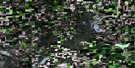
Rosthern Satellite Image Map
Download Free Aerial Photo 073B09 at 1:50,000 scale
Rosthern Satellite Imagery
To view this satellite map, mouse over the air photo on the right.
You can also download this satellite image map for free:
073B09 Rosthern high-resolution satellite image map.
Maps for the Rosthern aerial map sheet 073B09 at 1:50,000 scale are also available in these versions:
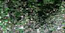
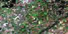
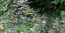
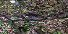
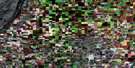
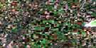
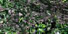
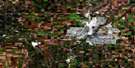
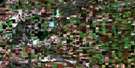
Rosthern Surrounding Area Aerial Photo Maps
 |
 |
 |
 |
 |
 |
 |
 |
 |
 |
 |
 |
 |
 |
 |
 |
© Department of Natural Resources Canada. All rights reserved.
Rosthern Gazetteer
The following places can be found on satellite image map 073B09 Rosthern:
Rosthern Satellite Image: Indian Reserves
One Arrow 95One Arrow 95-1A
Rosthern Satellite Image: Lakes
Boot LakeCaswell Lake
Duck Lake
Hnatiw Lake
Manika Lake
Marion Lake
Paul Lake
Red Goose Lake
Reed Lake
Rempel Lake
Smuts Lake
Rosthern Satellite Image: Other municipal/district area - miscellaneous
Aberdeen No. 373Duck Lake No. 463
Fish Creek No. 402
Rosthern No. 403
St. Louis No. 431
Rosthern Satellite Image: Conservation areas
Batoche National Historic Site of CanadaBattle of Fish Creek National Historic Site of Canada
Lieu historique national du Canada de Batoche
Lieu historique national du Canada de la Bataille-de-Fish Creek
Prairie National Wildlife Area
Réserve nationale de faune des Prairies
Valley Regional Park (Rosthern Section)
Rosthern Satellite Image: Rivers
Fish CreekFriesen Creek
Kohleschmidt Creek
Rivière Saskatchewan Sud
Rosthern Creek
South Saskatchewan River
Rosthern Satellite Image: Towns
HagueRosthern
Rosthern Satellite Image: Unincorporated areas
ArmaBatoche
Batoche Ferry
Fish Creek
La Plaine
Rosthern Satellite Image: Villages
Alvena
© Department of Natural Resources Canada. All rights reserved.
