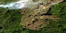
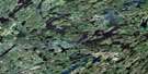
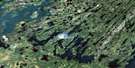
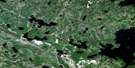
Eulas Lake Satellite Image Map
Download Free Aerial Photo 073P13 at 1:50,000 scale
Eulas Lake Satellite Imagery
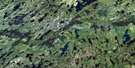
To view this satellite map, mouse over the air photo on the right.
You can also download this satellite image map for free:
073P13 Eulas Lake high-resolution satellite image map.
Maps for the Eulas Lake aerial map sheet 073P13 at 1:50,000 scale are also available in these versions:
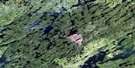
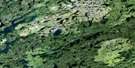
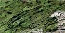
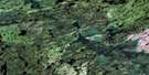
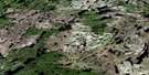
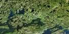
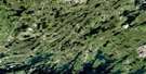
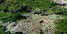
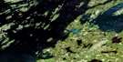
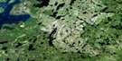
Eulas Lake Surrounding Area Aerial Photo Maps
 |
 |
 |
 |
 |
 |
 |
 |
 |
 |
 |
 |
 |
 |
 |
 |
© Department of Natural Resources Canada. All rights reserved.
Eulas Lake Gazetteer
The following places can be found on satellite image map 073P13 Eulas Lake:
Eulas Lake Satellite Image: Bays
Brown BayEulas Lake Satellite Image: Islands
Hicks IslandMacKay Island
Western Island
Eulas Lake Satellite Image: Lakes
Acorn LakeAugust Lake
Bancescu Lake
Boissiere Lake
Boxall Lake
Briese Lake
Brisbin Lake
Brunning Lake
Burke Lake
Buss Lake
Campbell Lake
Chalk Lake
Corner Lake
Darnell Lake
Drew Lake
Eichendorf Lake
Eulas Lake
Fagrie Lake
Falhun Lake
Ferchuk Lake
Fiest Lake
Flatt Lake
Kinosaskaw Lake
Komarniski Lake
Lanes Lake
Larson Lake
Lorensen Lake
Meyers Lake
Olson Lake
Orr Lake
Prescott Lake
Putnam Lake
Sandfly Lake
Tokinchuwa Lake
Webley Lake
Wildey Lake
Eulas Lake Satellite Image: Rivers
Churchill RiverFoster River
Sandy River

© Department of Natural Resources Canada. All rights reserved.
073P Related Maps:
073P Lac La Ronge073P01 Cartier Lake
073P02 Hunter Bay
073P03 La Ronge
073P04 Morin Lake
073P05 Morning Lake
073P06 Nemeiben Lake
073P07 Stanley Mission
073P08 Nistowiak Lake
073P09 Guncoat Bay
073P10 Otter Lake
073P11 Kavanagh Lake
073P12 Black Bear Island Lake
073P13 Eulas Lake
073P14 Mctavish Lake
073P15 Forbes Lake
073P16 Settee Lake
