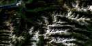
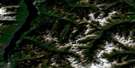
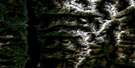
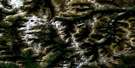
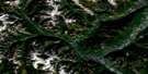
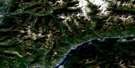
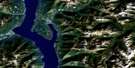
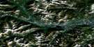
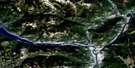
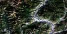
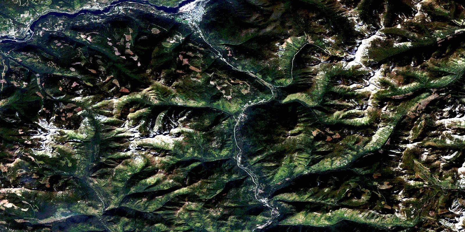
Nelson Satellite Image Map
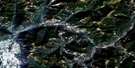
Download Free Aerial Photo 082F06 at 1:50,000 scale
Nelson Satellite Imagery
To view this satellite map, mouse over the air photo on the right.
You can also download this satellite image map for free:
082F06 Nelson high-resolution satellite image map.
Maps for the Nelson aerial map sheet 082F06 at 1:50,000 scale are also available in these versions:
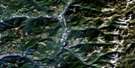
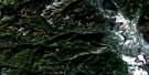
Nelson Surrounding Area Aerial Photo Maps
 |
 |
 |
 |
 |
 |
 |
 |
 |
 |
 |
 |
 |
 |
 |
 |
© Department of Natural Resources Canada. All rights reserved.
Nelson Gazetteer
The following places can be found on satellite image map 082F06 Nelson:
Nelson Satellite Image: Bays
West ArmNelson Satellite Image: Capes
Burns PointNelson Satellite Image: Channels
Grohman NarrowsNelson Satellite Image: City
NelsonNelson Satellite Image: Falls
McDiarmid FallsNelson Satellite Image: Hydraulic construction
Corra Linn DamNelson Satellite Image: Islands
Narrows IslandNelson Satellite Image: Lakes
Barrett LakeCottonwood Lake
Grady Lake
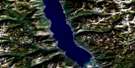
Kootenay Lake
Lost Lake
Marble Lake
Porcupine Lake
Qua Lake
Siwash Lake
Stuart Lake
Württemberg Lake
Nelson Satellite Image: Mountains
Baldy MountainBonnington Range
Burns Meadow
Cabin Peak
Colony Peak
Columbia Mountains
Commonwealth Mountain
Copper Mountain
DeFerro Ridge
Dominion Mountain
Elise Mountain
Empire Peak
Evening Ridge
Grassy Mountain
Jubilee Mountain
Kokanee Range
Midday Peak
Morning Mountain
Mount Beattie
Mount Connor
Mount Drummond
Mount Dundee
Mount Elise
Mount Verde
Nelson Range
Red Mountain
Selkirk Mountains
Siwash Mountain
Slocan Ranges
Territory Peak
Toad Mountain
White Queen
Württemberg Mountain
Ymir Mountain
Nelson Satellite Image: Conservation areas
Cottonwood Lake ParkGrohman Narrows Park
West Arm Park
Nelson Satellite Image: Recreational sites
WhitewaterNelson Satellite Image: Rivers
Active CreekAnderson Creek
Apex Creek
Avalanche Creek
Barrett Creek
Bird Creek
Boulder Mill Creek
Burnt Creek
Clearwater Creek
Connor Creek
Copper Creek
Cottonwood Creek
Craigtown Creek
Cultus Creek
Dunlop Creek
Eagle Creek
Elise Creek
Erie Creek
Falls Creek
Fell Creek
Five Mile Creek
Fortynine Creek
Garrity Creek
Giveout Creek
Glade Creek
Gladstone Creek
Gold Creek
Granite Creek
Grassy Creek
Grohman Creek
Hall Creek
Hemlock Creek
Huckleberry Creek
Keno Creek
Kootenay River
Kutetl Creek
Laib Creek
Lasca Creek
Laurel Creek
Marion Brook
Midas Creek
Mohawk Creek
Noman Creek
Olive Creek
Oscar Creek
Periodical Creek
Porcupine Creek
Porter Creek
Qua Creek
Quartz Creek
Rapid Creek
Rover Creek
Rumbling Creek
Rush Creek
Salmo River
Sandy Creek
Seeman Creek
Selous Creek
Skilet Creek
Slide Creek
Smallwood Creek
Smelter Creek
Snowwater Creek
Sproule Creek
Star Creek
Stewart Creek
Trites Creek
Wally Creek
Warrington Creek
Wren Creek
Württemberg Creek
Ymir Creek
Young Creek
Young Grouse Creek
Nelson Satellite Image: Unincorporated areas
ApexBeasley
Belford
Blewett
Bonnington
Bonnington Falls
Corra Linn
Granite
Granite Siding
Hall
Mountain
Mountain Station
Porto Rico
South Nelson
Taghum
Ymir
© Department of Natural Resources Canada. All rights reserved.
