Makkovik Topo Map Online
Download Free Topo Map Sheet 013O03 at 1:50,000 scale
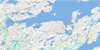
013O03 Makkovik Topo Map
To view this map, mouse over the map preview on the right.
You can also download this topo map for free:
013O03 Makkovik high-resolution topo map image.
Maps for the Makkovik topo map sheet 013O03 at 1:50,000 scale are also available in these versions:
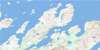
Makkovik Surrounding Area Topo Maps
 |
 |
||
 |
 |
 |
© Department of Natural Resources Canada. All rights reserved.
Makkovik Gazetteer
The following places can be found on topographic map sheet 013O03 Makkovik:
Makkovik Topo Map: Bays
Ailik BayAillik Bay
Alcock's Cove
Bar Harbour
Bens Cove
Bents Cove
Big Bight
Broompeel Cove
Canuck's Cove
Cape Cove
Children's Cove
Clones Cove
Daughter Cove
Dawe's Cove
Doter Cove
Doughnut Cove
Edwards Cove
Fitzgerald's Cove
Ford's Bight
Humby's Cove
Jockos Bight
Johns Cove
Kaipokok Bay
Kennedy's Cove
Little Paradise Cove
Little Strawberry Cove
Long Point Cove
Lower North Head Cove
Makkovik Bay
Makkovik Harbour
Marks Bight
Monkey Bight
Monkeys Bight
Morgan's Cove
Nesbit Harbour
New Harbour
Nipper Cove
Old House Cove
Peters Cove
Ranger Bight
Sally's Cove
Shoal Cove
Strawberry Harbour
Summer Cove
Taylor's Table Cove
Tilt Cove
Toms Cove
Tom's Cove
Upper North Head Cove
Woody Cove
Yetman's Cove
Makkovik Topo Map: Beaches
Northeast BreakerMakkovik Topo Map: Capes
Big HeadBlackberry Point
Brassy Point
Burntwood Point
Cape Ailik
Cape Aillik
Cape Makkovik
Cape Point
Cape Roy
Cape Strawberry
Ford's Bight Point
Grassy Point
Gull Island Point
High Point
Ikey's Point
Indian Head
Jackos Point
Kaipokok Cape
Long Point
Lookout Point
Low Point
Measles Point
Middle Head
Nipper Cove Point
North Head
North Point
Northwest Point
Old Man's Head
Perret's Point
Point of the Bight
Ranger Bight Point
Samuel's Point
Southwest Point
Strawberry Head
Talasinimavik
Tickle Point
Tom's Point
Trap Point
White Nap Head
White Point
Yetman's Point
Makkovik Topo Map: Channels
NarrowsThe Narrows
The Tickle
Makkovik Topo Map: Cliffs
Red CliffThe Bluff
Makkovik Topo Map: Islands
Ailik IslandsAillik Islands
Bar Islands
Big Duck Island
Big Island
Black Islands
Can Islands
Drunken Harbour Island
Groundy Island
Gull Island
Gull Island
Inside Pigeon Island
Jackos Island
Jackos Islands
Jacques Island
Jockos Island
Long Island
Loyal Island
Lyalls Islands
Man Island
Man Islands
Outside Pigeon Island
Passing Islands
Pigeon Island
Punching Island
Red Islands
The Gull
The Little Gull
The Sisters Islands
Turnavik Islands
West Turnavik Island
Makkovik Topo Map: Lakes
Banana LakeBens Cove Pond
Broomfields Pond
Kits Pond
Long Hill Pond
Makkovik Pond
Marks Bight Pond
Ranger Bight Pond
Round Pond
Stillwater Pond
Makkovik Topo Map: Mountains
Kaipokok HillMakkovik Topo Map: Rivers
Big Bight BrookCorner Brook
Dry Tree Brook
Halibut Brook
Makkovik Brook
Mink Trap Brook
Ranger Bight Brook
Ranger Brook
Rattling Brook
Makkovik Topo Map: Seas
Labrador SeaMer du Labrador
Makkovik Topo Map: Shoals
Black RockHarbour Rock
North Sister
Punching Island Rock
South Sister
The Black Family
Makkovik Topo Map: Unincorporated areas
AilikAillik
Makkovik Topo Map: Villages
Makkovik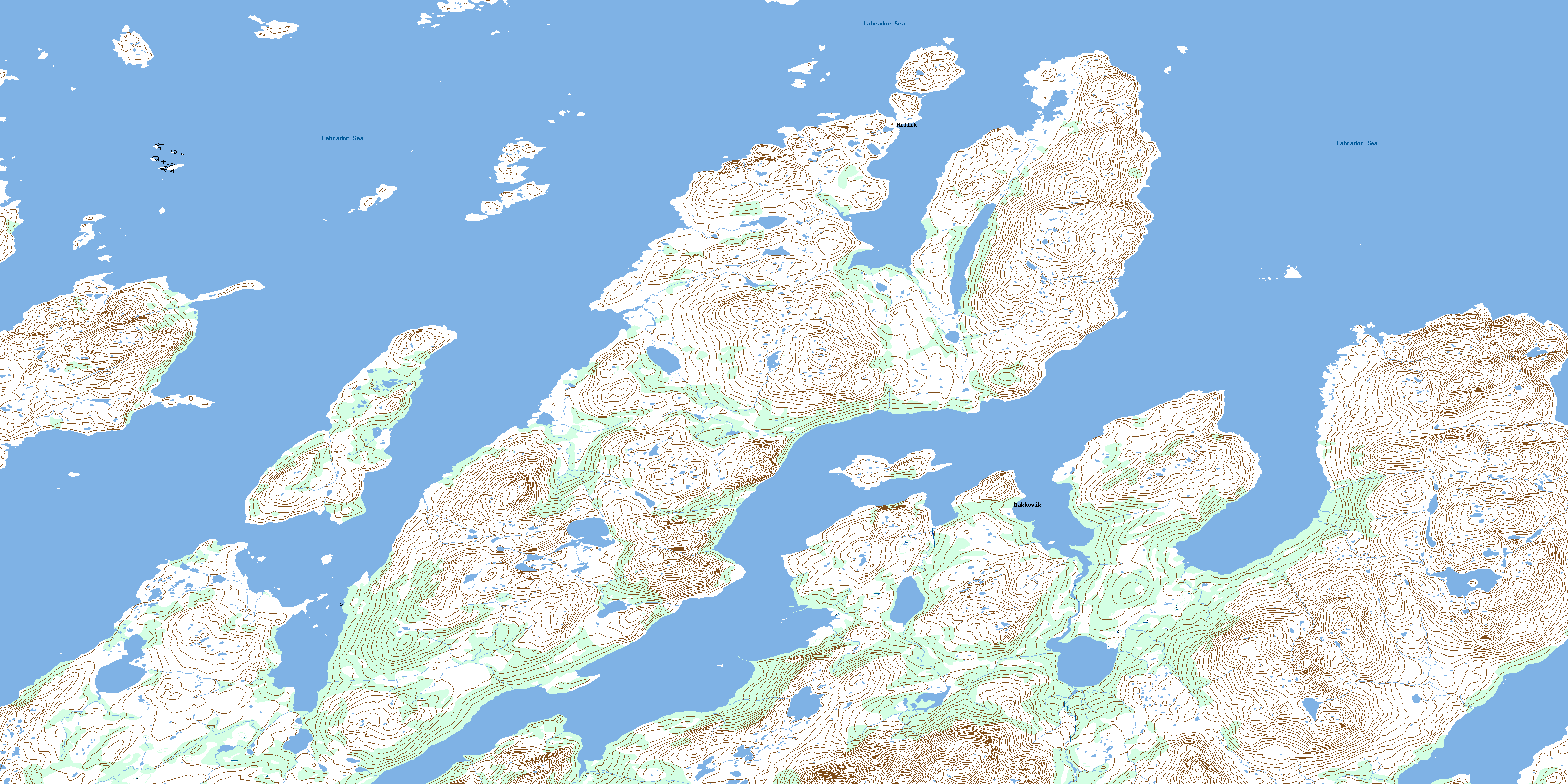
© Department of Natural Resources Canada. All rights reserved.
