Wallaceburg Topo Map Online
Download Free Topo Map Sheet 040J09 at 1:50,000 scale
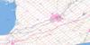
040J09 Wallaceburg Topo Map
To view this map, mouse over the map preview on the right.
You can also download this topo map for free:
040J09 Wallaceburg high-resolution topo map image.
Maps for the Wallaceburg topo map sheet 040J09 at 1:50,000 scale are also available in these versions:
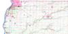
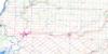
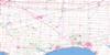
Wallaceburg Surrounding Area Topo Maps
 |
|||
 |
 |
||
 |
 |
 |
|
 |
 |
 |
© Department of Natural Resources Canada. All rights reserved.
Wallaceburg Gazetteer
The following places can be found on topographic map sheet 040J09 Wallaceburg:
Wallaceburg Topo Map: Bays
Johnston BayWallaceburg Topo Map: Channels
Grape RunJohnston Channel
Pottowatamie Island Dredge Cut
Wallaceburg Topo Map: City
Chatham-KentWallaceburg Topo Map: Geographical areas
CamdenChatham
Dawn
Dover
Euphemia
Howard
Kent
Lambton
Sombra
Zone
Wallaceburg Topo Map: Hydraulic construction
Annette DrainChapple Drain
Dawson Drain
Highland Drain
Julian Drain
McCargon Drain
Townline Drain
Turrell Drain
Wallaceburg Topo Map: Indian Reserves
Réserve indienne Walpole Island 46Walpole Island Indian Reserve 46
Wallaceburg Topo Map: Islands
Fawn IslandPottaminie Island
Pottowatamie Island
St. Anne Island
Walpole Island
Wallaceburg Topo Map: Lakes
Lac Sainte-ClaireLake St. Clair
Wallaceburg Topo Map: Major municipal/district area - major agglomerations
KentLambton
Wallaceburg Topo Map: Other municipal/district area - miscellaneous
CamdenChatham
Dawn
Dawn-Euphemia
Dover
Euphemia
Harwich
Howard
Moore
Orford
Raleigh
Romney
Sombra
St. Clair
Tilbury East
Zone
Wallaceburg Topo Map: Provinces
OntarioWallaceburg Topo Map: Rivers
Bear CreekBig Creek
Black Creek
Booth Creek
Chenail Ecarté (The Snye)
Chenal Ecarté
Clay Creek
Crooked Creek
Danforth Creek
Donkey Creek
East Otter Creek
Fansher Creek
Goodens Creek
Indian Creek
Jarvis Creek
Little Bear Creek
Long Creek
Marshy Creek
Maxwell Creek
Mollys Creek
North Sydenham River
Otter Creek
Rivière Sainte-Claire
Rivière Thames
Running Creek
Ryans Creek
St. Clair River
Sydenham River
Thames River
West Otter Creek
Wallaceburg Topo Map: Unincorporated areas
AppledoreBeaver Meadow
Becher
Bentpath
Charlemont
Croton
Cuthbert
Dawn Mills
Dawn Valley
Dresden
Duthill
Eberts
Edys Mills
Electric
Ennett
Florence
Garville
Henry Corners
Huffs Corners
Kent Bridge
Langbank
Mirwins Park
North Thamesville
Oakdale
Oldfield
Port Lambton
Rutherford
Sombra
Terminus
Thorncliffe
Thornyhurst
Tupperville
Turnerville
Wabash
Wallaceburg
West Becher
Whitebread
Wilkesport

© Department of Natural Resources Canada. All rights reserved.
