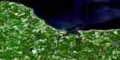
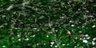
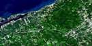
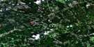
Lochaber Satellite Image Map
Download Free Aerial Photo 011E08 at 1:50,000 scale
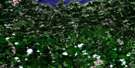
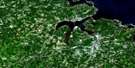
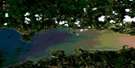
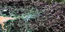
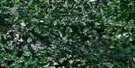
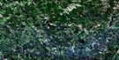
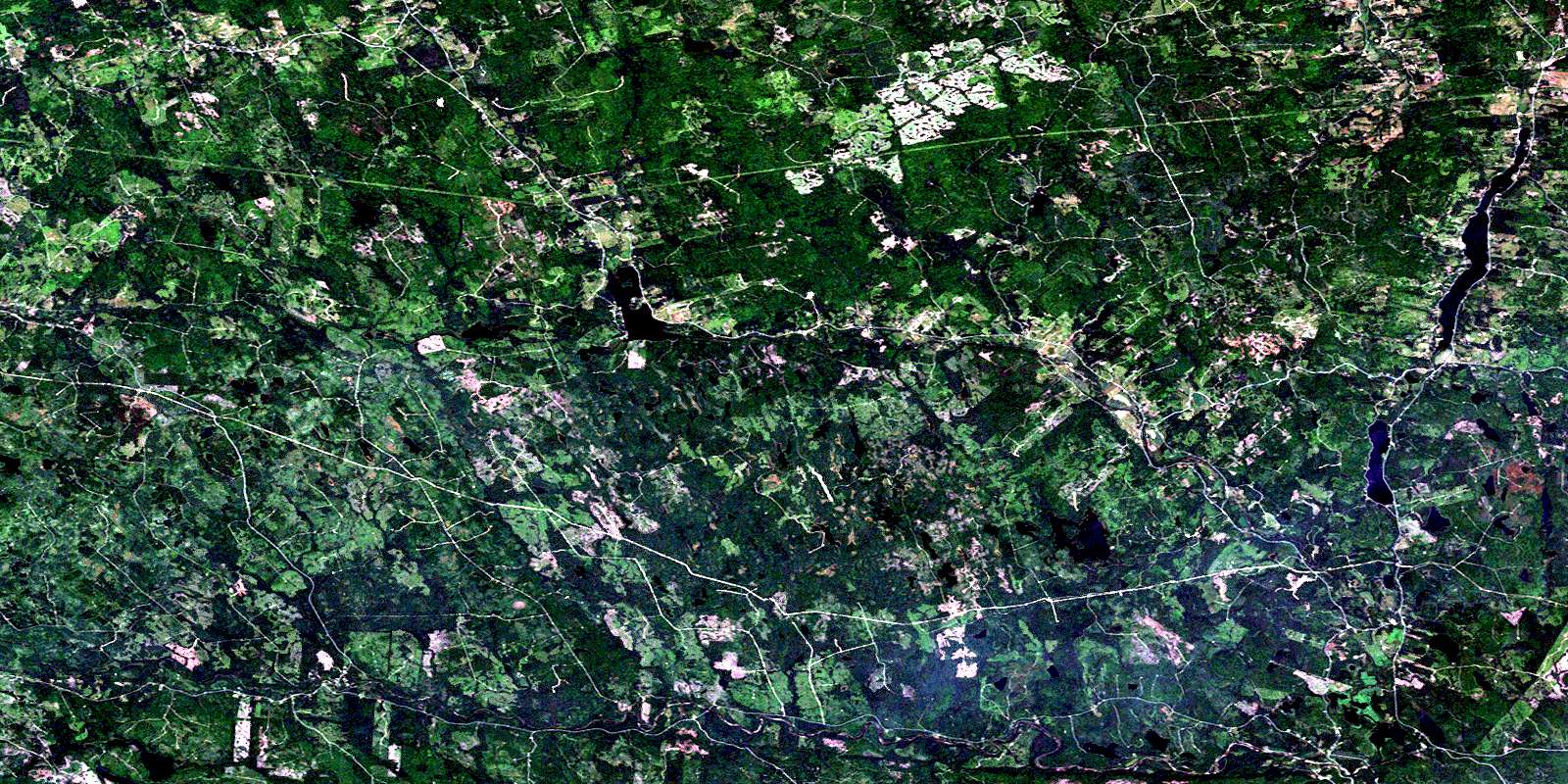
Lochaber Satellite Imagery
To view this satellite map, mouse over the air photo on the right.
You can also download this satellite image map for free:
011E08 Lochaber high-resolution satellite image map.
Maps for the Lochaber aerial map sheet 011E08 at 1:50,000 scale are also available in these versions:
Lochaber Surrounding Area Aerial Photo Maps
 |
 |
 |
 |
 |
 |
 |
 |
 |
 |
 |
 |
 |
 |
 |
 |
© Department of Natural Resources Canada. All rights reserved.
Lochaber Gazetteer
The following places can be found on satellite image map 011E08 Lochaber:
Lochaber Satellite Image: Bays
The GutLochaber Satellite Image: Channels
The NarrowsLochaber Satellite Image: Falls
Black Brook FallsLochaber Satellite Image: Geographical areas
AntigonishGuysborough
Pictou
Sydney
Lochaber Satellite Image: Islands
Sheep IslandLochaber Satellite Image: Lakes
Archibald LakeArchibalds Mill Lake
Archie Lake
Battery Lake
Battery Lakes
Bear Lake
Beaver Lake
Beaver Lake
Big Bog Lake
Birch Brook Lake
Black Brook Lake
Black Brook Lake
Black Brook Lake
Black Brook Lakes
Black Gully
Black Lake
Black Lake
Black Lake
Boggs Lake
Boot Lake
Brora Lake
Broro Lake
Bruce Lake
Bryden Lakes
Burrough Lake
Burroughs Lake
Campbell Lake
Charlie Lake
Chisholm Lake
Christie Lake
Christy Lake
Clarkes Lakes
College Lake
Corner Lake
Cranberry Lake
Cranberry Lake
Cranberry Lake
Cranberry Lakes
Cranberry Lakes
Cranberry Lakes
Cumminger Lake
D Lake
Demmons Lake
Duck Pond
Duncan Wood Lake
East Lake
Eden Lake
Elbow Lake
Fraser Lake
Garvie Lake
Garvies Lake
Gaspereaux Lake
Glencross Lake
Glencross Lake
Glencross Lakes
Glenelg Lake
Glenelg Lakes
Gunn Lake
Gunn Lake
Haggard Lake
Haggarts Lake
Hattie Lake
Hattie Lake
Hattie Lake
Hattie Lakes
Hay Lake
Hunters Lake
Indian Man Lake
Island Lake
Jocks Lake
John Miller Lake
Jordy Mitchells Lake
Juniper Hill Lake
Kent Lake
Kirk Lake
Kirks Lake
Lake Henry
Leech Lake
Leitch Lake
Lily Pond
Little Lake
Little Liscomb Lake
Little Pond
Little Sandy Lake
Lochaber Lake
Lochiel Lake
Long Lake
Long Lake
MacEacherns Lake
MacKay Lake
MacKays Lake
MacLeans Lake
McCarthy Lake
McInnis Lake
McIsaac Lake
McKay Lake
McKay Lake
McKeen Lake
McLeod Lake
Middleton Lakes
Mill Pond
Milldam Lake
Mitchell Lake
Mitchell Lake
Murray Lake
Normans Lake
Oak Lake
Pats Lake
Pemmon Lake
Peter Allen Lake
Peter Bills Lake
Peter Gill Lake
Pot Lake
Round Lake
Round Lake
Sandy Gunns Lake
Sandy Lake
Sandy Lake
Shallow Lake
Siloam Lake
Silver Lake
Simon Lake
Sinclair Lake
Smith Lake
Stewart Lake
Stewarts Lake
Sucker Lake
Sucker Lake
Sutherland Lake
Sutherland Lake
Sutherlands Lake
Tait Lake
Taylor Lake
Taylor Lake
The Bog
Trout Lake
Trout Lake
Turtle Lake
Twin Lakes
Twin Oak Lakes
Two Mile Lake
Upper Dam Lake
Wallace Lake
White Lake
Wood Lake
Z Lake
Lochaber Satellite Image: Mountains
Blue MountainCochrane Hill
Hardwood Hill
Mount Adam
Sutherlands Mountain
The Keppoch
Lochaber Satellite Image: Major municipal/district area - major agglomerations
AntigonishGuysborough
Pictou
St. Mary's
Lochaber Satellite Image: Conservation areas
Lochiel Lake Provincial ParkTwo Mile Lake Provincial Park
Lochaber Satellite Image: Rapids
West River RunLochaber Satellite Image: Rivers
Archibald BrookArchibald Brook
Archibalds Mill Brook
Barren Brook
Beaver Brook
Big Meadow Brook
Black Brook
Black Brook
Black Brook
Bogg Brook
Boggs Brook
Bryden Brook
Campbell Brook
Campbells Brook
Chisholm Brook
Chisholm Creek
Churn Brook
Clark Brook
Cross Brook
Cummingers Run
Donny Brook
East Branch Donny Brook
East River
East River of Pictou
East River St. Mary
East River St. Marys
East River St. Mary's
Ellis Brook
Fraser Brook
Fraser Brook
Frasers Brook
French River
Garden River
Glencross Brook
Green Brook
Greens Brook
Gusset Brook
Gut Brook
Harry Gunns Brook
Hattie Brook
Hemlock Brook
Hurlbert Brook
Indian Man Brook
Jordan Brook
Kelly Brook
Kirks Gully
Kittle River
Leitch Lake Brook
Little River
MacKay Brook
MacQuarries Brook
McDonald Brook
McDonald Mill Brook
McFarlen Brook
McGillivray Brook
McIntosh Brook
McKay Brook
McKeen Brook
McNab Brook
McNaughton Brook
McQuarrie Brook
Mitchell Brook
Mitchells Brook
Moose River
Normans Brook
North River St. Marys
North River St. Mary's
Ohio River
Palmer Brook
Ross Brook
St. Mary River
St. Marys River
St. Mary's River
Sutherland Brook
Sutherland River
Sutherlands River
Tait Brook
Thompson Brook
Walsh Brook
West Barneys River
West Barney's River
West Branch French River
West River St. Mary
West River St. Marys
West River St. Mary's
Lochaber Satellite Image: River features
Archibald PoolBarren Brook Pool
Footbridge Pool
Gunns Hole
Harrisons Pool
Head of the Lake Pool
Indian Lake Stillwaters
Indian Man Pool
Lead Mines Pool
MacQuarries Pool
McKeens Pool
Oak Stillwater
Rock Island Pool
Rock Pool
Silvers Pool
Sutherlands Bridge Pool
The Weir
West River Bridge Pool
Lochaber Satellite Image: Unincorporated areas
Archibalds MillAspen
Blanchard Road
Blue Mountain
Caledonia
Cameron Settlement
College Grant
Cross Roads Ohio
Denver
East River St. Marys
East River St. Mary's
East River St. Marys West Side
Eden Lake
Garden of Eden
Glen Alpine
Glenelg
Greens Brook
Green's Brook
Hillcrest
Ireland
Kerrowgare
Lochaber
Lochiel Lake
Lower Caledonia
Melrose
Moose River
New Town
Newtown
North Lochaber
Rocky Mountain
Smithfield
South Lochaber
Sunny Brae
Sunnybrae
Upper Barneys River
Upper Smithfield
West Lochaber
Willowdale
Lochaber Satellite Image: Low vegetation
Garden of Eden BarrensJim Camerons Meadow
Kent Bog
The Meadow
© Department of Natural Resources Canada. All rights reserved.
011E Related Maps:
011E Truro011E01 Liscomb
011E02 Upper Musquodoboit
011E03 Shubenacadie
011E04 Kennetcook
011E05 Bass River
011E06 Truro
011E07 Hopewell
011E08 Lochaber
011E09 Merigomish
011E10 New Glasgow
011E11 Tatamagouche
011E12 Oxford
011E13 Pugwash
011E14 Malagash
011E15 Pictou Island
011E16 Malignant Cove
