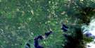
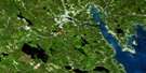
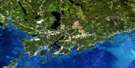
Saint John Satellite Image Map
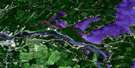
Download Free Aerial Photo 021G08 at 1:50,000 scale
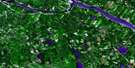
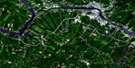
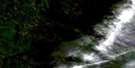
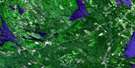
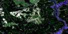
Saint John Satellite Imagery
To view this satellite map, mouse over the air photo on the right.
You can also download this satellite image map for free:
021G08 Saint John high-resolution satellite image map.
Maps for the Saint John aerial map sheet 021G08 at 1:50,000 scale are also available in these versions:
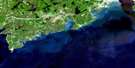
Saint John Surrounding Area Aerial Photo Maps
 |
 |
 |
 |
 |
 |
 |
 |
 |
 |
 |
|
 |
 |
 |
© Department of Natural Resources Canada. All rights reserved.
Saint John Gazetteer
The following places can be found on satellite image map 021G08 Saint John:
Saint John Satellite Image: Bays
Brothers CoveBuckleys Cove
Carters Cove
Cathline Cove
Courtenay Bay
Cudlips Cove
Davidsons Cove
Deadmans Cove
Deep Cove
Den Boom Cove
Drury Cove
Farrys Cove
Frenchmans Cove
Garden of Eden Cove
Grand Bay
Green Head Cove
Hasting Cove
Hastings Cove
Hazen Creek
Hendersons Cove
Hunters Cove
Keiths Cove
Kennebecasis Bay
Kimble Cove
Lee Cove
Longs Cove
Marble Cove
McCormack Cove
Milkish Creek
Milkish Inlet
Mill Cove
Mosquito Cove
Mulally Cove
Ragged Point Cove
Renforth Cove
Rostherne Mere
Saint John Harbour
Sand Cove
Sandy Beach Cove
Sea Dog Cove
South Bay
Torryburn Cove
Torryburn Cove
Welchs Cove
Whelpley Cove
Yankee Cove
Saint John Satellite Image: Beaches
Boars Head BeachLittle River Beach
Martinon Beach
Raynes Beach
Renforth Beach
Sandy Beach
Tucker Park Beach
Turners Flats
Vairs Beach
Vances Beach
Veirs Beach
Saint John Satellite Image: Capes
Arthurs PointAsh Point
Baxter Point
Beasley Point
Beesleys Point
Belyea Point
Belyeas Point
Blue Point
Boar Head
Boars Head
Brandy Point
Brigantine Point
Carter Point
Carters Point
Cedar Point
Collins Point
Craig Point
Craigs Point
Days Landing
Days Point
Green Head
Gregorys Point
Hamms Point
Harding Point
Hardings Point
Head of the Bluff
Hendersons Point
Holder Point
Kingston Peninsula
Kingston Point
Lands End
MacDougall Point
McColgan Point
McNamara Point
Milkish Head
Milkish Point
Milkish Point
Navy Island
Otter Point
Pleasant Point
Polly Sams Point
Portland Point
Prospect Point
Purdy Point
Purdys Point
Ragged Point
Red Head
Reeds Point
Reed's Point
Robertson Point
Rowans Point
Rowan's Point
Sand Point
Sand Point
Sandy Point
Streeters Point
Swift Point
Torryburn Point
Union Point
Whelpley Point
White Head
Woodmans Point
Saint John Satellite Image: Channels
Courtenay Bay ChannelMilkish Channel
North Channel
The Narrows
Saint John Satellite Image: City
CarletonLancaster
Parrtown
Portland
Saint John
Saint John Satellite Image: Cliffs
Barlow BluffBarlows Bluff
Ministers Face
Whites Bluff
Saint John Satellite Image: Falls
Reversing FallsSilver Falls
Saint John Satellite Image: Geographical areas
CharlotteClarendon
Greenwich
Kings
Kingston
Lepreau
Musquash
Petersville
Queens
Rothesay
Saint John
Simonds
Westfield
Saint John Satellite Image: Indian Reserves
The Brothers 18Saint John Satellite Image: Islands
Beams IslandBrothers Islands
Burnt Island
Catons Island
Crow Island
False Island
Goat Island
Goat Island
Goat Island
Indian Island
Indian Island
Isle of Pines
Kennebecasis Island
Long Island
Mather Island
Middle Island
Ram Island
Rocky Island
Rowans Island
Rush Island
Spoon Island
The Brothers
Saint John Satellite Image: Lakes
Anne LakeAshburn Lake
Auger Lake
Back Creek (No. 10) Lake
Belvidere Lake
Big Indian Lake
Big Lyon Lake
Bog Lake
Bonnell Lake
Calvin Lake
Capple Lake
Caribou Lake
Carr Lake
Chance Lake
Clarks Lake
Coles Lake
Compton Lake
Cooks Lake
Crescent Lake
Crystal Lake
Crystal Lake
Days Lake
Deep Lake
Deer Lake
Deer Lake
Delaney Lake
Donaldson Lake
Douglas Lake
Duck Lake
Duck Lake
Eagle Lake
Eastern Lake
Elizabeth Lake
Emigrant Lake
First Hasty Lake
Fisher Lakes
Flaglor Lake
Frying Pan Lake
Frying-pan Lake
Ghost Lake
Globe Lake
Grassy Lake
Harrigan Lake
Harvey Lake
Hasty Lakes
Henderson Lake
Howe Lake
Island Lake
Jenkins Lake
Keating Lake
Kelly Lake
Knockdrin Lake
Labrador Lake
Lawlor Lake
Lily Lake
Lily Lake
Little Crystal Lake
Little Deer Lake
Little Eagle Lake
Little Harvey Lake
Little Indian Lake
Little John Lake
Little Lyon Lake
Little Lyon Lake
Little Lyons Lake
Little Negro Lake
Little Otter Lake
Little Queens Lake
Little Sherwood Lake
Little Simpson Lake
Little Trout Lake
Loch Alva
Long Lake
Long Lake
Long Lake
Long Lake
Long Pond
Longs Lake
Loon Lake
Manks Lake
Mary Ann Lake
Mathers Lake
Mathews Lake
Mayflower Lake
McBeth Lake
McKeel Lake
McNulty Flowage
Mill Pond
Mitchell Lake
Moose Lake
Mountain Lake
Mud Lake
Mud Lake
Mud Lake
Mud Lake
Mud Lake
Mud Lake
Munson Lake
Negro Lake
Nelson Lake
Nigger Lake
Number Ten Lake
Ogden Lake
O'Leary Lake
Oram Lake
Otter Lake
Owen Lake
Parker Lake
Parker Lake
Patchell Lake
Pitts Lake
Puddington Lake
Queens Lake
Rancliffe Lake
Ready Pond
Red Bridge Lake
Robertson Lake
Robin Hood Lake
Rocky Lakes
Rosherne Mere
Round Lake
Sancton Dam Lake
Scallan Lake
Scotchman Lake
Scott Lake
Sears Lake
Second Hasty Lake
Seven Mile Lake
Sherwood Lake
Simpson Lake
Smith Lake
Smith Lake
Spectacle Lake
Spruce Lake
Square Lake
Square Lake
Stevens Lake
Telegraph Lake
ThirdHasty Lake
Trout Lake
Trout Lake
Tulley Lake
Tully Lake
Turtle (Friar Tuck) Lake
Turtle Lake
Upper Tully Lake
Waddell Lake
Walton Lake
Waltons Lake
Wedderburn Lake
West Lake
West Lake
Wetmore Lake
Wetmore Lake
White Lake
Whites Lake
Whittaker Lake
Williams Lake
Saint John Satellite Image: Military areas
Canadian Forces Base GagetownChamp de tir et champ de manoeuvre Gagetown
Gagetown Range and Training Area
Saint John Satellite Image: Mountains
Bald MountainBuckleys Mountain
Champlain Mountain
Charliton Bluff
Crane Mountain
Crow Mountain
Crowley Mountain
Devils Back
Eagle Mountain
Eagle Rock
Green Ridge
High Hills
Mawhane Mountain
Mount Champlain
Mount Douglas
Mount Serjeant
Nowland Hill
Oak Ridge
Pancake Hill
Queens Ridge
Round Mountain
Sisters Mountains
Soup Plate Hill
Squaw Mountain
Telegraph Hill
The Devils Back
Turtle Mountain
Watters Mountain
Saint John Satellite Image: Conservation areas
Calvin Church/Shaarei Zedek Synagogue and Saint John Jewish Community CentreCarleton Martello Tower National Historic Site of Canada
Chipman Hill Properties
City Market
Église Calvin/Synagogue Shaarei-Zedek et Centre communautaire juif de Saint-Jean
Fort LaTour
Lieu historique national du Canada de la Tour-Martello-de-Carleton
Propriétés Chipman Hill
Saint John Satellite Image: Rapids
Sherwood RipsSaint John Satellite Image: Rivers
Alden BrookAlder Brook
Askwith Brook
Back (No. 10) Creek
Back Creek
Bedford Brook
Belvidere Stream
Black Brook
Bone Brook
Bonnel Brook
Boyne Brook
Bradley Brook
Branch Brook
Britains Creek
Brittain Stream
Brittains Creek
Burke Brook
Carvell Brook
Clarendon Falls Brook
Cold Brook
County Line Brook
Crystal Brook
Crystal Stream
Cunningham Creek
Davies Brook
Deer Lake Brook
Devils Back Brook
Devils Back Creek
Donaldson Lake Brook
Douglas River
Douglas Valley Brook
Dowling Brook
Eagle Brook
Eagle Mountain Brook
East Musquash River
Eastern Brook
Echo Valley Brook
Edwards Brook
Egerton Creek
Fall Brook
Finley Creek
Fishing Stream
Goose Creek
Halfway Brook
Hasty Brook
Henderson Brook
Hendersons Brook
Hueson Brook
Jones Brook
Kennebecasis River
Lepreau River
Little Marsh Creek
Little River
Livingston Brook
Lizzy Brook
Lobster Brook
MacDougall Brook
Majors Brook
Marsh Creek
McKenzie Brook
Meadow Brook
Milkish Brook
Mill Creek
Millican Creek
Milligan Brook
Moose Brook
Mountain Brook
Nail Factory Brook
Negro Brook
Nerepis River
Nichols Brook
Number Ten Brook
Otter Brook
Pascal Brook
Patterson Brook
Puddington Brook
Puddington Lake Brook
Quigg Brook
Rancliffe Creek
Rivière Saint-Jean
Saint John River
Sand Brook
Sanders Brook
Scallen Brook
Scott Brook
Simpson Brook
Smith Lake Brook
Snider Brook
Spar Creek
Spruce Lake Outlet
Spruce Lake Stream
Straight Brook
Taylors Brook
Three Bridge Brook
Welsford Brook
Welsford Falls Brook
West Branch Musquash River
West Musquash River
Wheaton Brook
Wheaton Brook
Whittaker Brook
Saint John Satellite Image: River features
Long ReachNelson Deadwater
Saint John Satellite Image: Shoals
America RockFairvale Reef
Hilyards Reef
Man of War Rock
Red Rock
Round Reef
Split Rock
Troop Reef
White Rock
Saint John Satellite Image: Towns
Grand Bay-WestfieldQuispamsis
Rothesay
Saint John Satellite Image: Unincorporated areas
AcamacAurora
Bayard
Bayswater
Bedford
Belmont
Blagdon
Brookville
Browns Flat
Browns Flats
Carters Point
Centreton
Champlain Heights
Chapel Grove
Cheyne Settlement
Clarendon
Clarendon Station
Clifton
Clifton Royal
Cochrane Corner
Coldbrook
Crystal Beach
Day Landing (Crystal Beach)
Days Corner
Days Landing
Drury Cove
East Riverside
East Riverside-Kinghurst
East Saint John
Eastmount
Epworth Park
Fairvale
Fairvale Station
Fairville
Fairville Plateau
Forest Hills
Fowlers Corners
Fowler's Corners
Fundy Heights
Glen Falls
Glen Park
Glenwood
Grand Bay
Grand View
Grandview Industrial Park
Grays Mills
Greendale
Greenwich Hill
Harding Point
Hardings Point
Hillandale
Hillhurst
Holderville
Indiantown
Ingleside
Ingleside Heights
Johnson Croft
Keatings Corner
Kennebecasis Park
Ketepec
Kingshurst
Lands End
Leighside
Lingley
Little River
Long Reach
Martinon
Midwood
Milford
Milkish
Milledgeville
Millidgeville
Morna
Morna Heights
Morrisdale
Moss Glen
Nerepis
Ononette
Pamdenec
Pokiok
Public Landing
Quinton Heights
Randolph
Red Head
Renforth
Sagwa
Saint John East
Saint John West
Sand Point
Sand Point Road
Sandy Point Road
Scott Brook
Silver Falls
Silver Falls Park
Simms Corner
South Bay
Summerville
Sunset Valley
The Cedars
Torryburn
Victoria
Victoria Beach
Waltons Lake
Welsford
West Saint John
Westfield
Westfield Beach
Westfield Centre
Westmorland Heights
White Head
Whitehead
Whites Bluff
Whites Mills
Woodman Point
Woodmans Point
Saint John Satellite Image: Valleys
Ghost HollowValley of Diamonds
Saint John Satellite Image: Low vegetation
Caribou BogCaribou Bogs
Cochrane Meadows
Fowler Bog
Hazen Flats
Morral Bog
Renforth Bog
Saint John Satellite Image: Villages
East Riverside-Kingshurst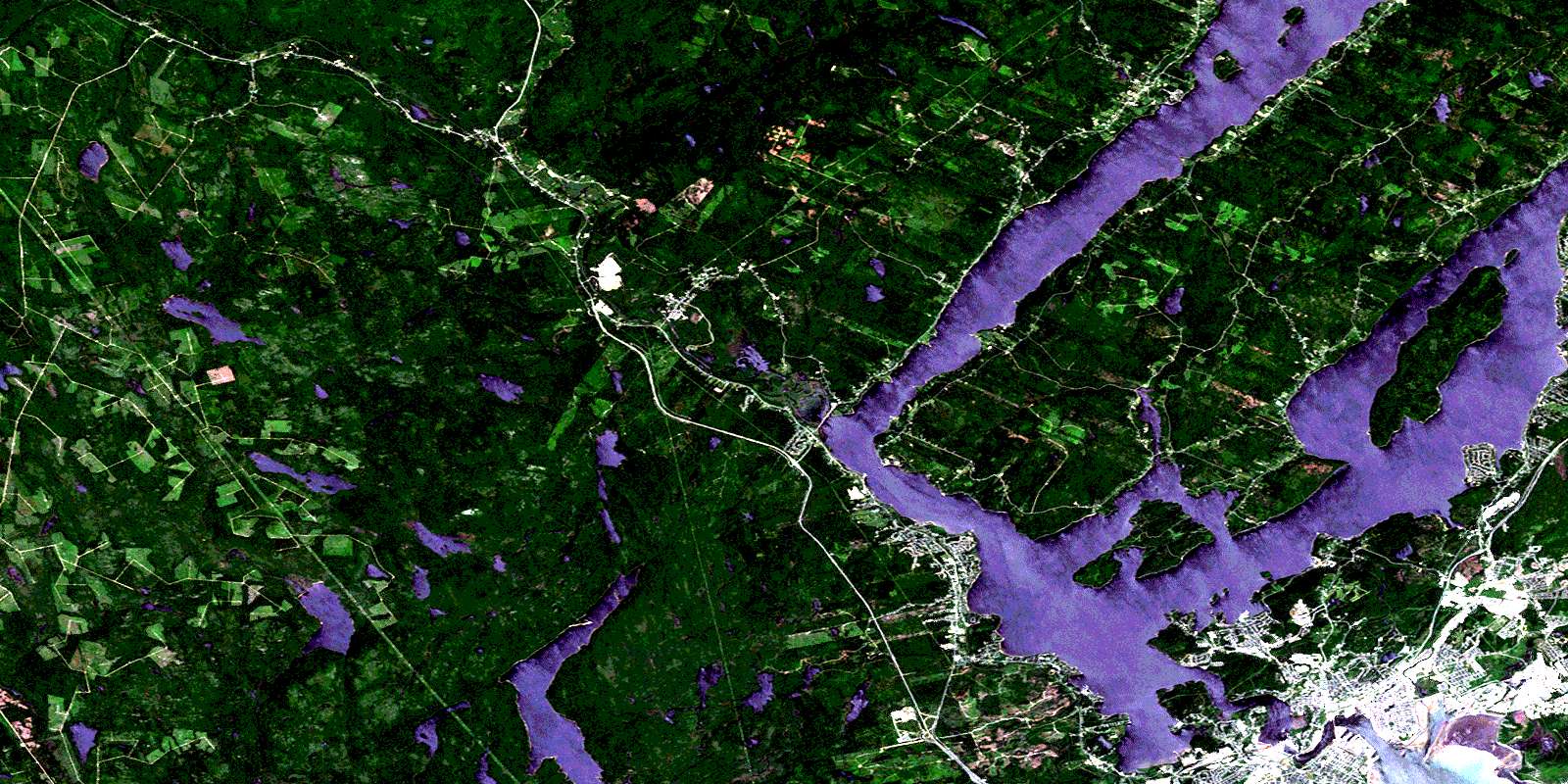
© Department of Natural Resources Canada. All rights reserved.
