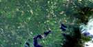
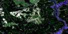
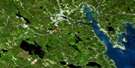
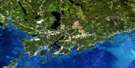
Hampstead Satellite Image Map
Download Free Aerial Photo 021G09 at 1:50,000 scale
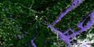
Hampstead Satellite Imagery
To view this satellite map, mouse over the air photo on the right.
You can also download this satellite image map for free:
021G09 Hampstead high-resolution satellite image map.
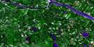
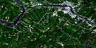
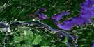
Maps for the Hampstead aerial map sheet 021G09 at 1:50,000 scale are also available in these versions:
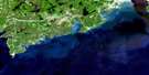
Hampstead Surrounding Area Aerial Photo Maps
 |
 |
 |
 |
 |
 |
 |
 |
 |
 |
 |
|
 |
 |
 |
© Department of Natural Resources Canada. All rights reserved.
Hampstead Gazetteer
The following places can be found on satellite image map 021G09 Hampstead:
Hampstead Satellite Image: Bays
Belleisle BayBelyeas Cove
Crafts Cove
Gorhams Creek
Kingston Creek
Marley Creek
Mistake Cove
Rouses Cove
Schampers Cove
Shampers Cove
Tennant Cove
Tennants Cove
The Mistake
Hampstead Satellite Image: Capes
Colwells PointKingston Peninsula
MacDonalds Point
McDonald Point
Oak Point
Palmer Point
Penrey Point
Picnic Point
Hampstead Satellite Image: Channels
Colwells CreekLawson Passage
Long Island Bend
Washademoak Creek
Hampstead Satellite Image: Cliffs
Gorhams BluffSchampers Bluff
Shampers Bluff
Hampstead Satellite Image: Geographical areas
BlissvilleBurton
Cambridge
Clarendon
Gagetown
Greenwich
Hampstead
Kars
Kings
Kingston
Petersville
Queens
Sunbury
Wickham
Hampstead Satellite Image: Islands
Belle IsleGrassy Island
Hog Island
Hog Island
Killaboy Island
Killboy Island
Long Island
Lower Musquash Island
Pig Island
Rush Island
Spoon Island
Upper Musquash Island
Hampstead Satellite Image: Lakes
Bacon LakeBecketts Pond
Bogle Lake
Britain Lake
Brunswick (Grassy) Lake
Brunswick Lake
Clark Lake
Connors Lake
Cranberry Lake
Crowley Lake
Deep Lake
Fanning Lake
Fanning Lake
Fish Lake
Foshay Lake
Fowler Lake
Gaspereau Lake
George Lake
Island Lake
Island Lake
Jones Lake
Little Rocky Lake
Long Island Lake
McCutcheon Lake
Morgan Lake
Murphy Lake
Musquash Lake
Otnabog Lake
Quinn Lake
Rabbit Lake
Richards Round Lake
Rocky Lake
Rocky Lake
Roddys Lake
Sheriff Lake
Swain Lake
Vanwart Lake
Vanwart Lake
Washademoak Lake
Wirral Lake
Hampstead Satellite Image: Marine navigation features
Colwells WharfMotts Wharf
Hampstead Satellite Image: Military areas
Canadian Forces Base GagetownChamp de tir et champ de manoeuvre Gagetown
Gagetown Range and Training Area
Hampstead Satellite Image: Mountains
Bald HillBlue Mountain
Blue Mountain
Boone Mountain
Break Neck Hill
Campbell Hill
Coleman Hill
Cootehill Ridge
Cootes Hill
Crozier Hill
Daly Mountain
Day Hill
Doughnut Hill
Fanning Mountain
Finnegans Hill
Flaglor Mountain
Friendship Hill
Hamilton Mountain
Headline Ridge
Hogan Hill
Inchby Ridge
Jerusalem Ridge
Manor Ridge
Mary Ann Daly Hill
McGuire Hill
Mooneys Ridge
Nutter Hill
Oak Ridge
Otnabog Hill
Queens Brook Hill
Round Hill
Rush Hill
Summer Hill
Telegraph Hill
Tyng Hill
Wirral Mountain
Hampstead Satellite Image: Conservation areas
Oak Point Provincial ParkHampstead Satellite Image: Rivers
Back (No. 10) CreekBack Creek
Back Creek
Back Field Brook
Back Hollow Brook
Barnet Brook
Belyea Brook
Ben Brook
Birch Brook
Bradley Brook
Braydon Brook
Brizley Stream
Brown Brook
Carpenter Brook
Cochrane Brook
Coleman Brook
Crystal Brook
Daly Brook
Days Brook
Dunn Brook
Eastern Brook
Ellingham Brook
Elm Brook
Elm Stream
Factory Brook
Falls Brook
Fanning Brook
Fitch Creek
Flaglor Brook
Front Hollow Brook
Gamble Brook
Geary Brook
Glass Brook
Hogan Brook
Howe Brook
Hughes Brook
Hurley Brook
Image Brook
Irving Brook
Jones Brook
Jones Brook
Jones Creek
Kerr Brook
Killen Brook
Lake Stream
Little River
Little River
Lucifee Brook
MacDonalds Brook
Mad Brook
Malone Brook
McCain Brook
McCarthy Brook
McDonald Brook
McKeen Brook
McLean Brook
Menzie Brook
Mersereau Stream
Mile Brook
Mill Creek
Monaghan Brook
Moore Brook
Mountain Brook
Mud Brook
Nerepis River
North Brook
Number Ten Brook
Nutter Creek
Otnabog River
Otnabog Stream
Oxbow Brook
Palmer Creek
Pascal Brook
Patterson Brook
Pendar Brook
Pender Brook
Pender Brook
Popple Brook
Queen Brook
Queens Brook
Quinn Brook
Rathburn Brook
River George
Rivière Saint-Jean
Rockwell Stream
Rouses Brook
Saint John River
Sawmill Brook
Scott Brook
Shannon Brook
Sharpes Brook
Smith Brook
Snake Creek
Sucker Brook
Tantawanta Stream
Taylor Brook
Three Bridge Brook
Three Mile Brook
Valley Brook
Webster Brook
Welsh Brook
Wildcat Hollow Brook
Hampstead Satellite Image: River features
Long ReachHampstead Satellite Image: Shoals
Crow RockHampstead Satellite Image: Unincorporated areas
Armstrong CornerBelyea Cove
Belyeas Cove
Beulah
Blakely
Browns Corner
Carpenter
Central Cambridge
Central Greenwich
Central Hampstead
Clones
Cootes Hill
Crafts Cove
Dunham
Dunns Corner
Elm Hill
Enniskillen
Enniskillen Station
Evandale
Fentons
Ferris
Gaspereau Forks
Geary
Gerow
Gillans Corner
Glenwood
Grays Mills
Hamilton Mountain
Hampstead
Headline
Hibernia
Inchby
Jerusalem
Lawfield
Loisville
London Settlement
Lower Cambridge
Lower Gagetown
Lynch Corner
MacDonalds Point
McAlpines
McDonald Point
McPherson
New Jerusalem
New Jerusalem
Oak Point
Olinville
Petersville
Pleasant Villa
Polleyhurst
Quarries
Queenstown
Schampers
Shampers
Shannon
South Clones
Summer Hill
Tennant Cove
Tennants Cove
The Bluffs
The Manor
Tweedsmuir
Upper Greenwich
Upper Hampstead
Upper Otnabog
Victoria Settlement
Vincent
West Jerusalem
Wickham
Wirral
Wirral Station
Hampstead Satellite Image: Low vegetation
Big BogBoyds Marsh
Hughes Meadow
Kelly Meadow
Little Bog
Mersereau Meadow
Mistake Interval
Mistake Intervale

© Department of Natural Resources Canada. All rights reserved.
