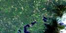
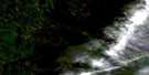
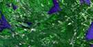
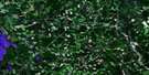
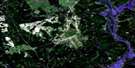
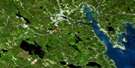
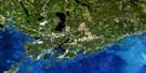
Canterbury Satellite Image Map
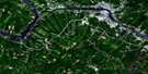
Download Free Aerial Photo 021G14 at 1:50,000 scale
Canterbury Satellite Imagery
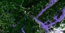
To view this satellite map, mouse over the air photo on the right.
You can also download this satellite image map for free:
021G14 Canterbury high-resolution satellite image map.
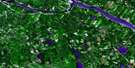
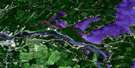
Maps for the Canterbury aerial map sheet 021G14 at 1:50,000 scale are also available in these versions:
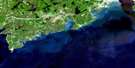
Canterbury Surrounding Area Aerial Photo Maps
 |
 |
 |
 |
 |
 |
 |
 |
 |
 |
 |
|
 |
 |
 |
© Department of Natural Resources Canada. All rights reserved.
Canterbury Gazetteer
The following places can be found on satellite image map 021G14 Canterbury:
Canterbury Satellite Image: Bays
Bear Island CoveCulliton Cove
Joslin Brook Basin
Joslin Creek Basin
Shogomoc Cove
Canterbury Satellite Image: Channels
Little Magaguadavic ThoroughfareCanterbury Satellite Image: Falls
Big FallsJoslin Creek Falls
Canterbury Satellite Image: Geographical areas
CanterburyCarleton
Dumfries
Manners Sutton
McAdam
Prince William
Queensbury
Southampton
York
Canterbury Satellite Image: Islands
Coac IslandsGreat Bear Island
Little Bear Islands
Long Island
Middle Island
Canterbury Satellite Image: Lakes
Amelia LakeBig Duck Lake
Big Jamieson Lake
Brown Lake
Carney Lake
Charlie Lake
Clear Lake
Clear Lake
Collicott Pond
Cranberry (Harvey) Lake
Cranberry Lake
Davidson Lake
Deer Lake
Doherty Pond
Doyle Pond
Duck Lake
Fawn Lake
Fox Lake
Grassy Lake
Grieve Lake
Harvey Lake
Indian Lake
Ingraham Lake
Jamieson Lake
Kilburn Lake
Lake Amelia
Lake George
Lily Lake
Little Jamieson Lake
Little Lake
Little Magaguadavic Lake
Long Pond
Mactaquac Lake
Magaguadavic Lake
Moon Pond
Moose Lake
Mud Lake
Pear Lake
Rocky Lake
Second Harvey Lake
Shogomoc Lake
Skiff Lake
Slough Gundy
Slugundy Ponds
Snowshoe Lake
Sullivan Lake
Tom Davis Lake
Tweedie Lake
Waterloo Lake
Canterbury Satellite Image: Mountains
Annies MountainBlaney Ridge
Carroll Ridge
Cranberry Ridge
Dorrington Hill
Dunham Hill
Flat Top Mountain
Magundy Hill
Meductic Hill
Canterbury Satellite Image: Conservation areas
Barony Provincial ParkLake George Provincial Park
Shogomoc Provincial Park
Canterbury Satellite Image: Rapids
Canoe RipsEllegood Rips
Grassy Lake Rips
Indian Rips
Canterbury Satellite Image: Rivers
Beaver BrookBlack Brook
Bulls Creek
Cann Brook
Clinch Brook
Coac Stream
Cranberry Brook
Cranberry Brook
Davidson Brook
Dead Creek
Deadwater Brook
Deer Lake Brook
Duck Brook
Duck Brook
Dunham Brook
Eel River
Estey Brook
Farnham Brook
Four Mile Brook
Fox Brook
Grassy Lake Brook
Greer Creek
Greers Creek
Hammond Brook
Indian Brook
Jocelyne Brook
Jocelyne Brook
Johnson Brook
Joslin Brook
Joslin Creek
King Brook
Little Cranberry Brook
Little Patterson Brook
Little Pokiok River
Little Pokiok Stream
Magundy Stream
Meadow Brook
Meadow Brook
Mill Brook
Mill Stream
Mud Brook
North Branch Duck Brook
Palfrey Brook
Palfrey Stream
Pine Swamp Brook
Pokiok River
Pokiok Stream
Quigg Brook
Risteen Brook
Rivière Saint-Jean
Saint John River
Serpentine Brook
Shogomoc River
Shogomoc Stream
Sinnots Brook
South Branch Mactaquac Stream
Stony Brook
Sugar Brook
Sullivan Brook
Sullivan Creek
Tweedie Brook
Waterloo Brook
West Branch Shogomoc Stream
West Duck Brook
West Shogomoc River
Canterbury Satellite Image: River features
Big DeadwaterCoac Reach
Kilburn Deadwater
Long Sluice Deadwater
Meductic Reach
Nackawic Bend
Pokiok Reach
Risteen Deadwater
Shogomoc Reach
Canterbury Satellite Image: Towns
NackawicCanterbury Satellite Image: Unincorporated areas
AllandaleAllandale Station
Barony
Bear Island
Blaney Ridge
Cairds
Carroll Ridge
Carson
Davidson Lake
Day Hill
Deer Lake
Donnelly Settlement
Dorrington Hill
Dow Settlement
Dumfries
Granite Hill
Green Bush
Hawkshaw
Johnson Settlement
Lake George
Lake Road
Lower Pokiok
Lower Prince William
Magaguadavic
Magundy
Marne
Middle Southampton
Murray
Otis
Pokiok
Pokiok Settlement
Prince William
Ritchie
Rosborough Settlement
Shogomoc
Southampton
Temple
Upper Bear Island
Upper Magaguadavic
Upper Prince William
Upper Queensbury
Upper Southampton
Canterbury Satellite Image: Low vegetation
Parent BogCanterbury Satellite Image: Villages
CanterburyCanterbury Station
Meductic
Rosborough

© Department of Natural Resources Canada. All rights reserved.
