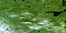
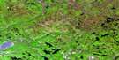
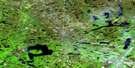
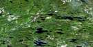
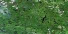
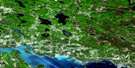
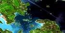
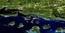
Echo Lake Satellite Image Map
Download Free Aerial Photo 041J12 at 1:50,000 scale
Echo Lake Satellite Imagery
To view this satellite map, mouse over the air photo on the right.
You can also download this satellite image map for free:
041J12 Echo Lake high-resolution satellite image map.
Maps for the Echo Lake aerial map sheet 041J12 at 1:50,000 scale are also available in these versions:
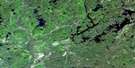
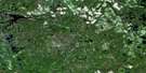
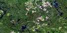
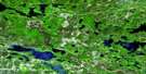
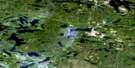
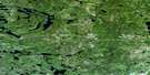
Echo Lake Surrounding Area Aerial Photo Maps
 |
 |
 |
 |
 |
 |
 |
 |
 |
 |
 |
 |
 |
 |
 |
 |
© Department of Natural Resources Canada. All rights reserved.
Echo Lake Gazetteer
The following places can be found on satellite image map 041J12 Echo Lake:
Echo Lake Satellite Image: Capes
Marble PointSand Point
Echo Lake Satellite Image: Geographical areas
195196
201
202
4G
Aberdeen
Aberdeen Additional
Algoma
Anderson
Chesley
Chesley Additional
Curtis
Cuthbertson
Galbraith
Gillmor
Haughton
Hodgins
Hurlburt
Kane
Kehoe
Macdonald
McMahon
Meredith
Morin
Otter
Reilly
Shingwaukonce
Whitman
Echo Lake Satellite Image: Indian Reserves
Garden River Indian Reserve 14Réserve indienne Garden River 14
Echo Lake Satellite Image: Islands
Centre IslandEcho Lake Satellite Image: Lakes
Aberdeen LakeAustin Lake
Bass Lake
Bijou Lake
Birch Lake
Birch Lake
Bottle Lake
Boundary Lake
Bruce Lake
Carpenter Lake
Cassidy Lake
Castleman Lake
Charley Lake
Chipman Lake
Conacher Lake
Cooper Lake
Crockatt Lake
Cuncic Lake
Daisy Mae Lake
Darragh Lake
Davieaux Lake
Desayeux Lake
Douglas Lake
Echo Lake
Erickson Lake
Ess Lake
Fairy Lake
Fern Lake
Fetherston Lake
Fish Lake
Gapp Lake
Garrick Lake
Giguere Lake
Gillmor Lake
Gimby Lake
Gracie Lake
Grant Lake
Green Lake
Hart Lake
Haversack Lake
Hoath Lake
Horner Lake
Hub Lake
Hugli Lake
Iron Lake
Kinahan Lake
Kinch Lake
Lamothe Lake
Lees Lake
Leishman Lake
Letz Lake
Lucille Lake
Lunkie Lake
Lutes Lake
McMahon Lake
Metivier Lake
Mole Lake
Moon Lake
One Horse Lake
Onion Lake
Osawomick Lake
Packsack Lake
Paquette Lake
Patten Lake
Pearl Lake
Petauguin Lake
Pine Island Lake
Primeau Lake
Quigley Lake
Rat Lake
Red Pine Lake
Red Rock Lake
Rheaume Lake
Roddy Lake
Round Lake
Roussain Lake
Saunders Lake
Shelden Lake
Skookum Lake
Smith Lake
Snare Lake
Solar Lake
Sorenson Lake
Spring Lake
Springsteele Lake
St. Onge Lake
Stilin Lake
Stuart Lake
Tarpaper Lake
Tee Lake
Thorp Lake
Toombs Lake
Topsy Lake
Towell Lake
Trotter Lake
Two Horse Lake
Vincent Lake
Wakegijig Lake
Wilson Lake
Echo Lake Satellite Image: Conservation areas
Echo River Hardwoods Conservation ReserveGarden River Forest Conservation Reserve
Stuart Lake Wetland Conservation Reserve
Echo Lake Satellite Image: Rivers
Austin CreekBar Creek
Cassidy Creek
Coffee Creek
Cuddy Creek
Dam Creek
Echo River
Echo River
Garden River
Iron Creek
Kinch Creek
Leishman Creek
Letz Creek
Little Garden River
Lower Echo River
Mink Creek
Mississagi River
Pearl Creek
Silver Creek
South Creek
Stony Creek
Stuart Creek
Thessalon River
Upper Echo River
Wood Creek
Echo Lake Satellite Image: Unincorporated areas
Poplar DaleEcho Lake Satellite Image: Low vegetation
Lost Man Swamp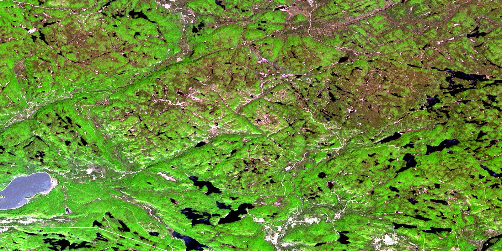
© Department of Natural Resources Canada. All rights reserved.
041J Related Maps:
041J Blind River041J01 Spanish
041J02 Algoma
041J03 Dean Lake
041J04 St Joseph Island
041J05 Bruce Mines
041J06 Iron Bridge
041J07 Elliot Lake
041J08 Whiskey Lake
041J09 Madawanson Lake
041J10 Rawhide Lake
041J11 Wakomata Lake
041J12 Echo Lake
041J13 Ranger Lake
041J14 Rocky Island Lake
041J15 Kindiogami Lake
041J16 Mozhabong Lake
