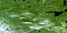
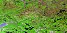
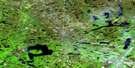
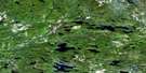
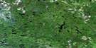
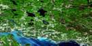
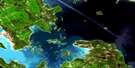
Algoma Satellite Image Map
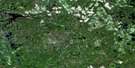
Download Free Aerial Photo 041J02 at 1:50,000 scale
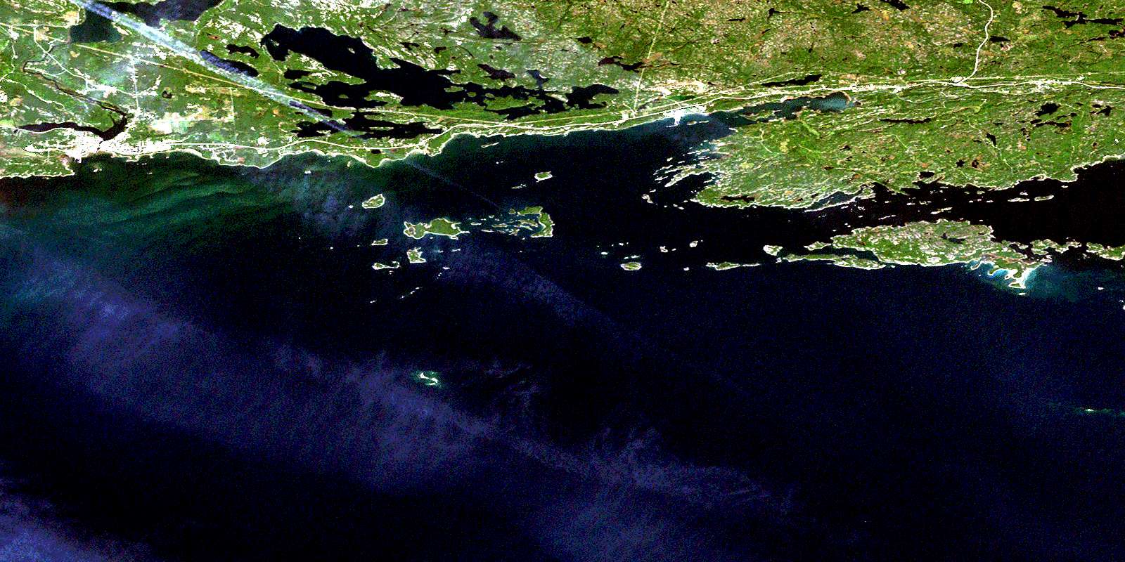
Algoma Satellite Imagery
To view this satellite map, mouse over the air photo on the right.
You can also download this satellite image map for free:
041J02 Algoma high-resolution satellite image map.
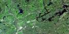
Maps for the Algoma aerial map sheet 041J02 at 1:50,000 scale are also available in these versions:
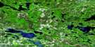
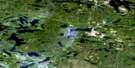
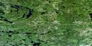
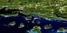
Algoma Surrounding Area Aerial Photo Maps
 |
 |
 |
 |
 |
 |
 |
 |
 |
 |
 |
 |
 |
 |
 |
 |
© Department of Natural Resources Canada. All rights reserved.
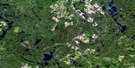
Algoma Gazetteer
The following places can be found on satellite image map 041J02 Algoma:
Algoma Satellite Image: Bays
Algoma BayAllen Bay
Beardrop Harbour
Bickel's Bay
Bootleggers Bay
Colin Cove
Dorothy Inlet
East Bay
Fisherman's Bay
Gwynne Bay
Hoffman Bight
John Harbour
Lauzon Bay
Medicine Bay
Moiles Harbour
Mud Bay
Serpent Harbour
Spooner's Bay
Taschereau Bay
Wettlaufer Bay
Wicksteed Harbour
Algoma Satellite Image: Capes
Bartlett PointBattle Point
Bergeron Point
Big Sandy Point
Camp Point
Caribou Point
Comb Point
Davin Point
Emerald Point
Harriette Point
Herman Point
Hospital Point
Knight Point
Lally Point
Little Green Point
Little Sandy Point
Long Point
Mary Point
Narrow Point
Pregnant Point
Sandy Point
South Point
Table Rock
Waters Point
West Point
Wicksteed Point
Algoma Satellite Image: Channels
East EntranceNewport Channel
North Channel
North Entrance
North Passage
Scott Passage
South Passage
Spooner's Narrows
Turnbull Passage
Whalesback Channel
Algoma Satellite Image: Geographical areas
AlgomaCobden
Lewis
Long
Manitoulin
Spragge
Striker
Algoma Satellite Image: Indian Reserves
Mississagi River Indian Reserve 8Réserve indienne Mississagi River 8
Réserve indienne Serpent River 7
Serpent River 7
Serpent River Indian Reserve 7
Algoma Satellite Image: Islands
Aikens IslandAlfred Island
Bassett Island
Beaufort Island
Bell's Island
Blueberry Island
Can Island
Caroline Island
Chicora Island
Clara Island
Cook Island
Cross Island
Dalrymple Island
Daly Islands
David Island
DeCelles Island
Dewdney Island
Dewdney Rock
Dixon Islands
Dot Island
Double Islands
Drew Island
Duffield Island
Edgar Island
Ely's Island
Fisher Island
Flood Island
Fournier Islands
Garibaldi Island
Gibson Island
Goalen Island
Godfrey Islands
Gowan Island
Greenway Island
Harbour Island
Henriette Island
Indian Island
John Island
Kimmy's Island
Klotz Island
LeSueur Island
Lett Island
Loughlin Island
Louis Island
Magazine Islands
McCallum Islands
McCracken Island
Mills Island
Mitchell Island
Morrison Islands
Mouse Island
Mulock Island
Navy Island
Nelles Island
Nicholas Island
Nobles Island
Norquay Island
O'Dwyer Island
Parsons Island
Peter Islands
Plumb Island
Prendergast Island
Rainboth Island
Ramsay Islands
Robin Island
Round Island
Sandford Island
Sanford Island
Sanford Island
Scott Island
Smith Island
Snider Island
Spotted Island
Spragge Island
Strong Island
Struthers Island
Sugar Island
Susanne Island
Sylvain Island
Tern Island
The Cousins
The Three Sisters
Turnbull Island
Vaux Island
Whitcher Island
White Island
Algoma Satellite Image: Lakes
Allen LakeBass Lake
Carson Lake
Hastie Lake
Lac Huron
Laderoute Lake
Lake Duborne
Lake of the Mountains
Lauzon Lake
Lillie Lake
Little Lake
Lizard Lake
Long Lake
Red Lake
Surprise Lake
Thurston Lake
Waugush Lake
Algoma Satellite Image: Mountains
Graveyard HillOld Baldy
Algoma Satellite Image: Other municipal/district area - miscellaneous
GordonHowland
The North Shore
Algoma Satellite Image: Rivers
Black CreekBlind River
Cobden River
Lauzon River
Lizard Creek
Marcellus Creek
Mississagi River
Potomac River
Serpent River
Spragge Creek
Algoma Satellite Image: Shoals
Acadia RockAmyot Rocks
Beaufort Reef
Belle Rock
Bergin Rock
Berrypicker Rock
Black Rock
Blind River Bank
Bradley Rock
Bruce Rock
Campana Shoal
Casey Shoal
Chapman Reef
Cherub Rock
Chrysler Rocks
Colmer Ground
Dalton Reef
Darby Rock
Davies Rock
Denison Rock
Deuce Rock
Dixie Rocks
Dog Point Shoal
Doucet Rock
Europa Reef
Fortin Rocks
Fraser Rocks
Gull Rock
Gunboat Shoal
Hamilton Rock
Huntly Reef
Isaac Rock
Jane Rock
Labelle Reef
LaFrance Rock
Maitland Patch
May Reef
Meteor Rock
Michels Ground
Minstrel Rock
Moodie Rock
Page Rocks
Pancake Rock
Pandora Rock
Ploughboy Rock
Rescue Rock
Restless Bank
Rob Roy Patch
Robb Rock
Robb Rocks
Shickluna Rock
Simon Rock
Southwest Patches
Spartan Rock
Tenspot Shoal
Tug Reef
Turtle Rock
Tyrwhitt Shoals
Weldon Shoal
Whalesback
Algoma Satellite Image: Towns
Blind RiverNortheastern Manitoulin and the Islands
Algoma Satellite Image: Unincorporated areas
AlgomaAlgoma Mills
Blind River
McFerson
Moiles Mills
Newport
Pronto East
Serpent River
Sheppard
Spragge
© Department of Natural Resources Canada. All rights reserved.
041J Related Maps:
041J Blind River041J01 Spanish
041J02 Algoma
041J03 Dean Lake
041J04 St Joseph Island
041J05 Bruce Mines
041J06 Iron Bridge
041J07 Elliot Lake
041J08 Whiskey Lake
041J09 Madawanson Lake
041J10 Rawhide Lake
041J11 Wakomata Lake
041J12 Echo Lake
041J13 Ranger Lake
041J14 Rocky Island Lake
041J15 Kindiogami Lake
041J16 Mozhabong Lake
