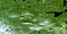
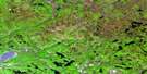
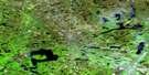
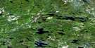
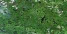
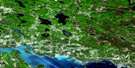
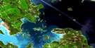
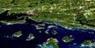
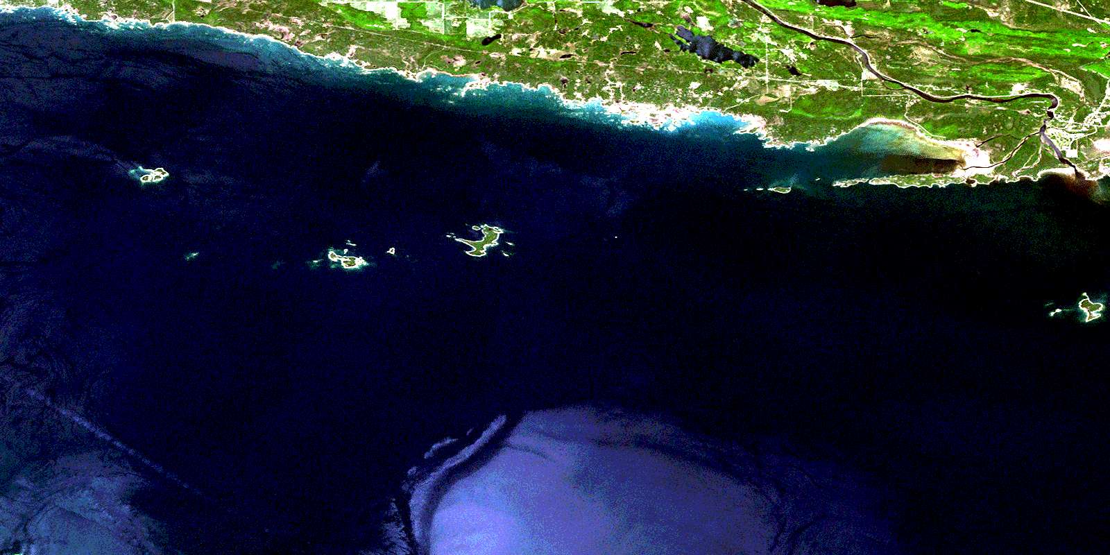
Dean Lake Satellite Image Map
Download Free Aerial Photo 041J03 at 1:50,000 scale
Dean Lake Satellite Imagery
To view this satellite map, mouse over the air photo on the right.
You can also download this satellite image map for free:
041J03 Dean Lake high-resolution satellite image map.
Maps for the Dean Lake aerial map sheet 041J03 at 1:50,000 scale are also available in these versions:
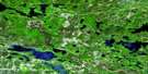
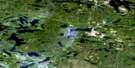
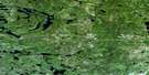
Dean Lake Surrounding Area Aerial Photo Maps
 |
 |
 |
 |
 |
 |
 |
 |
 |
 |
 |
 |
 |
 |
 |
 |
© Department of Natural Resources Canada. All rights reserved.
Dean Lake Gazetteer
The following places can be found on satellite image map 041J03 Dean Lake:
Dean Lake Satellite Image: Bays
Barrets HarbourBishops Harbour
Foul Bight
Mississagi Bay
Dean Lake Satellite Image: Capes
Beaumont PointBright Point
Cobden Peninsula
De Roberval Point
Dobie Point
Dog Point
Glanville Point
North Point
Patrick Point
Siccorde Point
Supply Point
Wolstan Point
Dean Lake Satellite Image: Channels
Fisherman GutNorth Channel
Dean Lake Satellite Image: Falls
Mississagi FallsDean Lake Satellite Image: Geographical areas
AlgomaBright
Bright Additional
Cobden
Manitoulin
Thessalon
Thompson
Dean Lake Satellite Image: Indian Reserves
Mississagi River 8Mississagi River Indian Reserve 8
Réserve indienne Mississagi River 8
Réserve indienne Thessalon 12
Thessalon Indian Reserve 12
Dean Lake Satellite Image: Islands
Anchor IslandBigsby Island
Bird Island
Burton Island
Burton Islands
Cobden Island
East Grant Island
Fishery Island
Fox Island
Hennepin Island
Herbert Island
Joliette Islands
La Salle Island
Middle Grant Island
Mississagi Island
Richelieu Island
Sayers Island
The French Islands
Tonty Island
Webber Island
West Grant Island
West Island
Woman Island
Dean Lake Satellite Image: Lakes
Bright LakeDean Lake
Everett Lake
Lac Huron
Pakowkami Lake
Dean Lake Satellite Image: Other municipal/district area - miscellaneous
Day and Bright AdditionalHowland
Huron Shores
Thessalon
Thompson
Dean Lake Satellite Image: Conservation areas
Mississagi Delta Provincial Nature ReserveNorth Channel Inshore Provincial Park
Dean Lake Satellite Image: Rapids
Monkey RunDean Lake Satellite Image: Rivers
Cook CreekLivingstone Creek
Mississagi River
Pahpashcah Creek
Pickerel Creek
Potomac River
West Branch
Dean Lake Satellite Image: Shoals
Barrets Range RockBarrett Bank
Briggs Rock
Butcher Boy Bank
Crowley Reef
Cumberland Rock
De Caen Rock
Dog Point Shoal
Fisk Reef
Horne Rock
Ivor Rocks
Leo Rock
McDonald Shoal
McGlashan Patch
North Point Shoal
Northwest Reef
Patrick Point Bank
Steeple Rock
Talon Rock
Dean Lake Satellite Image: Towns
Blind RiverNortheastern Manitoulin and the Islands
Dean Lake Satellite Image: Unincorporated areas
DaytonDayton
Dayton Station
Dean Lake
Eley
Heather
Mississagi
Mississauga
Nesterville
© Department of Natural Resources Canada. All rights reserved.
041J Related Maps:
041J Blind River041J01 Spanish
041J02 Algoma
041J03 Dean Lake
041J04 St Joseph Island
041J05 Bruce Mines
041J06 Iron Bridge
041J07 Elliot Lake
041J08 Whiskey Lake
041J09 Madawanson Lake
041J10 Rawhide Lake
041J11 Wakomata Lake
041J12 Echo Lake
041J13 Ranger Lake
041J14 Rocky Island Lake
041J15 Kindiogami Lake
041J16 Mozhabong Lake
