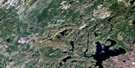
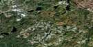
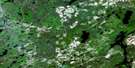
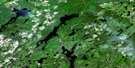
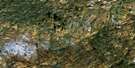
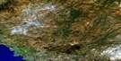
Kabinakagami Lake Satellite Image Map
Download Free Aerial Photo 042C16 at 1:50,000 scale
Kabinakagami Lake Satellite Imagery
To view this satellite map, mouse over the air photo on the right.
You can also download this satellite image map for free:
042C16 Kabinakagami Lake high-resolution satellite image map.
Maps for the Kabinakagami Lake aerial map sheet 042C16 at 1:50,000 scale are also available in these versions:
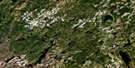
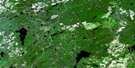
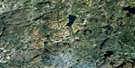
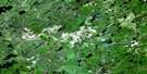
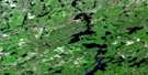
Kabinakagami Lake Surrounding Area Aerial Photo Maps
 |
 |
 |
 |
 |
 |
 |
 |
 |
 |
 |
 |
 |
 |
 |
 |
© Department of Natural Resources Canada. All rights reserved.
Kabinakagami Lake Gazetteer
The following places can be found on satellite image map 042C16 Kabinakagami Lake:
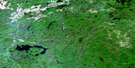
Kabinakagami Lake Satellite Image: Bays
Beaver BayBoot Bay
Burnt Bay
Five Mile Bay
Goulet Bay
Little Kaby Bay
Little Whitefish Bay
Pine Portage Bay
Rocky Bay
Schist Bay
Simon's Bay
Whitefish Bay
Kabinakagami Lake Satellite Image: Capes
Alligator PointBig Point
Driller's Point
Picard's Point
Wigwam Point
Windy Point
Kabinakagami Lake Satellite Image: Channels
Agamik GapFirst Gap
Fourth Gap
Second Gap
Third Gap
Kabinakagami Lake Satellite Image: Falls
Jumper FallsKabinakagami Lake Satellite Image: Geographical areas
CarneyDerry
Ermine
Hawkins
Irving
Lipton
Lizar
Marjorie
Martin
Mildred
Mosambik
Walls
Kabinakagami Lake Satellite Image: Islands
Agamik IslandBirch Island
Blueberry Island
Burnt Island
Dog Island
John's Island
Moose Island
Twenty Pound Island
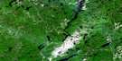
Kabinakagami Lake Satellite Image: Lakes
Agamapashik LakeAkron Lakes
Ankrom Lake
Beaver Lake
Bullmoose Lake
Cameron Lake
Carney Lake
Dana Lake
Dubroy Lake
Ermine Lake
Evelyn Lake
Gull Lake
Hawkins Lake
Hilliard Lake
Irving Lake
Kabinakagami Lake
Kabinakagamisis Lake
Langdon Lake
Little Akron Lake
Little Carney Lake
Little Coat Lake
Little Ermine Lake
Little Pichogen Lake
Little Watt Lake
Lost Lake
Marjorie Lake
Moose Lake
Pichogen Lake
Pine Portage Lake
Rat Lake
Sharpe Lake
The Expansion
Upper Pichogen Lake
Kabinakagami Lake Satellite Image: Rapids
First RapidsGull Rapids
Second Rapids
Third Rapids
Trout Rapids
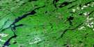
Kabinakagami Lake Satellite Image: Rivers
Akron CreekBear Creek
Breckenridge Creek
Carney Creek
Coat River
Dana Creek
Ermine Creek
Fairy Creek
Five Mile Creek
Hawkins Creek
Irving Creek
Kabinakagami River
Kabinakagamisis River
Lipton Creek
Little Akron Creek
Little Coat River
Noisy Creek
Oba River
Sharpe Creek
Stoney Creek
Swanson Creek
Watt Creek
Kabinakagami Lake Satellite Image: Road features
Chain of Lakes PortageFive Mile Portage
Pine Portage
Kabinakagami Lake Satellite Image: Shoals
Gull RockKabinakagami Lake Satellite Image: Unincorporated areas
AkronDana
Langdon
Price

© Department of Natural Resources Canada. All rights reserved.
042C Related Maps:
042C White River042C01 Manitowik Lake
042C02 Hawk Junction
042C03 Mishibishu Lake
042C04 Pukaskwa River
042C05 Lurch Lake
042C06 Pokei Lake
042C07 Medhurst Creek
042C08 Franz
042C09 Oba Lake
042C10 Anahareo Lake
042C11 White River
042C12 Cedar Lake
042C13 White Lake
042C14 Kwinkwaga Lake
042C15 Gourlay Lake
042C16 Kabinakagami Lake
