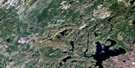
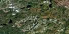
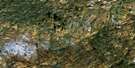
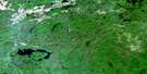
Pokei Lake Satellite Image Map
Download Free Aerial Photo 042C06 at 1:50,000 scale
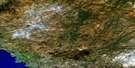
Pokei Lake Satellite Imagery
To view this satellite map, mouse over the air photo on the right.
You can also download this satellite image map for free:
042C06 Pokei Lake high-resolution satellite image map.
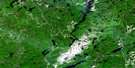
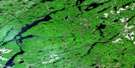
Maps for the Pokei Lake aerial map sheet 042C06 at 1:50,000 scale are also available in these versions:
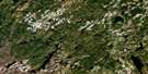
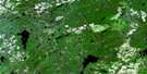
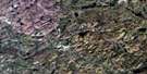
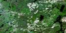
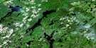
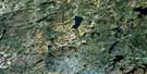
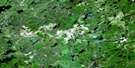
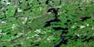
Pokei Lake Surrounding Area Aerial Photo Maps
 |
 |
 |
 |
 |
 |
 |
 |
 |
 |
 |
 |
 |
 |
 |
 |
© Department of Natural Resources Canada. All rights reserved.
Pokei Lake Gazetteer
The following places can be found on satellite image map 042C06 Pokei Lake:
Pokei Lake Satellite Image: Bays
No Fish BayPerry Bay
Pokei Lake Satellite Image: Geographical areas
31,2631,27
32,26
32,27
32,28
33 Additional, 26
33,26
33,27
33,28
56
63
64
65
Alanen
Ashley
Chapais
Charbonneau
Dahl
Keating
Keating Additional
Killins
Knicely
McDowell
McGowan
Memaskwosh
Thunder Bay
Vasiloff
Pokei Lake Satellite Image: Islands
Iserhoff IslandStar Island
Pokei Lake Satellite Image: Lakes
Beaver LakeBogle Lake
Burnfield Lake
Charlotte Lake
Coronation Lake
Cotton Lake
Crayfish Lake
Cushing Lake
Dennison Lake
Doss Lake
Gibson Lake
Hammer Lake
Heart Lake
Jarvey Lake
Kabenung Lake
Knife Lake
Line Lake
Lower Pokei Lake
Marianne Lake
Marion Lake
McCrea Lake
McMaster Lake
McQuown Lake
Moki Lake
Negwazu Lake
Nemategun Lake
Nichols Lake
North McCrea Lake
Obatanga Lake
Okoko Lake
One Island Lake
Parkinson's Pothole
Patron Lake
Pokei Lake
Raymond Lake
Sad Lake
Saniga Lake
Soulier Lake
South Hammer Lake
Spriggs Lake
University Lake
West Kabenung Lake
Whitefish Lake
Wilder Lake
Pokei Lake Satellite Image: Mountains
Heart MountainKabenung Hills
Morse Mountain
Pokei Lake Satellite Image: Conservation areas
Obatanga Provincial ParkPokei Lake/White River Wetlands Provincial Nature Reserve
Pokei Lake/White River Wetlands Provincial Park
Pukaskwa River Provincial Park
Pokei Lake Satellite Image: Rivers
Coronation CreekCrayfish Creek
Dog (University) River
Dog River
Doss Creek
East Bremner River
Knife Creek
McQuown Creek
Obatanga Creek
Okoko Creek
Pokei Creek
Pukaskwa River
University River
White River
Wilder Creek
Pokei Lake Satellite Image: Unincorporated areas
Birch
© Department of Natural Resources Canada. All rights reserved.
042C Related Maps:
042C White River042C01 Manitowik Lake
042C02 Hawk Junction
042C03 Mishibishu Lake
042C04 Pukaskwa River
042C05 Lurch Lake
042C06 Pokei Lake
042C07 Medhurst Creek
042C08 Franz
042C09 Oba Lake
042C10 Anahareo Lake
042C11 White River
042C12 Cedar Lake
042C13 White Lake
042C14 Kwinkwaga Lake
042C15 Gourlay Lake
042C16 Kabinakagami Lake
