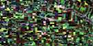
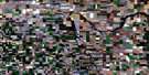
Altona Satellite Image Map
Download Free Aerial Photo 062H04 at 1:50,000 scale
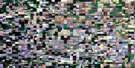
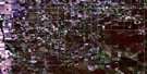
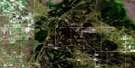
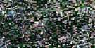
Altona Satellite Imagery
To view this satellite map, mouse over the air photo on the right.
You can also download this satellite image map for free:
062H04 Altona high-resolution satellite image map.
Maps for the Altona aerial map sheet 062H04 at 1:50,000 scale are also available in these versions:
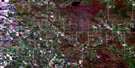
Altona Surrounding Area Aerial Photo Maps
 |
 |
 |
 |
 |
 |
 |
 |
 |
 |
 |
 |
 |
 |
 |
 |
© Department of Natural Resources Canada. All rights reserved.
Altona Gazetteer
The following places can be found on satellite image map 062H04 Altona:
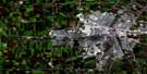
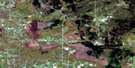
Altona Satellite Image: Channels
Buffalo Lake ChannelAltona Satellite Image: Hydraulic construction
Buffalo DrainHespeler Drain
Knopf Drain
Rempel Drain
Rosenheim Drain
Thiessen Drain
Altona Satellite Image: Other municipal/district area - miscellaneous
RhinelandStanley
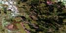
Altona Satellite Image: Conservation areas
A. Enns Wildlife RefugeG. C. Froese Wildlife Refuge
G. J. Froese Wildlife Refuge
Altona Satellite Image: Provinces
ManitobaAltona Satellite Image: Rivers
Buffalo CreekDeadhorse Creek
Altona Satellite Image: Road features
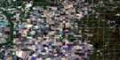
Boundary Commission - N.W.M.P. RouteAltona Satellite Image: Towns
AltonaGretna
Plum Coulee
Winkler
Altona Satellite Image: Unincorporated areas
AltbergthalBlumenfeld
Blumengart
Blumenort
Blumenort South
Chortitz
Chortitza
Friedensfeld
Friedensfeld West
Friedensruh
Gnadenfeld
Gnadenthal
Greenfarm
Hamburg
Haskett
Hochfeld
Horndean
Kronstal
Kronsthal
Neuenberg
Neuenburg
Neuhorst
Old Altona
Osterwick
Reinfeld
Reinland
Rosenfeld
Rosengart
Rosenort
Rosetown
Schanzenfeld
Schoenwiese
Shanzenfeld
Silberfeld

© Department of Natural Resources Canada. All rights reserved.
