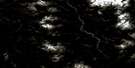
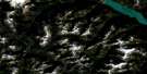
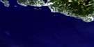
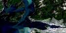
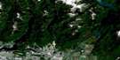
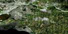
Nanaimo Satellite Image Map
Download Free Aerial Photo 092G04 at 1:50,000 scale
Nanaimo Satellite Imagery
To view this satellite map, mouse over the air photo on the right.
You can also download this satellite image map for free:
092G04 Nanaimo high-resolution satellite image map.
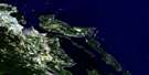
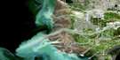
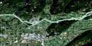
Maps for the Nanaimo aerial map sheet 092G04 at 1:50,000 scale are also available in these versions:
Nanaimo Surrounding Area Aerial Photo Maps
 |
 |
 |
 |
 |
 |
 |
 |
 |
 |
 |
 |
 |
 |
 |
 |
© Department of Natural Resources Canada. All rights reserved.
Nanaimo Gazetteer
The following places can be found on satellite image map 092G04 Nanaimo:
Nanaimo Satellite Image: Bays
Baines BayBoat Harbour
Burleith Arm
Clark Bay
Coal Mine Bay
Commercial Bay
Commercial Inlet
Cufra Inlet
Davidson Bay
Degnen Bay
Departure Bay
Descanso Bay
Duke Inlet
Hammond Bay
Herring Bay
Keel Cove
Kenary Cove
Kulleet Bay
Ladysmith Harbour
Leboeuf Bay
Lighthouse Bay
Lock Bay
Logan Bay
Mark Bay
Nanaimo Harbour
Nicholson Cove
Noel Bay
North Cove
Oyster Harbour
Percy Anchorage
Pilot Bay
Pirate Cove
Pirates Cove
Silva Bay
Taylor Bay
Wakes Cove
West Bay
Nanaimo Satellite Image: Beaches
Sunset BeachNanaimo Satellite Image: Capes
Alcala PointAngle Point
Batchelor Point
Bate Point
Berry Point
Blackberry Point
Brechin Point
Cardale Point
Cayetano Point
Cordero Point
Deer Point
Detwiller Point
Dibuxante Point
Dionisio Point
Duke Point
Flewett Point
Fraser Point
Gallows Point
Good Point
Jack Point
Joan Point
Josef Point
Lagoon Head
Law Point
Malaspina Point
McKay Point
Nares Point
Neck Point
Orlebar Point
Page Point
Pilkey Point
Pimbury Point
Purvis Point
Race Point
Reynolds Point
Rowboat Point
Shaft Point
Shah Point
Shingle Point
Stuart Point
Tinson Point
Tyne Point
Vernaci Point
Virago Point
Wedge Point
Williams Point
Yellow Point
Nanaimo Satellite Image: Channels
Commodore PassageDodd Narrows
Fairway Channel
False Narrows
Forwood Channel
Gabriola Passage
Horswell Channel
McKay Channel
Newcastle Island Passage
Northumberland Channel
Porlier Pass
Pylades Channel
Rainbow Channel
Ruxton Passage
Strait of Georgia
Stuart Channel
Trincomali Channel
Whaleboat Passage
Nanaimo Satellite Image: City
NanaimoNanaimo Satellite Image: Cliffs
Galiano GalleryHorswell Bluff
Nanaimo Satellite Image: Geographical areas
Bright Land DistrictCedar Land District
Cowichan Land District
Cranberry Land District
Douglas Land District
Mountain Land District
Nanaimo Land District
New Westminster Land District
Oyster Land District
Wellington Land District
Nanaimo Satellite Image: Indian Reserves
Burial Ground Indian Reserve 6Chemainus Indian Reserve 13
Gabriola Island Indian Reserve 5
Galiano Island Indian Reserve 9
Lyacksun Indian Reserve 3
Ma-Guala Indian Reserve 6
Nanaimo River Indian Reserve 2
Nanaimo River Indian Reserve 3
Nanaimo River Indian Reserve 4
Nanaimo Town Indian Reserve 1
Oyster Bay Indian Reserve 12
Portier Pass Indian Reserve 5
Réserve indienne Burial Ground 6
Réserve indienne Chemainus 13
Réserve indienne Gabriola Island 5
Réserve indienne Galiano Island 9
Réserve indienne Lyacksun 3
Réserve indienne Ma-Guala 6
Réserve indienne Nanaimo River 2
Réserve indienne Nanaimo River 3
Réserve indienne Nanaimo River 4
Réserve indienne Nanaimo Town 1
Réserve indienne Oyster Bay 12
Réserve indienne Portier Pass 5
Réserve indienne Shingle Point 4
Shingle Point Indian Reserve 4
Nanaimo Satellite Image: Islands
Acorn IslandBath Island
Brandon Island
Brandon Islands
Breakwater Island
Canoe Islet
Carlos Island
De Courcy Group
De Courcy Island
Entrance Island
Five Finger Island
Flat Top Islands
Gabriola Island
Galiano Island
Gaviola Island
Gulf Islands
Île de Vancouver
Jesse Island
Kendrick Island
Lily Island
Link Island
Miami Islet
Mudge Island
Newcastle Island
Protection Island
Pylades Island
Ragged Islets
Reid Island
Rose Islets
Round Island
Ruxton Island
Saturnina Island
Sear Island
Snake Island
Thetis Island
Tree Island
Tugboat Island
Valdes Island
Vance Island
Vancouver Island
Whaleboat Island
Woods Islands
Nanaimo Satellite Image: Lakes
Beck LakeBlind Lake
Cathers Lake
Crystal Lake
Greenway Lake
Harewood Lake
Hoggan Lake
Holden Lake
Long Lake
Lost Lake
McKay Lake
Michael Lake
Myles Lake
Overton Lake
Page Lagoon
Priest Lake
Quennell Lake
Richard Lake
Stark Lakes
Timberland Lake
Westwood Lake
Whisky Lake
York Lake
Nanaimo Satellite Image: Military areas
Champ de tir NanaimoNanaimo Range
Nanaimo Satellite Image: Mountains
Mexicana HillMoore Hill
Mount Hayes
Vancouver Island Ranges
Woodley Range
Nanaimo Satellite Image: Major municipal/district area - major agglomerations
Capital Regional DistrictCowichan Valley Regional District
Greater Vancouver Regional District
Regional District of Nanaimo
Nanaimo Satellite Image: Conservation areas
Dionisio Point ParkDrumbeg Park
Gabriola Sands Park
Gabriola Sands Recreation Area
Hemer Park
Ivy Green Park
Morden Colliery Historic Park
Newcastle Island Marine Park
Newcastle Island Park
Newcastle Island Recreation Area
Petroglyph Park
Pirates Cove Marine Park
Roberts Memorial Park
Sandwell Park
Whaleboat Island Marine Park
Nanaimo Satellite Image: Plains
Harewood PlainsNanaimo Satellite Image: Rivers
Beck CreekBerkley Creek
Bush Creek
Chase River
Cottle Creek
Departure Creek
Elkhorn Creek
Haslam Creek
Hokkanen Creek
Meakin Channel
Millstone River
Nanaimo River
North Cottle Creek
North Haslam Creek
Northfield Creek
Stark Creek
Tyee Creek
Nanaimo Satellite Image: Shoals
Beacon RockBlack Rock
Black Rock
Boscowitz Rock
Brant Reef
Carpenter Rock
Clarke Rock
Danger Reefs
Gabriola Reefs
Horswell Rock
Hudson Rocks
Inskip Rock
Middle Bank
Oregon Rock
Passage Rock
Power Squadron Reef
Rogers Reef
Romulus Reef
Romulus Rock
Satellite Reef
Shipyard Rock
Thrasher Rock
Three Fathom Patches
Virago Rock
Nanaimo Satellite Image: Unincorporated areas
Boat HarbourBrenton
Cassidy
Cedar
Chase
Chase River
Cinnabar Valley
Departure Bay
Extension
Fiddicks
Gabriola
Gabriola Island
Harmac
Newcastle
North Gabriola
North Galiano
Northfield
Silvene
South Wellington
Starks
Stockett
Storms
Stovely
Wellcox
Nanaimo Satellite Image: Low vegetation
Buttertubs Marsh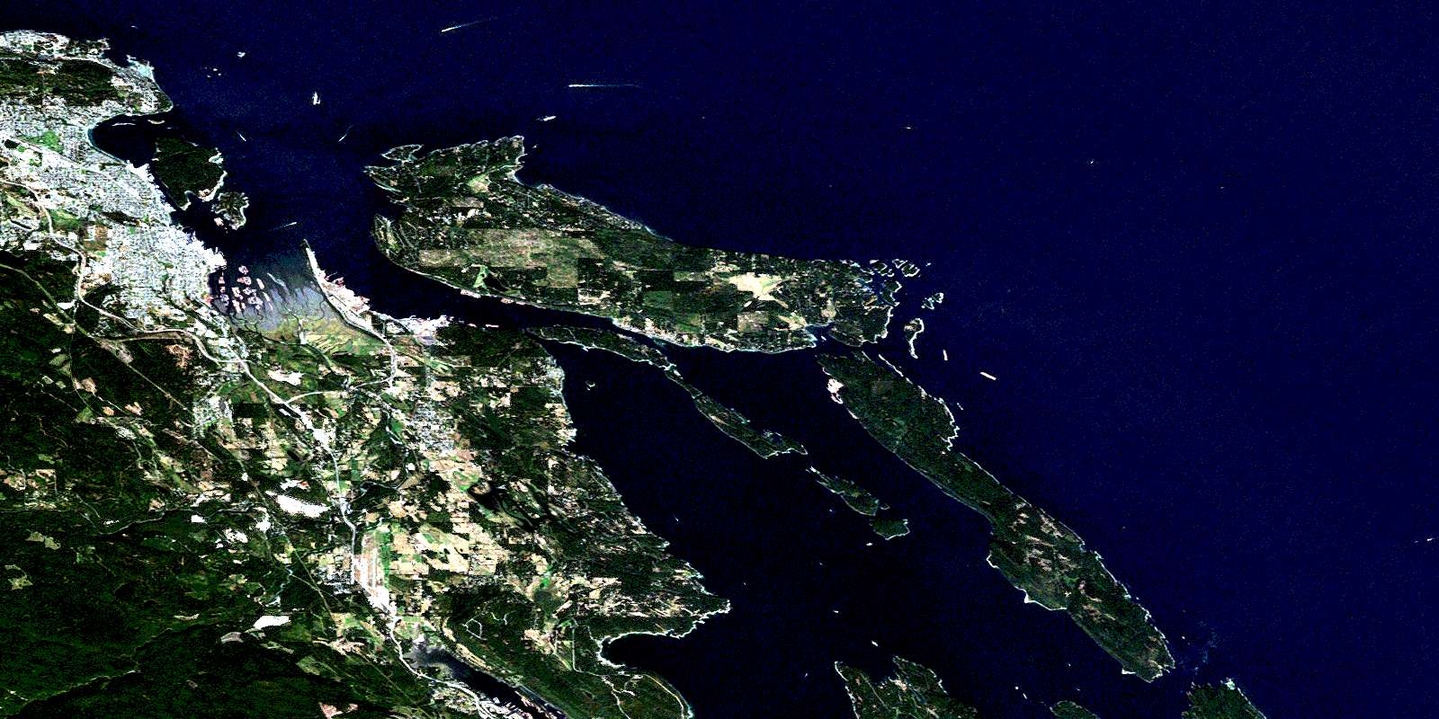
© Department of Natural Resources Canada. All rights reserved.
092G Related Maps:
092G Vancouver092G01 Mission
092G02 New Westminster
092G03 Lulu Island
092G04 Nanaimo
092G05 Sechelt
092G06 North Vancouver
092G07 Port Coquitlam
092G08 Stave Lake
092G09 Stave River
092G10 Pitt River
092G11 Squamish
092G12 Sechelt Inlet
092G13 Jervis Inlet
092G14 Cheakamus River
092G15 Mamquam Mountain
092G16 Glacier Lake
