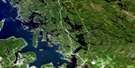
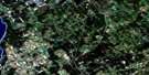
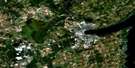
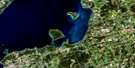
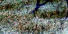
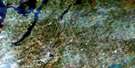
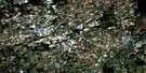
Burleigh Falls Satellite Image Map
Download Free Aerial Photo 031D09 at 1:50,000 scale
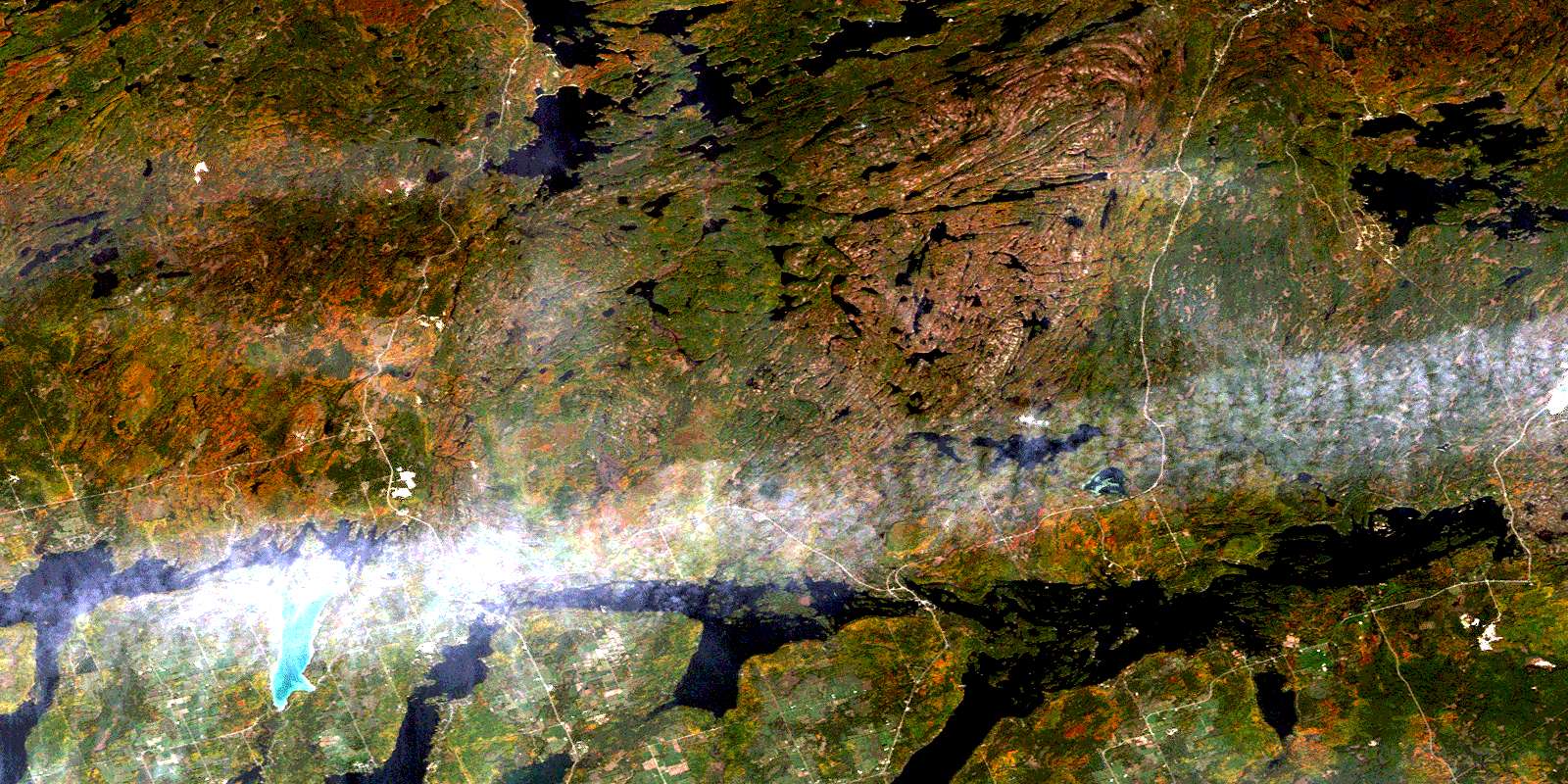
Burleigh Falls Satellite Imagery
To view this satellite map, mouse over the air photo on the right.
You can also download this satellite image map for free:
031D09 Burleigh Falls high-resolution satellite image map.
Maps for the Burleigh Falls aerial map sheet 031D09 at 1:50,000 scale are also available in these versions:
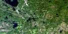
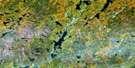
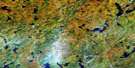
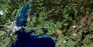
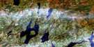
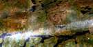
Burleigh Falls Surrounding Area Aerial Photo Maps
 |
 |
 |
 |
 |
 |
 |
 |
 |
 |
 |
 |
 |
 |
 |
 |
© Department of Natural Resources Canada. All rights reserved.
Burleigh Falls Gazetteer
The following places can be found on satellite image map 031D09 Burleigh Falls:
Burleigh Falls Satellite Image: Bays
Bicelow BayBlack Duck Bay
Brooks Bay
Brysons Bay
Burleigh Bay
Butchers Bay
Callahan Bay
Cassidy Bay
Deer Bay
Gilchrist Bay
Grundys Bay
Hamilton Bay
Hull Bay
Long Bay
Lower Black Bay
Mackenzie Bay
McCoy Bay
Nicholas Cove
Northey Bay
Puffer Bay
Quarry Bay
Rathbun Bay
Redmond Bay
Sandy Creek Bay
Sandy Point Bay
Sharpe Bay
South Bay
Spencleys Bay
Sunrise Bay
Tait Bay
Tate's Bay
Upper Black Bay
Whetung Bay
Young Bay
Burleigh Falls Satellite Image: Capes
Black PointBrown Point
Craft Point
Davis Point
Fair Oaks Point
Fish House Point
Freeborn Point
Hall Point
Head Lands
Hurricane Point
Hurricane Point
Johnsons Point
Lancasters Point
Long Pine Point
McIllmoy Point
Millage Point
Monroe Point
Nicholls Point
North Point
Pearson Point
Pearsons Head
Sandy Point
Sandy Point
Scotchman Point
Scotsman Point
Snooky Point
South Birch Point
Stricker Point
Tait Point
Tanner Point
Tate's Point
Traynor Point
Wood Wharf Point
Young Point
Burleigh Falls Satellite Image: Channels
Back ChannelBack Channel
Bald Lake Narrows
Big Bald Narrows
Boshing Narrows
Buckhorn Narrows
Catchacoma Narrows
Chemong Narrows
Chemung Narrows
Devils Elbow
Foul Narrows
Hells Gate
Hurricane Bend
Lost Lake Channel
Snaggy Channel
Burleigh Falls Satellite Image: Falls
Burleigh FallsHigh Falls
Burleigh Falls Satellite Image: Geographical areas
AnstrutherBurleigh
Cavendish
Chandos
Douro
Dummer
Galway
Harvey
Methuen
Peterborough
Smith
Burleigh Falls Satellite Image: Indian Reserves
Islands in the Trent Waters Indian Reserve 36ARéserve indienne Islands in the Trent Waters 36A
Burleigh Falls Satellite Image: Islands
Ackerman IslandActon Island
Al-Jo Island
Amy Island
Anchorage Island
Armstrong Island
Austin Island
Barries Island
Beaver Island
Berghaven Island
Big Island
Big Island
Big Otter Island
Blomfield Island
Bloomfield Island
Bohacker Island
Boyd Island
Bradburn Island
Bravenders Island
Breeze Island
Brock Island
Brown Island
Brownscombe Island
Bruces Islands
Brushy Island
Burnham Island
Butchers Island
Caldwell Island
Callender Island
Callinan Island
Canfields Island
Casement Island
Casement Island
Chicopee Island
Christian Island
Clark Island
Collins Island
Collins Island
Comstock Island
Cotton Island
Cox Island
Craig Island
Craigs Island
Cranberry Island
Cut Island
Davis Island
Dennes Island
Dinnertime Island
Dodsworth Island
Doe Island
Dr. Moirs Island
Duncombe Island
Dynamite Island
E.M.D. Halls Island
Eagle Mount Island
East Island
Eastland Island
Eddis Island
Elliot Island
Emerald Isle
Fairy Lake Island
Feathers Island
Fiji Island
Fish Island
Footes Island
Frasers Island
Gibson Island
Gladhalken Island
Gladman Island
Glassey Island
Goldsmith Island
Gould Island
Grassy Island
Grassy Island
Green Island
Greenwood Island
Grey Duck Island
Griffith Island
Griggs Island
Grubbe Island
Halls Island
Hardstone Island
Harston Island
Haywood Island
Hendrens Island
Heron Island
Higgins Island
Hilliard Island
Hitchins Island
Hopkins Island
Horseshoe Island
Howell Island
Hughes Island
Indian Island
Jacknife Island
Juniper Island
Kennedy Island
Kiluna Island
Knapmans Island
Lamoyne Island
Lech Island
Leming Island
Lindsays Island
Little Otter Island
Long Island
Long Pinepoint Island
Lundy Island
Majestic Island
Maniece Island
Marshall Island
McBains Island
McCallums Island
Meyers Island
Millage Island
Millers Island
Minnewawa Island
Mitchell Island
Moirs Island
Moore Island
Morrow Island
Morrows Island
Munroe Island
Neills Island
Nenabush Island
Oak Island
Peck Island
Pine Island
Pine Point Island
Piper Island
Pompadour Island
Porters Island
Porters Island
Quarry Island
R.R. Halls Island
Rackhams Island
Rebus Island
Red Rock Island
Richards Island
Robinsons Island
Rock Island
Roetzel Island
Rose Island
Roxborough Island
Ruba Island
Salmon Island
Sheehys Island
Sheriff Island
Sherin Island
Ship Island
Simpson Island
Sister Islands
Snake Island
South Robbins Island
Spook Island
Stock Island
Stubbs Island
Syndicate Island
Tanner Island
Tarbox Island
Taylor Island
Taylors Island
Three Islands
Three Sisters Islands
Tickmo Island
Toronto Island
Toronto Islets
W. G. Morrows Island
Watch Island
Webbs Island
Whale Island
Whistle Islands
Wilcox Island
Willoughby Island
Wolf Island
Woods Island
Worrell Island
Burleigh Falls Satellite Image: Lakes
Agate LakeAnstruther Lake
Beaver Lake
Big Bald Lake
Big Cedar Lake
Big Duck Pond
Bolger Lake
Buckhorn Lake
Buzzard Lake
Catchacoma Lake
Cavendish Lake
Chemong Lake
Chemung Lake
Cherry Lake
Church Lake
Clear Lake
Cloudy Lake
Cold Lake
Compass Lake
Concession Lake
Coon Lake
Cox Lake
Crab Lake
Crane Lake
Crystal Lake
De Gaulle Lake
Duck Pond
Dummer Lake
Egg Lake
Elm Lake
Fair Lake
Fairy Lake
Galharv Lake
Golborne Lakes
Gold Lake
Hansa Lake
Hemlock Lake
Horseshoe Lake
Jack Lake
Julian Lake
Kawartha Lakes
Lavery Lake
Little Bald Lake
Little Jack Lake
Little Long Lake
Little Mountain Lake
Little Mud Lake
Little Spinster Lake
Long Lake
Long Lake
Loom Lake
Loon Call Lake
Loucks Lake
Lovesick Lake
Lower Buckhorn Lake
McGee Lake
McGinnis Lake
Minnow Lake
Mississagua Lake
Mountain Lake
Nogen Pond
Pigeon Lake
Pilot Lake
Poplar Lake
Red Lake
Sandy Lake
Shark Lake
Sparkler Lake
Spinster Lake
Stony Lake
Stoplog Lake
Tamarack Lake
Ties Lake
Triangle Lake
Turtle Lake
Udra Lake
Upper Chemong Lake
Upper Chemung Lake
Vixen Lake
Volturno Lake
White Lake
Wolf Lake
Burleigh Falls Satellite Image: Major municipal/district area - major agglomerations
PeterboroughUnited Counties of Northumberland and Durham
Burleigh Falls Satellite Image: Other municipal/district area - miscellaneous
Belmont and MethuenBurleigh and Anstruther
Burleigh-Anstruther-Chandos
Chandos
Douro
Douro-Dummer
Douro-Dummer
Dummer
Ennismore
Galway and Cavendish
Galway-Cavendish and Harvey
Harvey
Havelock-Belmont-Methuen
North Kawartha
Smith
Smith-Ennismore
Smith-Ennismore-Lakefield
Burleigh Falls Satellite Image: Conservation areas
Kawartha Highlands Provincial ParkKawartha Highlands Signature Site Park
Lieu historique national du Canada de la Voie-Navigable-Trent--Severn
Petroglyphs Provincial Park
Quackenbush Provincial Park
Sharpe Bay Fen Conservation Reserve
Trent--Severn Waterway National Historic Site of Canada
Wolf Island Provincial Park
Burleigh Falls Satellite Image: Rivers
Anstruther CreekApsley Creek
Bear Creek
Bottle Creek
Buzzard Creek
Camp Creek
Cloudy Creek
Crane Creek
Deer Bay Creek
Eels Creek
Eels Creek
Grassy Creek
Indian River
Jack Creek
Julia Creek
Lavery Creek
Loom Creek
Loon Call Creek
Miskwaa Ziibi
Mississagua Brook
Mississagua River
Nogies Creek
Perrys Creek
Redmond Creek
Sandy Creek
Squaw River
St. Croix Creek
Volturno Creek
Burleigh Falls Satellite Image: River features
Deer Bay ReachBurleigh Falls Satellite Image: Shoals
Amburgs ReefBoarding House Reef
Church Steeple Rock
Confusion Shoal
Cruiser Shoal
Dead Horse Shoal
Dropping Reef
Dry Rock
Elephant Rock
Falaasa Rock
Five Foot Shoal
Gordon Rock
Gordon Rocks
Grandfathers Rock
Gull Rock
Hannahs Rock
Hurricane Reef
July Reefs
Mouse Rock
Neills Shoal
North Goose Rock
Old Tar
Plum Pudding Rock
Plum Stone
Polly Cow Rock
Red Rock
Scow Rock
Sherin Shoal
Sockeye Rock
Sunken Rock
The Black Rock
The Spoiler
Tobico Rock
Vivians Shoal
Wash Rock
Burleigh Falls Satellite Image: Springs
Dropping SpringsBurleigh Falls Satellite Image: Unincorporated areas
Alpine VillageAnstruther Lake
Big Cedar
Buckhorn
Burleigh Falls
Catchacoma
Clarina
Crowes Landing
Deer Bay
Flynns Turn
Gilchrist Bay
Hall Glen
Hall's Bridge
Haultain
Jack Lake
Juniper Island
Kawartha Park
Lakehurst
McCrackens Landing
McCracken's Landing
Mississagua Landing
Mount Julian
Nephton
Nogies Creek
Point Pleasant
Rockcroft
Stonyridge
Victoria Springs
Woodview
© Department of Natural Resources Canada. All rights reserved.
