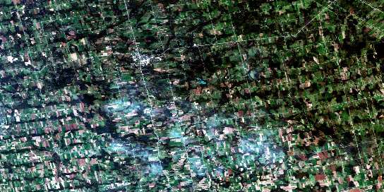
Durham Satellite Imagery
To view this satellite map, mouse over the air photo on the right.
You can also download this satellite image map for free:
041A02 Durham high-resolution satellite image map.
Maps for the Durham aerial map sheet 041A02 at 1:50,000 scale are also available in these versions:
Durham Surrounding Area Aerial Photo Maps
© Department of Natural Resources Canada. All rights reserved.
Durham Gazetteer
The following places can be found on satellite image map 041A02 Durham:
Durham Satellite Image: Falls
Hayward FallsDurham Satellite Image: Geographical areas
ArtemesiaBentinck
Bruce
Carrick
East Luther
Egremont
Glenelg
Grey
Luther
Minto
Normanby
Proton
Wellington
West Luther
Durham Satellite Image: Lakes
Allan Park Trout PondBlack Lake
Gillies Lake
Holstein Dam
MacCuaig Lake
Matthews Lake
McCormick Lake
McDonald Lake
McLean Lake
Moss Lake
Turner Lake
Westfall's Lake
Wilcox Lake
Wilder Lake
Durham Satellite Image: Major municipal/district area - major agglomerations
BruceGrey
Wellington
Durham Satellite Image: Other municipal/district area - miscellaneous
ArtemesiaArthur
Bentinck
Bentinck
Carrick
Culross
Egremont
Euphrasia
Glenelg
Grey Highlands
Luther
Mapleton
Mildmay-Carrick
Mount Forest/Arthur/West Luther/Arthur
Normanby
Osprey
Proton
South Bruce
Southgate
Teeswater-Culross
Wellington North
West Garafraxa
West Grey
West Luther
Durham Satellite Image: Conservation areas
Allan Park Conservation AreaDurham Conservation Area
Durham Satellite Image: Rivers
Aljoe CreekBeatty Saugeen River
Boyne River
Camp Creek
Fairbanks Creek
Meux Creek
Norman Reeves Creek
Rocky Saugeen River
Saugeen River
South Saugeen River
Styx River
Traverston Creek
Durham Satellite Image: Towns
HanoverMinto
Durham Satellite Image: Unincorporated areas
AberdeenAllan Park
Allan Park Station
Alsfeldt
Alsfeldt Station
Ayton
Ayton Siding
Ayton Station
Bieman's Corners
Biemansville
Birdell
Boothville
Bunessan
Calderwood
Cedarville
Ceylon
Dromore
Durham
Ebordale
Edge Hill
Egerton
Flesherton Station
Gildale
Glen
Glenelg Centre
Hampden
Holstein
Hopeville
Lamlash
Landerkin
Lauderbach
Letterbreen
Maple Lane
McWilliams
Mulock
Nenagh
Neustadt
Orchard
Orchardville
Pomona
Priceville
Robb
Robbtown
Rocky Saugeen
Saugeen
Swinton Park
Tartan
Thistle
Topcliff
Varney
Vickers
Wilcox Lake
Yeovil
Zion
© Department of Natural Resources Canada. All rights reserved.


