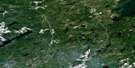
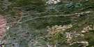
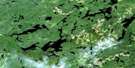
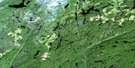
Pagwachuan Lake Satellite Image Map
Download Free Aerial Photo 042E09 at 1:50,000 scale
Pagwachuan Lake Satellite Imagery
To view this satellite map, mouse over the air photo on the right.
You can also download this satellite image map for free:
042E09 Pagwachuan Lake high-resolution satellite image map.
Maps for the Pagwachuan Lake aerial map sheet 042E09 at 1:50,000 scale are also available in these versions:
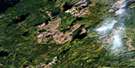
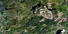
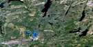
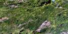
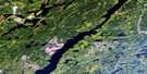
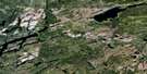
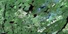
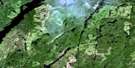
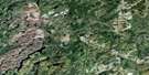
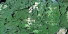
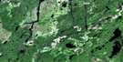
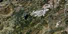
Pagwachuan Lake Surrounding Area Aerial Photo Maps
 |
 |
 |
 |
 |
 |
 |
 |
 |
 |
 |
 |
 |
 |
 |
 |
© Department of Natural Resources Canada. All rights reserved.
Pagwachuan Lake Gazetteer
The following places can be found on satellite image map 042E09 Pagwachuan Lake:
Pagwachuan Lake Satellite Image: Bays
Boot BayNortheast Bay
Outlet Bay
Rankin Bay
Reedy Bay
Yankee Bay
Pagwachuan Lake Satellite Image: Capes
Burnt Hill PointCamping Point
Long Point
Poplar Point
Shanty Point
Pagwachuan Lake Satellite Image: Channels
Morrin ChannelNorth Channel
South Channel
West Channel
Pagwachuan Lake Satellite Image: Falls
Purgatory ChutePagwachuan Lake Satellite Image: Indian Reserves
Ginoogaming First Nation Indian Reserve 77Long Lake Indian Reserve 77
Réserve indienne Ginoogaming First Nation 77
Réserve indienne Long Lake 77
Pagwachuan Lake Satellite Image: Islands
Big IslandPagwachuan Lake Satellite Image: Lakes
Arms LakeBambino Lake
Bluejay Lake
Broadsword Lake
Caramat Lake
Cass Lake
Charon Lake
Decision Lake
Durn Lake
Eino Lake
Fairbairn Lake
Fairbairn Lake
Gabbro Lake
Gap Lake
Griffen Lake
Hagarty Lake
Heinrich Lake
Hoiles Lake
Hollowrock Lake
Kaboosa Lake
Koandowango Lake
Laponen Lake
Little Charon Lake
Little Hagarty Lake
Little McKay Lake
Loponen Lake
Lunam Lake
Lunom Lake
MacPherson Lake
Mamamia Lake
McKay Lake
Meg Lake
Moran Lake
Mustela Lake
Pagwachuan Lake
Pendant Lake
Picarson Lake
Pout Lake
Robb Lake
Rockyshore Lake
Sadie Lake
Sandlink Lakes
Seagram Lake
Snoopy Lake
Squash Lake
Star Lake
Upper Laponen Lake
Upper Loponen Lake
Willie Lake
Pagwachuan Lake Satellite Image: Other municipal/district area - miscellaneous
BeardmoreNakina
Pagwachuan Lake Satellite Image: Rapids
Bigrock RapidsPagwachuan Lake Satellite Image: Rivers
Arms CreekBambino Creek
Bluejay Creek
Caramat Creek
Charon Creek
Dianthus Creek
Divide Creek
Gabbro Creek
Griffen Creek
Hagarty Creek
Hagarty River
Hoiles Creek
Kaboosa Creek
Mustela Creek
Norse Creek
Pagwachuan River
Pendant Creek
Phipps Creek
Pic River
Picarson Creek
Pout River
Rockyshore Creek
Sandlink Creek
Pagwachuan Lake Satellite Image: Road features
Charon PassSummit Portage
Pagwachuan Lake Satellite Image: Towns
GreenstonePagwachuan Lake Satellite Image: Unincorporated areas
ArmsCaramat
Pagwachuan
Seagram
© Department of Natural Resources Canada. All rights reserved.
042E Related Maps:
042E Longlac042E01 Vein Lake
042E02 Killala Lake
042E03 Dickison Lake
042E04 Gurney Lake
042E05 Barbara Lake
042E06 Wintering Lake
042E07 Spider Lake
042E08 Kagiano Lake
042E09 Pagwachuan Lake
042E10 Geraldton
042E11 Wildgoose Lake
042E12 Beardmore
042E13 North Wind Lake
042E14 Treptow Lake
042E15 Longlac
042E16 Castlebar Lake
