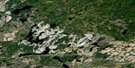
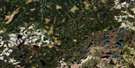
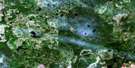
Osawin River Satellite Image Map
Download Free Aerial Photo 042F11 at 1:50,000 scale
Osawin River Satellite Imagery
To view this satellite map, mouse over the air photo on the right.
You can also download this satellite image map for free:
042F11 Osawin River high-resolution satellite image map.
Maps for the Osawin River aerial map sheet 042F11 at 1:50,000 scale are also available in these versions:
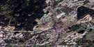
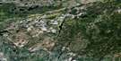
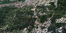
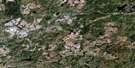
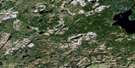
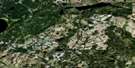
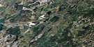
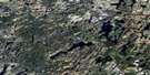
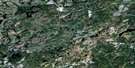
Osawin River Surrounding Area Aerial Photo Maps
 |
 |
 |
 |
 |
 |
 |
 |
 |
 |
 |
 |
 |
 |
 |
 |
© Department of Natural Resources Canada. All rights reserved.
Osawin River Gazetteer
The following places can be found on satellite image map 042F11 Osawin River:
Osawin River Satellite Image: Geographical areas
ClavetCochrane
Downer
Frances
Hiawatha
Kohler
Mercer
Osawin River Satellite Image: Lakes
Dead Shot LakeDecoy Lake
Downer Lake
East West Lake
Ebba Lake
Half Shot Lake
Hiawatha Lake
Kalz Lake
Loughlan Lake
McMahon Lake
Mistake Lake
One Shot Lake
Otasawian Lake
Phillip Lake
Pincers Lake
Pody Lake
Sky Lake
Snowflake Lake
Tauno Lake
Thornben Lake
Toch Lake
Turtle Lake
Osawin River Satellite Image: Conservation areas
North Thornben Lake Moraine Conservation ReserveOsawin River Satellite Image: Rivers
Bad RiverDowner Creek
Ebba Creek
Four Mile Creek
Hiawatha Creek
Kalz Creek
Little Fraser River
Loughlan Creek
Mistake River
North Pagwachuan River
Osawin River
Otasawian River
Pagwachuan River
Pincers Creek
Pody Creek
White Otter River

© Department of Natural Resources Canada. All rights reserved.
042F Related Maps:
042F Hornepayne042F01 Oba
042F02 Hornepayne
042F03 Obakamiga Lake
042F04 Manitouwadge
042F05 White Otter River
042F06 Nagagami Lake
042F07 Nagagamisis Lake
042F08 Pope Creek
042F09 Nassau Lake
042F10 Ahmabel Lake
042F11 Osawin River
042F12 Kassagimini Lake
042F13 Flint Lake
042F14 Eureka Lake
042F15 Pitopiko River
042F16 Constance Lake
