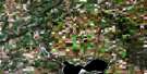
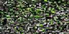
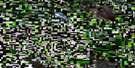
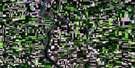
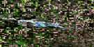
Delmas Satellite Image Map
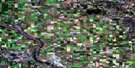
Download Free Aerial Photo 073C15 at 1:50,000 scale
Delmas Satellite Imagery
To view this satellite map, mouse over the air photo on the right.
You can also download this satellite image map for free:
073C15 Delmas high-resolution satellite image map.
Maps for the Delmas aerial map sheet 073C15 at 1:50,000 scale are also available in these versions:
Delmas Surrounding Area Aerial Photo Maps
 |
 |
 |
 |
 |
 |
 |
 |
 |
 |
 |
 |
 |
 |
 |
 |
© Department of Natural Resources Canada. All rights reserved.
Delmas Gazetteer
The following places can be found on satellite image map 073C15 Delmas:
Delmas Satellite Image: Cliffs
Eagle Hills EscarpmentThe Coteau
Delmas Satellite Image: Hamlets
DelmasDelmas Satellite Image: Indian Reserves
Min-a-he-quo-sis 116CMoosomin 112
Poundmaker 114
Poundmaker 114-15
Poundmaker 114-15C
Poundmaker 114-8A
Réserve indienne Sweet Grass 113
Réserve indienne Sweet Grass 113A
Réserveindienne Sweet Grass 113B
Sweet Grass 113-028
Sweet Grass 113-C19
Sweet Grass 113-C7
Sweet Grass 113-F16
Sweet Grass 113-G7
Sweet Grass 113-M16
Sweet Grass 113-N27
Sweet Grass Indian Reserve 113
Sweet Grass Indian Reserve 113A
Sweet Grass Indian Reserve 113B
Sweetgrass 113
Sweetgrass 113A
Sweetgrass 113B
Sweetgrass 113-E22
Sweetgrass 113-P2
Delmas Satellite Image: Islands
Bernier IslandBlais Island
Caplette Islands
Michaud Islands
Delmas Satellite Image: Lakes
Atton LakeBuggs Lakes
Bushy Lake
Kinoosasis Lake
Lambert Lake
Oliver Lake
Parker Lake
Twin Lakes
Wishtikan Lake
Delmas Satellite Image: Mountains
Chief Poundmaker HillCut Knife Hill
Cutknife Hill
Drumming Hill
Delmas Satellite Image: Other municipal/district area - miscellaneous
Battle River No. 438Cut Knife No. 439
Meota No. 468
Paynton No. 470
Prairie No. 408
Turtle River No. 469
Delmas Satellite Image: Conservation areas
Atton's Lake Regional ParkTable Mountain Regional Park
Delmas Satellite Image: Rivers
Battle RiverCut Knife Creek
Cutknife Creek
Drumming Creek
North Saskatchewan River
Poundmaker Creek
Rivière Saskatchewan Nord
Saline Creek
Turtlelake River
Delmas Satellite Image: Unincorporated areas
BresaylorGallivan
Rosemound
Sweet Grass
Sweetgrass

© Department of Natural Resources Canada. All rights reserved.
