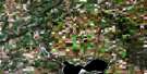
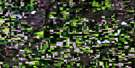
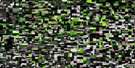
North Battleford Satellite Image Map
Download Free Aerial Photo 073C16 at 1:50,000 scale
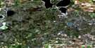
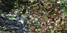
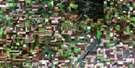
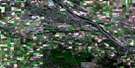
North Battleford Satellite Imagery
To view this satellite map, mouse over the air photo on the right.
You can also download this satellite image map for free:
073C16 North Battleford high-resolution satellite image map.
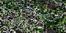
Maps for the North Battleford aerial map sheet 073C16 at 1:50,000 scale are also available in these versions:
North Battleford Surrounding Area Aerial Photo Maps
 |
 |
 |
 |
 |
 |
 |
 |
 |
 |
 |
 |
 |
 |
 |
 |
© Department of Natural Resources Canada. All rights reserved.
North Battleford Gazetteer
The following places can be found on satellite image map 073C16 North Battleford:
North Battleford Satellite Image: City
North BattlefordNorth Battleford Satellite Image: Cliffs
The CoteauNorth Battleford Satellite Image: Hamlets
PrinceNorth Battleford Satellite Image: Indian Reserves
Gold EagleLittlePine 116
Moosomin 112A
Saulteaux 159B
Saulteaux First Nation 159GG
North Battleford Satellite Image: Islands
Davidson IslandFinlayson Island
Woodward Island
North Battleford Satellite Image: Lakes
Eightmile LakeMoore Lake
Scentgrass Lake
Wing Lake
Woodland Lake
North Battleford Satellite Image: Mountains
Rosalie HillNorth Battleford Satellite Image: Other municipal/district area - miscellaneous
Battle River No. 438Meota No. 468
North Battleford No. 437
Prairie No. 408
Round Hill No. 467
North Battleford Satellite Image: Conservation areas
Refuge d'oiseaux du lac Scent GrassScent Grass Lake Bird Sanctuary
Scent Grass Lake Game Preserve
North Battleford Satellite Image: Rivers
Battle RiverCrystal Creek
Jackfish River
North Saskatchewan River
Page Creek
Rivière Saskatchewan Nord
North Battleford Satellite Image: Towns
BattlefordNorth Battleford Satellite Image: Unincorporated areas
Battleford JunctionCraigavon
Hamlin
Highgate
Highgate Siding
Iffley
Lindequist
Pierard
Prinham
Scentgrass
North Battleford Satellite Image: Low vegetation
Kittle Slough
© Department of Natural Resources Canada. All rights reserved.
