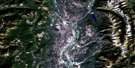
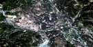
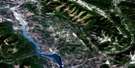
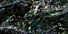
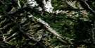
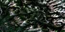
Skookumchuck Satellite Image Map
Download Free Aerial Photo 082G13 at 1:50,000 scale
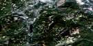
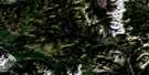
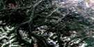
Skookumchuck Satellite Imagery
To view this satellite map, mouse over the air photo on the right.
You can also download this satellite image map for free:
082G13 Skookumchuck high-resolution satellite image map.
Maps for the Skookumchuck aerial map sheet 082G13 at 1:50,000 scale are also available in these versions:
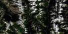
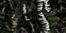
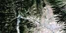
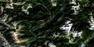
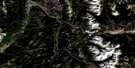
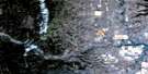
Skookumchuck Surrounding Area Aerial Photo Maps
 |
 |
 |
 |
 |
 |
 |
 |
 |
 |
 |
 |
 |
 |
 |
 |
© Department of Natural Resources Canada. All rights reserved.
Skookumchuck Gazetteer
The following places can be found on satellite image map 082G13 Skookumchuck:
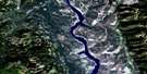
Skookumchuck Satellite Image: Lakes
Canuck LakeEchoes Lake
Echoes Lakes
Hahas Lake
Hanson Lake
Johnson Lake
Larchwood Lake
Lazy Lake
Lewis Slough
Lost Dog Lake
McNair Lakes
Premier Lake
Reed Lakes
Rockbluff Lake
Sowerby Lake
Ta Ta Lake
Tamarack Lake
Twin Lakes
Wasa Lake
Yankee Lake
Skookumchuck Satellite Image: Mountains
Columbia MountainsHughes Range
Kootenay Ranges
Montagnes Rocheuses
Mount Bill Nye
Mount McMillan
Mount Stevens
Mount Wirth
Purcell Mountains
Rocky Mountains
Teepee Mountain
Skookumchuck Satellite Image: Major municipal/district area - major agglomerations
Regional District of East KootenaySkookumchuck Satellite Image: Conservation areas
Premier Lake ParkWasa Lake Park
Wasa Park
Skookumchuck Satellite Image: Rivers
Allen CreekBradford Creek
Brussilof Creek
Cherry Creek
Diorite Creek
Grundy Creek
Hann Creek
Hanson Creek
Houle Creek
Kootenay River
Lewis Creek
Lost Dog Creek
Lussier River
Mather Creek
Nicol Creek
Pommier Creek
Ram Creek
Sandown Creek
Skookumchuck Creek
Staples Creek
Ta Ta Creek
Tackle Creek
Tamarac Creek
Tamarack Creek
Tracy Creek
Trail Creek
Wasa Creek
Wild Horse River
Wolf Creek
Skookumchuck Satellite Image: Unincorporated areas
Premier LakeSkookumchuck
Ta Ta Creek
Torrent
Wasa
Skookumchuck Satellite Image: Valleys
Rocky Mountain Trench
© Department of Natural Resources Canada. All rights reserved.
082G Related Maps:
082G Fernie082G01 Sage Creek
082G02 Inverted Ridge
082G03 Lake Koocanusa
082G04 Yahk River
082G05 Moyie Lake
082G06 Elko
082G07 Flathead Ridge
082G08 Beaver Mines
082G09 Blairmore
082G10 Crowsnest
082G11 Fernie
082G12 Cranbrook
082G13 Skookumchuck
082G14 Queen Creek
082G15 Tornado Mountain
082G16 Maycroft
