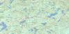
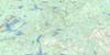
Westport Topo Map Online
Download Free Topo Map Sheet 031C09 at 1:50,000 scale
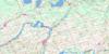
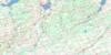
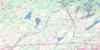
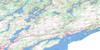
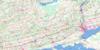
031C09 Westport Topo Map
To view this map, mouse over the map preview on the right.
You can also download this topo map for free:
031C09 Westport high-resolution topo map image.
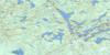
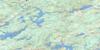
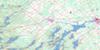
Maps for the Westport topo map sheet 031C09 at 1:50,000 scale are also available in these versions:
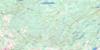
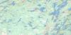
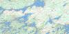
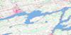
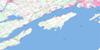
Westport Surrounding Area Topo Maps
 |
 |
 |
 |
 |
 |
 |
 |
 |
 |
 |
 |
 |
 |
 |
 |
© Department of Natural Resources Canada. All rights reserved.
Westport Gazetteer
The following places can be found on topographic map sheet 031C09 Westport:
Westport Topo Map: Bays
Austen BayBass Bay
Bass Bay
Beaver Bay
Beaver Cove
Bellows Bay
Big Bay
Big Water
Black Hole Bay
Boathouse Cove
Briton Bay
Brooks Bay
Buce Bay
Buttermilk Cove
Campbell Bay
Cedar Cove
Cold Spring Bay
Cronin Bay
Cunningham Bay
Darlings Bay
Deadlock Bay
Deep Water
Donaldson Bay
Duck Bay
Eastern Water
Eel Bay
Elliott Bay
Fishcamp Bay
Fosters Bay
Four Corners Water
Freeman Bay
Freemans Bay
Gambles Bay
Glover Bay
Glovers Bay
Gold Cove
Green Bay
Greens Bay
Halladay Bay
Hanlon Bay
Hardwood Bay
Head of Lake
Henrys Cove
Horseshoe Bay
Hudson Bay
Hungry Bay
Hunter Bay
Iron Mine Bay
Jones Falls Bay
Kanes Bay
Kendricks Bay
La Rose Bay
Larkin Bay
Lee Bay
Levs Cove
Lewis Bay
Little Bay
Little Boys Camp Cove
Loon Bay
Lost Bay
Lost Bay
Lucky Bay
MacDonalds Bay
Mahoney Bay
McNallys Bay
Mill Bay
Millers Bay
Minnow Bay
Mire Bay
Mooneys Bay
Moores Bay
Morton Bay
Mud Bay
Mulvilles Bay
Murphy Bay
Murphy Bay
Murphys Bay
Murphys Bay
Muskrat Hole
Myers Bay
Narrows Bay
Nest Bay
North Bay
Oak Bay
Ormonds Bay
Oswego Bay
Parkers Bay
Pierces Flow
Pipers Bay
Posters Bay
Powell Bay
Powells Bay
Purgatory Cove
Ransier Bay
Roes Bay
Rosal Bay
Running Bay
Runnings Bay
Sapbush Bay
Shad Bay
Sheldon Bay
Sheldons Bay
Shelter Cove
Sherwoods Bay
Slacks Bay
Slim Bay
Smith Bay
Smiths Bay
Somerville Cove
South Bay
Stedmans Bay
Stouts Lower Bay
Stouts Upper Bay
Sunfish Cove
Tallow Rock Bay
Telephone Bay
Warren Bay
Washburn Bay
Webster Bay
Wellys Bay
West Bay
West Bay
Western Water
Whites Bay
York Bay
Westport Topo Map: Beaches
Mattices ShoreSherwoods Shore
Westport Topo Map: Capes
Amis PointAngel Point
Austen Point
Balsam Point
Barkers Point
Barrel Point
Bass Point
Beech Point
Benson Point
Blairs Point
Blogget Point
Bluff Point
Bowsprit Point
Brady Point
Brooks Point
Buckhorn Point
Bullhead Point
Burnt Point
Carey Point
Carty Point
Cedars Point
Chipmans Point
Church Point
Croziers Point
Dead Horse Point
Derbyshire Point
Diamond Point
Dier Point
Donaldson Point
Donovans Point
Dunn Point
Eagle Point
Edwards Point
Election Point
Ferguson Point
Flatiron Point
Fox Point
Gibson Point
Gibsons Point
Giffords Point
Grape Point
Grass Point
Hartwell Point
Herman Point
Hungry Bay Point
Jacksons Point
Jenny Point
Joes Point
Justus Point
Kanes Point
Kellys Point
Kelseys Point
Kish Point
Klautz Point
Leisures Point
Little Squaw Point
Long Point
MacDonalds Point
McBrides Point
McNallys Point
McNamees Point
Medoles Point
Middle Point
Mosquito Point
Mustard Point
Oliver Point
Paradise Point
Parkers Point
Peggys Point
Peters Point
Pipers Point
Poplar Point
Prospect Point
Rams Point
Reid Point
Reids Point
Robinson Point
Rocky Point
Roes Point
Rosens Point
Sea Point
Second Island
Sheldons Point
Sherwoods Point
Shiner Point
Short Point
Slacks Point
Southams Point
Stedmans Point
Tetts Point
The Isthmus
Tracys Point
Walnut Point
White Sheep Point
Whites Point
Westport Topo Map: Channels
Bobs GapCaptains Gap
Coreys Gap
Crow Lake Narrows
Duck Creek
Elbow Channel
Foley Island Channel
Rocky Channel
Stevens Creek
Stone Fence Gap
The Narrows
The Quarters
Westport Topo Map: Cliffs
Red Horse CliffRubes Rocks
Westport Topo Map: Geographical areas
BastardBedford
Burgess
Escott
Front of Escott
Front of Leeds and Lansdowne
Front of Leeds and Lansdowne
Front of Yonge
Frontenac
Kitley
Lanark
Lansdowne
Leeds
Leeds
Loughborough
North Burgess
North Crosby
Pittsburgh
Rear of Leeds and Lansdowne
Rear of Leeds and Lansdowne
Rear of Yonge and Escott
Rear of Yonge and Escott
South Burgess
South Crosby
South Sherbrooke
Storrington
Storrington
Yonge
Westport Topo Map: Islands
Aird IslandAllan Island
American Island
Atkinson Island
Austen Island
Baby Island
Baby Trout Island
Baldys Island
Barr Island
Bass Island
Bateman Island
Bear Island
Because Island
Beechers Island
Berlin Islands
Bertha Island
Big Island
Big Island
Bill Island
Birch Island
Birch Island
Birch Island
Birch Island
Birmingham Island
Bishop Islands
Black Jack Island
Bobbs Island
Bobs Island
Brothers Island
Browns Island
Brunswick Island
Buck Island
Buck Island
Buckley Island
Bulford Island
Bull Island
Bungalow Island
Burnt Island
Camp Vega Island
Canoe Island
Cary Island
Channel Islands
Cherry Island
Chicadee Island
Chicken Island
Clarke Island
Clarke Island
Coburn Island
Colonel By Island
Connemara Island
Cordwood Island
Cow Island
Cow Island
Crane Island
Crawleys Island
Crow Island
Crow Island
Crozier Island
Croziers Island
Daly Island
Dan Island
Dargavel Island
Dean Island
Deans Island
Deer Island
Democrat Island
Dennison Island
Dewar's Island
Doctor Island
Dot Island
Dowsett Island
Duck Island
Duck Island
Dufferin Island
Eagle Island
Ebb Island
Eclestone Island
Eightacre Island
Emerald Island
English Island
Exe Island
Fahey Island
Fancy Free Island
Fingerboard Island
First Island
Fisher Island
Fleming Islands
Floods Island
Foley Island
Freds Island
Freed Island
Frizzle Island
Gibson Island
Goat Island
Goose Island
Goose Island
Goose Island
Gosling Islet
Grahams Island
Grape Island
Grape Island
Gravel Island
Green Island
Green Islands
Grindstone Island
Grindstone Island
Grouse Island
Guard Island
Halfway Island
Halfway Island
Happy Thought Island
Hawk Island
Hearts Delight Island
Hedge Hog Island
Hedgehog Island
Hemlock Island
Hen Island
Hen Island
Heron Island
Hitchcock Island
Hoffman Island
Hog Island
Hogback Island
Hogsback Island
Holder Island
Hopkins Island
Horse Island
Horseshoe Island
Howell Island
Huckleberry Island
Huckleberry Island
Hughsons Island
Indian Island
Indian Island
Indian Island
Iron Island
Jack Island
James Island
James Island
Jerry Island
Joe Island
Judas Island
Ken Yen Island
Kilburn Island
Killarney Island
Knowlton Island
Lake Island
Larkin Island
Lehmans Island
Lemon Island
Lena Island
Lewis Island
Limestone Island
Lion Island
Little Bluff Island
Little Island
Long Island
Long Island
Long Island
Loon Island
Loon Island
Lyons Island
MacDonalds Island
Mackay Island
Marble Island
Mary Island
McCaskill Island
Merriman Island
Miller Island
Mink Island
Morris Island
Murray Island
Muskrat Island
Narrows Island
Nest Island
Net Island
Nolan Island
Nutmeg Island
Oak Island
Olmstead Island
Orange Island
Papoose Island
Papoose Island
Parish Island
Partridge Island
Partridge Island
Partridge Island
Pates Island
Paymans Island
Pendletons Island
Petries Island
Pickerel Island
Picnic Island
Pig Island
Pike Island
Pine Island
Pine Island
Plum Island
Porcupine Island
Porcupine Island
Pork Islet
Potato Island
Powells Island
Preston Island
Price Green Island
Pritchards Island
Pulpit Island
Rabbit Island
Ralphs Island
Ramsay Islands
Ransier Island
Republican Island
Richardson Island
Richardson Islands
Ricks Island
Roblins Rock
Rock Island
Rockhouse Island
Rocky Island
Rodgers Island
Rosal Island
Rosie Island
Round Island
Round Island
Round Island
Salines Island
Salmon Island
Sand Island
Scott Island
Second Island
Seven Deer Island
Shadow Island
Sheep Island
Sheep Island
Sheep Island
Ship Island
Signboard Island
Sister Islands
Sisters Islands
Skulls Island
Slaughter Island
Snake Island
Snake Island
Snake Island
Soaf Island
Spice Island
Spruce Island
Squaw Island
Steadman Island
Steamboat Island
Stedmans Island
Steele Briggs Island
Stewart Island
Sturgeon Island
Sugarbush Island
Sumach Island
Tar Island
The Sisters Islands
Third Island
Three Sisters Islands
Tipperary Island
Topler Island
Tower Island
Trial Island
Trillium Island
Trout Island
Turnip Island
Turnip Island
Turnip Island
Turtle Island
Twin Islands
Twin Islands
Twin Islands
Vanderbilts Island
Victoria Island
Walnut Island
Whalen Island
Whetstone Island
Whippoorwill Island
Whiskey Island
Whiskey Island
Whitefish Island
Whitefish Island
Whitehall Island
Why Island
Wright Island
Yager Island
Westport Topo Map: Lakes
Bass LakeBear Lake
Bellamy Pond
Bellamys Lake
Benson Lake
Big Clear Lake
Big Rideau Lake
Big Salmon Lake
Black Lake
Brady Lake
Buck Lake
Camel Lake
Camerons Lake
Charleston Lake
Christie Lake
Clear Lake
Clear Lake
Coin Lake
Connells Lake
Crosby Lake
Crow Lake
Crow Lake
Davis Lake
Deans Pond
Devil Lake
Drysdales Pond
Dunbar Lake
Farren Lake
Gailhowie Pond
Garter Lake
Gibson Lake
Goldfish Lake
Grady Lake
Green Lake
Grippen Lake
Hamilton Lake
Hart Lake
Hemlock Lake
Higley Lake
Hinge Lake
Indian Lake
Judy Pond
Killenbeck Lake
Killingbeck Lake
Labelle Lake
Lindsay Lake
Little Bear Lake
Little Clear Lake
Little Lake
Little Lake
Little Long Lake
Little Wolfe Lake
Long Island Lake
Long Lake
Loon Lake
Lost Lake
Loughborough Lake
Lower Beverley Lake
Lower Peterson Lake
Lower Rock Lake
Lyndhurst Lake
Milk Lake
Mink Lake
Mosquito Lake
Mountain Lake
Mud Lake
Mud Lake
Mud Lake
Newboro Lake
Opinicon Lake
Pollywog Lake
Poole Lake
Pothole Lake
Red Horse Lake
Rideau Lake
Rock Lake
Round Lake
Russel Lake
Russell Lake
Salmon Lake
Sand Lake
Singleton Lake
Slide Lake
Spectacle Lake
Stonehouse Lake
Tommy Lake
Traverse Lake
Troy Lake
Upper Beverley Lake
Upper Peterson Lake
Upper Rideau Lake
Upper Rock Lake
Warner Lake
Westport (Sand) Lake
Westport Pond
Westport Sand Lake
Whitefish Lake
Wolfe Lake
Westport Topo Map: Mountains
Bellamys Mill HillConnaught Hill
Dunders Mate
Morton Park Hill
Rock Dunder
Straw Hill
The Mountain
Westport Mountain
White Hills
Willows Mountain
Youngs Hill
Westport Topo Map: Major municipal/district area - major agglomerations
FrontenacLanark
United Counties of Leeds and Grenville
Westport Topo Map: Other municipal/district area - miscellaneous
AthensBastard and South Burgess
Bathurst
Bathurst Burgess Sherbrooke
Bedford
Elizabethtown
Elizabethtown-Kitley
Front of Escott
Front of Leeds and Lansdowne
Kitley
Leeds and the Thousand Islands
Loughborough
North Burgess
North Crosby
Portland
Rear of Leeds and Lansdowne
Rear of Yonge and Escott
Rideau Lakes
South Crosby
South Elmsley
South Frontenac
South Sherbrooke
Storrington
Tay Valley
Westport Topo Map: Conservation areas
Canal RideauCharleston Lake Provincial Park
Frontenac Provincial Park
Lieu historique national du Canada du Canal-Rideau
Murphys Point Provincial Park
Rideau Canal National Historic Site of Canada
Rideau Canal World Heritage Site
Westport Topo Map: Rivers
Adrains CreekBadour Creek
Bedores Creek
Benson Creek
Black Creek
Cockrill Creek
Cooligan Creek
Corbett Creek
Cowans Creek
Dead Creek
Delta Creek
Farnham Creek
Fosters Creek
Grippen Creek
Hart Creek
Loughborough Lake Creek
Lyndhurst Creek
Marshalls Creek
Mississagua Creek
Morton Creek
North Branch Plum Hollow Creek
Peterson Creek
Plum Hollow Creek
Rock Lake Creek
Sicklers Creek
South Branch Plum Hollow Creek
Southwest Branch Plum Hollow Creek
Sucker Creek
Sucker Creek
The Stream
Westport Topo Map: River features
Long ReachThe Elbow
Westport Topo Map: Shoals
Big Island ShoalBig Shoal
Birch Rock
Caviar Rock
Chop Rock
Cow Island Shoal
Cruiser Cracker
Drummers Shoal
Gull Shoal
Hooked Shoals
Howell Rock
Little Brothers
Lost Chicks
March Rock
Nippers Shoal
Paymans Reef
Ravens Rocks
Red Rock
Redpath Rock
Rolling Bank
Sanctuary Rock
Shadow Rock
Sheep Island Shoal
Tallow Rock
The Owls
Tower Shoal
Turtle Shoal
Westport Topo Map: Unincorporated areas
Bedford MillsBellamy
Bellamys Mill
Black Rapids
Blairs Settlement
Brier Hill
Buck Lake
California
Chaffeys Locks
Chantry
Charleston
Crosby
Davis Lock
Daytown
Delta
Elgin
Eyre Corners
Forfar
Freeland
Harlem
Jones Falls
Lake Opinicon
Leeds
Little Brockville
Long Point
Lyndhurst
Lyndhurst Station
Morton
Newboro
Newboro'
Newboyne
Oak Leaf
Oakleaf
Philipsville
Philipsville Station
Plum Hollow
Portland
Rideau Lake
Salem
Sheldon Corners
Sheldon's Corners
Soperton
Soperton Station
Sweet Corners
Sweets Corners
The Bush
Washburns Corners
Westport Topo Map: Low vegetation
Cooligan MarshesMarsh Meadows
Quigleys Marsh
The Bog
Westport Topo Map: Villages
Westport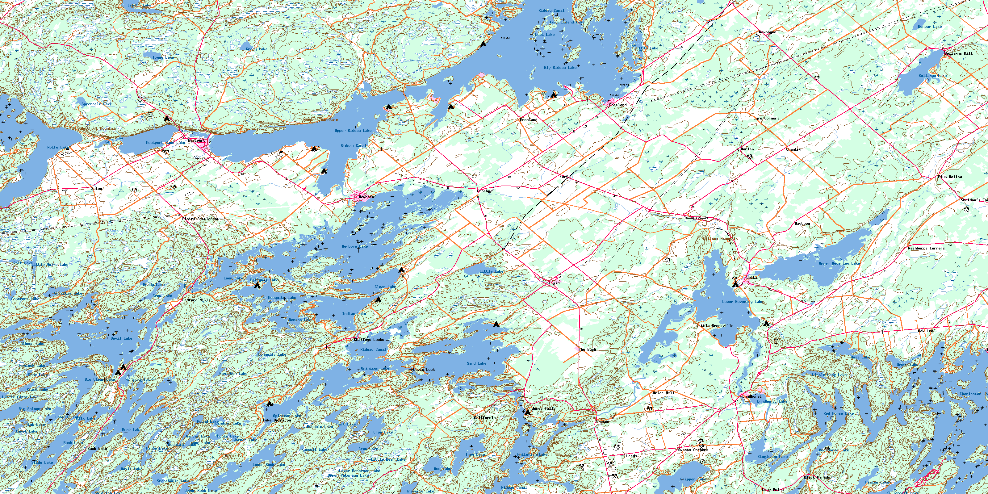
© Department of Natural Resources Canada. All rights reserved.
