Sharbot Lake Topo Map Online
Download Free Topo Map Sheet 031C15 at 1:50,000 scale
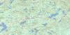
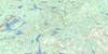
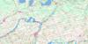
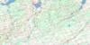
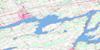
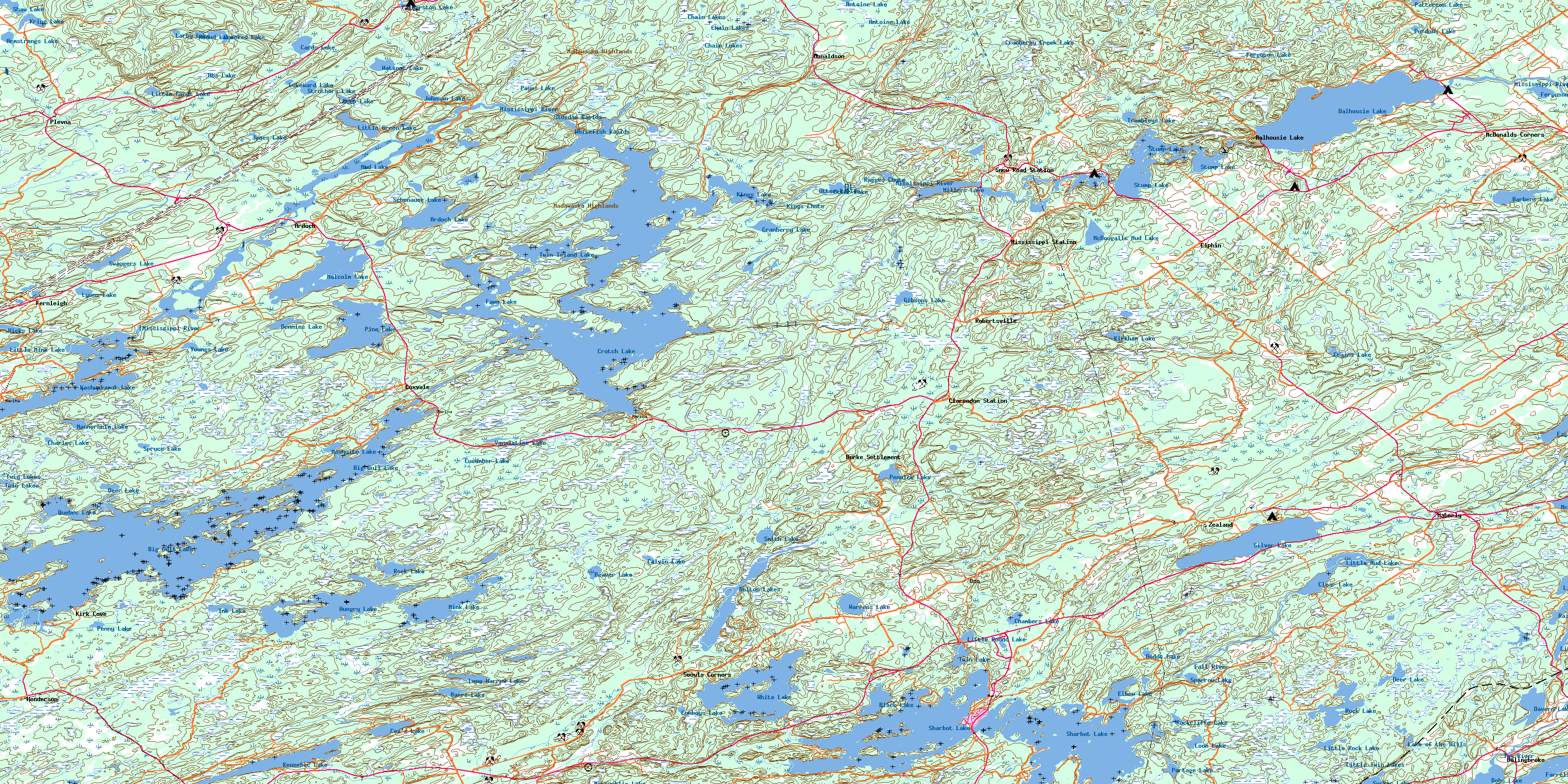
031C15 Sharbot Lake Topo Map
To view this map, mouse over the map preview on the right.
You can also download this topo map for free:
031C15 Sharbot Lake high-resolution topo map image.
Maps for the Sharbot Lake topo map sheet 031C15 at 1:50,000 scale are also available in these versions:
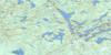
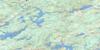
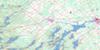
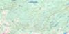
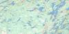
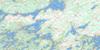
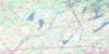
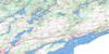
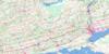
Sharbot Lake Surrounding Area Topo Maps
 |
 |
 |
 |
 |
 |
 |
 |
 |
 |
 |
 |
 |
 |
 |
 |
© Department of Natural Resources Canada. All rights reserved.
Sharbot Lake Gazetteer
The following places can be found on topographic map sheet 031C15 Sharbot Lake:
Sharbot Lake Topo Map: Bays
Big Black BayCranberry Bay
Doran Bay
East Bay
Hawley Bay
Kirk Cove
Little Black Bay
McCrimmon Bay
McIlquham Bay
McLeans Bay
Smiths Bay
Thompsons Bay
Warners Bay
Sharbot Lake Topo Map: Capes
Antoine PointBuck Point
Burneys Point
Coutlee Point
Echo Point
Hepner Point
Narrows Point
Squaw Point
Stormy Point
The Promontory
Sharbot Lake Topo Map: Channels
The NarrowsSharbot Lake Topo Map: Falls
Kings ChuteKings Falls
Ragged Chute
Sharbot Lake Topo Map: Geographical areas
BarrieBathurst
Clarendon
Dalhousie
Frontenac
Kennebec
Lanark
Miller
North Sherbrooke
Olden
Oso
Palmerston
South Sherbrooke
Sharbot Lake Topo Map: Islands
Big Boundary IslandBig Island
Big Island
Blueberry Island
Boundary Island
Bradleys Island
Burnt Island
Campbells Island
Cheese Island
Colonel Island
Cooley Island
Craig Island
Cranberry Island
Crusoe Island
Doyles Island
Frenches Island
Frenchs Island
Graceys Island
Green Island
Green Islands
Hausermans Island
Hencoop Island
Honeymoon Island
Housermans Island
Lanes Island
Long Island
Long Island
Lynns Island
Maxwell Island
O'Connell Island
Pinecrest Island
Riders Island
Round Island
Shibley Island
Sister Island
Skull Island
Three Sisters Islands
Upper Sister Island
Sharbot Lake Topo Map: Lakes
Abs LakeAntoine Lake
Ardoch Lake
Armstrongs Lake
Attewell Lake
Barbers Lake
Barrs Lake
Beaver Lake
Big Gull Lake
Black Lake
Bobs Lake
Bolton Lakes
Calvin Lake
Cards Lake
Chain Lakes
Chambers Lake
Charles Lake
Clarendon Lake
Clear Lake
Conboy Lake
Conboys Lake
Cox's Lake
Coxvale Lake
Crains Lake
Cranberry Creek Lake
Cranberry Lake
Crooked Creek Lake
Crooked Lake
Crooks Creek Lake
Cross Lake
Crotch Lake
Cucumber Lake
Dalhousie Lake
Davern Lake
Deep Lake
Deer Lake
Deer Lake
Deer Lake
Dennies Lake
Dodds Lake
Elbow Lake
Elphin Lake
Fagan Lake
Farrell Lake
Farren Lake
Fawn Lake
Ferguson Lake
Fergusons Mud Lake
Frog Lake
Gibsons Lake
Hicks Lake
Hungry Lake
Ink Lake
Izatt Lake
James Lake
Johnson Lake
Kashwakamak Lake
Kennebec Lake
Kings Lake
Kirkham Lake
Kring Lake
Lake of the Hills
Larby Lake
Little Cards Lake
Little Green Lake
Little Mink Lake
Little Mud Lake
Little Rock Lake
Little Round Lake
Little Silver Lake
Little Twin Lakes
Long Narrow Lake
Loon Lake
Lukeward Lake
Lyons Lake
Maberly Lake
Malcolm Lake
Mannerheim Lake
McDougalls Mud Lake
McGees Pond
McGowan Lake
McLaughlin Lake
McLeans Lake
Miller Lake
Millers Lake
Mink Lake
Mosquito Lake
Mud Lake
Otter Lake
Palmerston Lake
Patterson Lake
Payes Lake
Pennick Lake
Penny Lake
Pine Lake
Portage Lake
Purdons Lake
Purdons Mud Lake
Quebec Lake
Rainbow Lake
Rock Lake
Rock Lake
Rock Lake
Rockcliffe Lake
Round Lake
Schonauer Lake
Sharbot Lake
Shaw Lake
Silver Lake
Silver Lake
Silvery Lake
Smith Lake
Sparrow Lake
Spruce Lake
Spruce Lake
Struthers Lake
Stump Lake
Sucker Lake
Swaugers Lake
Trombleys Lake
Twin Island Lake
Twin Lake
Twin Lakes
Vanalstine Lake
Warrens Lake
Watsons Lake
White Lake
Youngs Lake
Sharbot Lake Topo Map: Mountains
Adams HillBoundary Hill
Elbow Hill
Gemmills Hill
Gordons Hill
Hydro Hill
Madawaska Highlands
Roger Hill
Smiths Hill
Stewarts Hill
Wilson Hill
Sharbot Lake Topo Map: Major municipal/district area - major agglomerations
FrontenacLanark
Sharbot Lake Topo Map: Other municipal/district area - miscellaneous
BarrieBathurst
Bathurst Burgess Sherbrooke
Central Frontenac
Clarendon and Miller
Dalhousie and North Sherbrooke
Darling
Hinchinbrooke
Kennebec
Lanark
Lanark Highlands
Lavant
Lavant, Dalhousie and North Sherbrooke
North Burgess
North Frontenac
North West Lanark
Olden
Oso
Palmerston and North and South Canonto
South Sherbrooke
Tay Valley
Sharbot Lake Topo Map: Conservation areas
Crotch Lake Conservation ReserveHungry Lake Conservation Reserve
Sharbot Lake Provincial Park
Silver Lake Provincial Park
Sharbot Lake Topo Map: Rapids
Birch RapidsOtter Rapids
Sidedam Rapids
Whitefish Rapids
Sharbot Lake Topo Map: Rivers
Antoine CreekBlack Creek
Bolton Creek
Boundary Creek
Buckshot Brook
Buckshot Creek
Conns Creek
Cranberry Creek
Cranberry Creek
Crooked Creek
Davern Creek
Dead Creek
Fairs Creek
Fall River
Gordons Creek
Gull Creek
Little Antoine Creek
Long Sault Creek
McLarens Creek
McLarens Depot Snye
Mississippi River
Mosquito Creek
Pauls Creek
Purdons Creek
Sharbot Creek
Silver Lake Creek
Swamp Creek
Tay River
Ward's Creek
Wesleys Creek
Sharbot Lake Topo Map: Shoals
Gull RockThree Sisters Rocks
Sharbot Lake Topo Map: Unincorporated areas
ArdochBolingbroke
Bolingbroke Siding
Bolingbroke Station
Burke Settlement
Cedarholm
Clarendon Station
Coxvale
Dalhousie Lake
Donaldson
Elphin
Feldspar
Fernleigh
Henderson
High Falls
Kirk Cove
Maberly
Maberly Station
McDonald Corners
McDonalds Corners
McDonald's Corners
McLaren Depot
Mississippi Station
Oso
Oso Station
Plevna
Pratt Corners
Robertsville
Seouls Corners
Sharbot Lake
Snow Road Station
Ungava
Zealand
© Department of Natural Resources Canada. All rights reserved.
