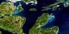
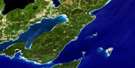
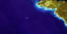
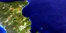
Sans Souci Satellite Image Map
Download Free Aerial Photo 041H01 at 1:50,000 scale
Sans Souci Satellite Imagery
To view this satellite map, mouse over the air photo on the right.
You can also download this satellite image map for free:
041H01 Sans Souci high-resolution satellite image map.
Maps for the Sans Souci aerial map sheet 041H01 at 1:50,000 scale are also available in these versions:
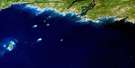
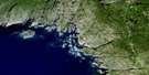
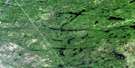
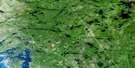
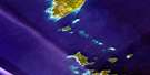
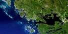
Sans Souci Surrounding Area Aerial Photo Maps
 |
 |
 |
 |
 |
 |
 |
|
 |
 |
||
 |
 |
 |
© Department of Natural Resources Canada. All rights reserved.
Sans Souci Gazetteer
The following places can be found on satellite image map 041H01 Sans Souci:
Sans Souci Satellite Image: Bays
Alexander BayBaie Georgienne
Big David Bay
Blackstone Harbour
Bowery Bay
Carson Bay
Chegahno Bay
Copperhead Harbour
Cowper Bay
Dauncey Bay
Echo Bay
Fryingpan Harbour
Georgian Bay
Gilman Bay
Goose Bay
Goose Neck Bay
Gordons Bay
Hennessy Bay
Hillis Bay
Indian Harbour
Isaac Bay
Jenner Bay
Johnny Bay
Kineras Bay
King Bay
Ladas Bay
Laundry Bay
Lough Bay
Moon Bay
Moose Bay
Moose Bay
Nightingale Bay
Port Rawson Bay
Portage Bay
Redner Bay
Ritchie Bay
Sheep Head Bay
Sheldrick Bay
Spider Bay
Starvation Bay
Twelve Mile Bay
Twelvemile Bay
White Bay
Woods Bay
Sans Souci Satellite Image: Capes
Barrel PointBear Head
Belrose Point
Bourke Point
Burgess Point
Cannon Point
Cox Point
Crewe Point
Culliton Point
Dave Point
Drinkwater Point
Dudgeon Point
Du-Houdie Point
Elizabeth Point
Emerson Point
Fry Point
Gonder Point
Greenly Point
Halcyon Point
Hambly Point
Hare Point
Heath Point
Holder Point
Houston Point
Jewell Point
Kay Point
King Point
Koenig Point
Loon Island
MacArthur Point
Maeder Point
Mainland Point
McKibbin Point
Monette Point
Monk Point
Moose Deer Point
Moose Point
Morris Point
Muir Point
Nicholson Spit
Nutley Point
O'Donnell Point
Pickel Point
Pilgrims Rest Point
Rennie Point
Spider Point
Spohn Spit
Stone Wall Point
Swan Point
Tadenac Peninsula
Towers Point
Veall Point
Sans Souci Satellite Image: Channels
Captain Allan StraitCoon Gap
Garden Channel
Hole in the Wall
Indian Dock Channel
Long Sault
Manitou Gap
North Channel
O'Donnell Channel
South Channel
Wabuno Channel
Waubuno Channel
Sans Souci Satellite Image: Geographical areas
CarlingConger
Cowper
Foley
Muskoka
Parry Sound
Sans Souci Satellite Image: Indian Reserves
Chippewa IslandChippewa Island Indian Reserve
Moose Point 79
Moose Point Indian Reserve 79
Parry Island First Nation Indian Reserve
Parry Island Indian Reserve 16
Réserve indienne Chippewa Island
Réserve indienne Moose Point 79
Réserve indienne Parry Island 16
Réserve indienne Parry Island First Nation
Sans Souci Satellite Image: Islands
Adele IslandAjax Island
Alexander Island
Algonquin Island
Alice Island
Altair Island
Alvinholme Island
Amanda Island
American Camp Island
Angel Island
Anker Pint Islet
Annette Island
Annie Island
Ansley Island
Anthony Island
Apostle Island
Appelbe Islands
Ardwell Island
Argyle Island
Asperitas Island
Assinaboia Island
Axford Island
Bagg Island
Bald Island
Band Island
Bands Island
Barley Island
Barnard Island
Barnicke Island
Bartram Island
Bass Group
Bath Islands
Bathgate Islands
Bayview Island
Bear Island
Beauty Island
Belle Island
Bellis Island
Bent Tree Island
Bernice Island
Bernyk Island
Beulah Island
Big Bobs Island
Black Bass Island
Blackmore Island
Blanchette Island
Block Island
Blower Island
Bonnet Island
Bonter Island
Boulevard Island
Bowering Island
Bowes Island
Boyd Group
Bradden Island
Bredin Island
Breen Island
Brint Island
Broad Island
Brownie Island
Bruce Island
Buller Island
Cairndhu Island
Caleb Island
Calvin Island
Cameron Island
Campbell Island
Camphausen Island
Canna Island
Carlotta Island
Carohoma Island
Casson Island
Cazaly Island
Chamberlain Island
Chancellor Islands
Charette Island
Chubb Island
Clapp Island
Cockaday Island
Cockburn Island
Colenso Island
Coltman Island
Columbia Island
Comfort Island
Cone Island
Coney Island
Conlin Island
Consolation Island
Copegog Island
Copperhead Island
Cork Island
Cormie Island
Cow Island
Craik Island
Craven Island
Crescent Island
Crooked Island
Crouse Island
Crozier Island
Dailey Island
Dauncey Island
Davis Island
Deer Horn Island
Deer Island
Delhaven Island
Delos Island
Denton Island
Derbyshire Island
Dew Island
Doll Island
Doll Island
Donaldson Island
Double Island
Double Top Island
Duck Island
Durham Islands
East Island
Echo Island
Edward Island
Egg Island
Eileen Island
Elkin Island
Ellawee Island
Ellen Island
Ellen Pearce Island
Ellsmere Island
Elwin Island
Elynor Island
Emerald Island
Emerald Island
Ermyn Island
Ethel Island
Ewing Island
Failthae Island
Fairlie Island
Falconbridge Island
Falkner Island
Fischers Island
Fleming Island
Flint Island
Florence Island
Flossie Island
Forage Island
Francis Island
Franks Island
Freedom Island
Fritz Island
Fryingpan Island
Gages Island
Gages Island
Galipeau Island
Garland Island
Garner Island
Gash Island
Gaskin Island
Gauge Islands
Gaviller Island
Gay Island
Georgina Island
Geraldine Island
Gibbs Island
Giff Island
Gillespie Island
Glass Island
Glencairn Island
Glenwood Island
Golden Island
Gooby Island
Gooseberry Island
Gotham Island
Granite Island
Gull Island
Gummow Island
Gunn Island
Haggis Island
Halcro Island
Hanstein Island
Happygolucky Island
Harbour Island
Hardcastle Island
Hardie Island
Harmer Island
Hartman Island
Hatch Island
Hazzard Island
Hewson Island
Heyburn Island
Hilborn Island
Hillier Islands
Howl Island
Hugh Murray Island
Hurd Island
Huron Island
Hurontario Island
Idletime Island
Iona Island
Iowa Island
Irwin Island
Isaac Island
Isabel Island
Islay Island
Isle of Bute
Isle of Rest
Jacklin Island
Jacks Island
Jacques Island
Jagged Island
Jake Island
Jane Island
Janisse Island
Jesso Island
Jubilee Island
Jumbo Island
Katerjan Island
Kater-Jan Island
Kathleen Island
Keele Island
Kerr Island
Kinnear Island
Kitchener Island
Kroon Island
Laggish Island
Lamont Island
Lanoka Island
Larrett Island
Leek Island
Lemmon Island
Lent Island
Leonard Island
Leroy Island
Link Island
L'Islet
Little Glencairn Island
Little Jane Island
Long Island
Lotz Island
Louisa Island
Loxton Island
Lumb Island
Lumsden Island
Manchee Island
Marino Island
Markham Island
Martin Island
Masson Island
Matches Island
Matthews Island
Maud Island
McBrien Island
McCorry Island
McGaw Island
McQuade Island
Menimmenis Island
Merry Island
Midford Island
Milligan Island
Miron Island
Molnar Island
Moon Island
Moonlight Island
Morgan Islands
Moseley Island
Muffitt Island
Murray Island
Nanibush Island
Nation Island
Near Island
Nebahwin
Niblett Island
Nice Island
North Group
North Island
North Wooded Pine Island
Northwest Pine Island
Novinka Island
Olimer Island
Oliver Island
Omar Island
Omemee Island
Onaway Island
One Tree Island
One Tree Island
Orchard Island
Ottley Island
Paff Island
Pare Island
Parkinson Island
Parry Island
Passage Island
Pate Island
Peacock Island
Peacock Island
Peak Island
Pedro Island
Penhale Island
Pennsylvania Island
Perdue Island
Phillips Island
Pine Islands
Pinerocks Island
Pisces Island
Pleasant Island
Polaris Island
Pomeroy Island
Post Island
Primrose Island
Prow Island
Putsholme Island
Qui-Vive Island
Range Island
Rannie Island
Rawbone Island
Rene Island
Revilo Island
Rice Island
Richmond Island
Ricketts Island
Rigby Island
Roberts Island
Robinson Island
Rockall Island
Rosalie Island
Round Island
Royal Canadian Island
Ruby Island
Ruddy Island
Rum Island
Rumbles Island
Running Island
Sadie Island
Sanger Island
Sans Souci Island
Sarah Island
Sarawa Island
Sauder Island
Saville Island
Scarr Island
Schade Island
Scovell Island
Scratch Island
Sereres Island
Sharpe Island
Shasha Island
Shawanaga Island
Sheldon Island
Sherry Island
Sign Island
Simonett Island
Skunk Island
Skye Island
Sleeth Island
Sloan Island
Smiths Island
Smooth Island
Snow Island
Somerset Island
South Group
St. Waleran Island
Stanley Island
Star Island
Starke Island
Steers Island
Stevenson Island
Stone Island
Strauss Island
Sugar Island
Tattersall Island
Taylor Island
The Pines Island
Tibbett Island
Totten Island
Tottens Island
Track Island
Trainor Island
Tranquility Island
Tree Island
Tribune Island
Truax Island
True Island
Trusty Island
Tryon Island
Tully Island
Turning Island
Tyrone Island
Umbrella Islands
Vancott Island
Vanderdasson Island
Vardy Island
Venus Island
Viau Island
Victor Island
Wahsoune Island
Warburton Island
Ward Island
Ware Island
Watt Island
Wawasekona Island
Wawataysee Island
West Island
West Onetree Island
Western Islands
White Pigeon Island
Wilcox Island
Wildgoose Island
Wilkinson Island
William Island
Willis Island
Windy Island
Winegarden Island
Winnett Island
Wiskin Island
Wood Island
Wreck Island
Wynn Island
Yankanuck Island
Zator Island
Zavitz Island
Zoraya Island
Sans Souci Satellite Image: Lakes
Clear LakeCowper Lake
Hooton Lake
Kingshott Lake
Lac Huron
Lake Huron
Little Cataraqui Creek Reservoir
Spider Lake
Three Legged Lake
Sans Souci Satellite Image: Major municipal/district area - major agglomerations
MuskokaSans Souci Satellite Image: Other municipal/district area - miscellaneous
CarlingChristie
Foley
Georgian Bay
Georgian Bay North Archipelago
Georgian Bay South Archipelago
Humphrey
Seguin
The Archipelago
Sans Souci Satellite Image: Conservation areas
O'Donnell Point Provincial Nature ReserveThe Massasauga Provincial Park
Sans Souci Satellite Image: Rivers
Miners CreekMoon River
Sucker Creek
Sans Souci Satellite Image: Road features
Loon PortageSans Souci Satellite Image: Shoals
Addington BankAjax Rock
Allen Rocks
Armstrong Rock
Barbara Bank
Bate Rock
Beaver Rock
Black Rock
Black Rock
Black Rocks
Bolger Rock
Bull Rock
Burkett Rock
Channel Rock
Clarke Rock
Cowie Reef
Dauphine Rock
Deaf Man Shoal
Dehring Rock
Digby Bank
Doty Rocks
Dowell Rock
Eagar Rock
Esther Rock
Gahan Rock
Gibson Reef
Gilead Rock
Gillford Rocks
Gladwyn Rock
Glyn Rock
Gull Rock
Guy Rock
Haha Rock
Haight Rock
Hampshire Rock
Hans Rock
Harris Bank
Haystack Rock
Hervey Rock
Hidden Rock
Hood Patch
Hood Reef
Iron Rock
Lewis Bank
Lone Rock
Mal de Mer Bank
Maxwell Rock
McCurry Rocks
McKechnie Rock
McKechnie Rocks
Mercer Rocks
Middle Rock
Minnie Rock
Nicolet Rock
Norman Bank
Northeast Rock
Ouida Rock
Pawsey Rock
Pawsey Rocks
Pelican Rock
Percy Rock
Phillimore Rock
Pool Rocks
Powys Rock
Quilliam Shoal
Ricketts Reef
Rowland Rock
Ryders Rock
Seaman Bank
Sister Rock
Sitric Rock
Southeast Rock
Southeast Rock
Southwest Shoal
Speke Bank
Spencer Reef
Spray Rock
Steers Rock
Susan Shoal
Teddy Rock
The Pig
The Sow
The Teat
The Teat Rocks
The Triplets
Thumb Rock
Tottenham Shoal
Umbrella Ledges
Vanguard Rock
Wabuno Rock
Wagstaff Rock
Waubuno Rock
West Rock
Whyte Reef
Sans Souci Satellite Image: Unincorporated areas
CopperheadManitou Dock
Sans Souci
Sans Souci Satellite Image: Low vegetation
Gropp's MarshKeefer Marsh

© Department of Natural Resources Canada. All rights reserved.
