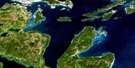
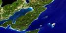
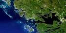
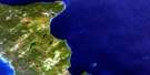
Collins Inlet Satellite Image Map
Download Free Aerial Photo 041H14 at 1:50,000 scale
Collins Inlet Satellite Imagery
To view this satellite map, mouse over the air photo on the right.
You can also download this satellite image map for free:
041H14 Collins Inlet high-resolution satellite image map.
Maps for the Collins Inlet aerial map sheet 041H14 at 1:50,000 scale are also available in these versions:
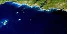
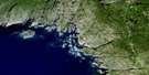
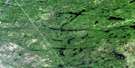
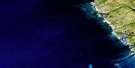
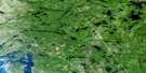
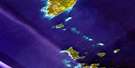
Collins Inlet Surrounding Area Aerial Photo Maps
 |
 |
 |
 |
 |
 |
 |
|
 |
 |
||
 |
 |
 |
© Department of Natural Resources Canada. All rights reserved.
Collins Inlet Gazetteer
The following places can be found on satellite image map 041H14 Collins Inlet:
Collins Inlet Satellite Image: Bays
Baie GeorgienneBatt Bay
Bay Dufois
Bear Bay
Beaverstone Bay
Big Rock Bay
Black Bay
Chaughis Bay
Collins Inlet
Cross Bay
Dave's Bay
Deer Island Bay
Desjardins Bay
Dufois Bay
Dupuis Bay
East Desjardin Bay
Garbage Bay
Georges Bay
Georgian Bay
Gravel Bay
Green Island Bay
Horseshoe Bay
Indian Bight
Jocko's Harbour
Killarney Bay
Le Haye Bay
Le Hayes Bay
Moose Bay
Moose Bay
Muskrat Bay
Solomon Bay
Solomons Bay
Sugar John Bay
Tarvat Bay
Thebo Cove
Thomas Bay
West Desjardin Bay
Winakaching Bay
Collins Inlet Satellite Image: Capes
Balis PointDesjardin Point
Eagle Nest Point
Midshipman Point
North Point
North Spit
Northeast Point
Point Grondine
Pond Point
Popham Point
Ragged Point
Red Rock Point
South Point
South Point
Thebo Point
Collins Inlet Satellite Image: Channels
Killarney ChannelLodge Channel
Old Voyageur Channel
Pine Island Channel
Silver Island Channel
The Western Entrance
Voyageur Channel
Collins Inlet Satellite Image: Geographical areas
CarlyleHumboldt
Killarney
Manitoulin
Parry Sound
Rutherford
Sudbury
Travers
Collins Inlet Satellite Image: Indian Reserves
Point Grondine 3Point Grondine Indian Reserve 3
Réserve indienne Point Grondine 3
Collins Inlet Satellite Image: Islands
Anchor IslandBaltzly Island
Barto Island
Bateman Island
Black Bill Island
Bottle Island
Brassey Island
Burnt Island
Campbell Island
Chicken Island
Crume Island
Deer Island
Draper Island
East Brother Island
East Fox Island
Edward Island
Fleming Island
Fox Islands
George Island
Green Island
Green Island
Green Island
Gull Island
Half Sphere Island
Hamilton Island
Hawk Islands
Hen Island
Hincks Island
Jensens Island
Keyhole Island
Lang Island
Le Haye Island
Le Hayes Island
Lochbieler Island
Low Island
Lowe Island
MacFarlane Island
Mann Island
Martel Island
Martins Island
Mocking Bird Island
Muskie Island
Nobles Island
One Tree Island
Papoose Island
Philip Edward Island
Pinch Island
Pine Tree Island
Robinson Island
Salisbury Island
Scarecrow Island
Sheep Island
Sheet Island
Silver Island
Solomon Island
Solomons Island
Southwest Hawk Island
Squaw Island
The Chickens
The Foxes
The Mailbox
Toad Island
Turning Island
Twin Islands
Two Pines Island
West Brother Island
West Fox Island
West Rock
Young Squaw Island
Collins Inlet Satellite Image: Lakes
Lac HuronLake Huron
Lighthouse Lake
Mill Lake
Collins Inlet Satellite Image: Other municipal/district area - miscellaneous
HowlandRutherford and George Island
Collins Inlet Satellite Image: Conservation areas
French River Provincial ParkKillarney Provincial Park
Collins Inlet Satellite Image: Rivers
Beaverstone RiverChikanishing River
Fort Channel
Collins Inlet Satellite Image: Road features
Big Rock PortageCollins Inlet Satellite Image: Shoals
Alec Clark RockAlexander Rock
Annie Rock
Azov Ledges
Celtic Rocks
Emery Reef
Entrance Rocks
Eulas Ground
Finnis Rock
Flat Rock
Grondine Rock
Halkett Rock
Harty Patches
Isabel Rock
Jackman Rock
Le Haye Rock
Maitland Bank
Matheson Shoal
McDonald Shoal
Moreland Bank
Nicholson Rock
North Rock
Pancake Rock
Pat Howe Patch
Phantom Shoal
Pisa Rock
Pring Reef
Rannie Rocks
Red Rock
Rooster Reef
Scarecrow Island Bank
Seven Fathom Bank
Simpson Rock
Single Rock
Sly Boots
Smooth Rock
South Rock
Square Rock
Squaw Island Bank
Steele Rock
Tadpole Rocks
Temple Rocks
The Brothers
The Long Rocks
The Triangle
Turtle Rock
White Rock
White Rock Ledge
Collins Inlet Satellite Image: Towns
KillarneyNortheastern Manitoulin and the Islands
Northeastern Manitoulin and the Islands
Collins Inlet Satellite Image: Unincorporated areas
Beaverstone Bay
© Department of Natural Resources Canada. All rights reserved.
